FORT VANCOUVER
The History of Fort Vancouver and its Physical Structure
|

|
PLATES
|
|
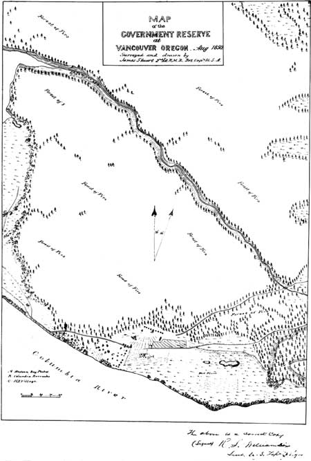
Plate XI—Map of the Government Reserve at Vancouver,
Oregon, August, 1850, Surveyed and Drawn by Brevet Capt. James Stuart. From General Land Office Records, Abandoned Military
Reservation Series, Ft. Vancouver, Washington, Box 100, in the
National Archives. (click on image for a PDF version)
|
|
|
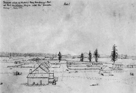
Plate XII—Fort Vancouver and the Village from the Northwest, July, 185 1, Drawn by George Gibbs. From collection of photographs entitled "Drawings by
George Gibbs in the Far Northwest, 1849-1851," in the American Bureau of
Ethnology. Smithsonian Institution.
|
|
|
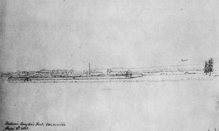
Plate XIII—Fort Vancouver from the North, July 2, 1851, Drawn by George Gibbs. From collection of photographs entitled "Drawings by George Gibbs
in the Far Northwest, 1849-1851," in the American Bureau of Ethnology,
Smithsonian Institution.
|
|
|
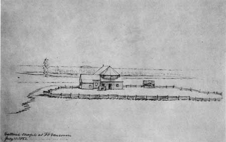
Plate XIV—Catholic Chapel at Fort Vancouver, July 1, 1851, Drawn by George Gibbs. From collection of photographs entitled "Drawings by
George Gibbs in the Far Northwest, 1849-1851," in the American Bureau of
Ethnology, Smithsonian Institution.
|
|
|
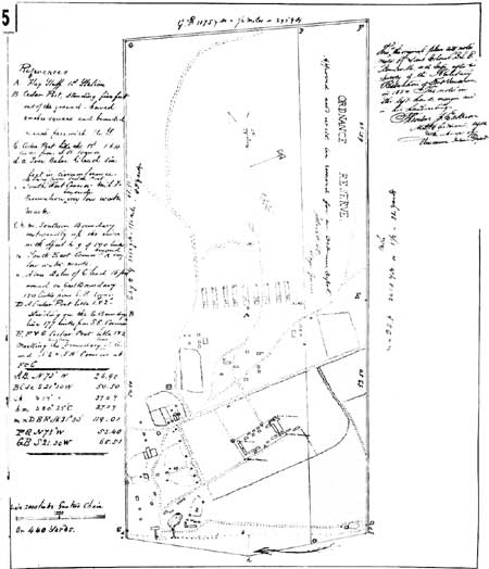
Plate XV—Original Plan of Survey of Fort Vancouver Military
Reservation, Made in 1854 by Lieut. Col. B. L. E. Bonneville. From photostat in possession of Howard J. Burnham.
(click on image for a PDF version)
|
fova/hussey/plates3.htm
Last Updated: 18-Feb-2008
|