FORT VANCOUVER
The History of Fort Vancouver and its Physical Structure
|

|
PLATES
|
|
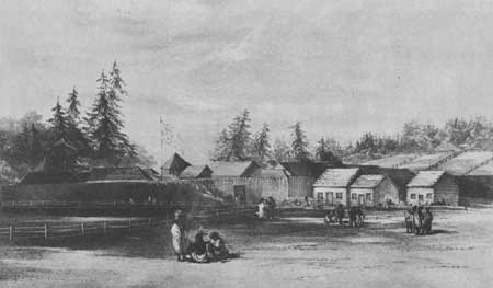
Plate VI—Fort Vancouver from the
Southeast, 1854, Drawn by Henry J. Warre. From Warre, Sketches in
North America and the Oregon Territory.
|
|
|
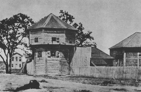
Plate VII—Bastion at Fort Victoria,
Vancouver Island, Showing Typical Construction of Octagonal Cap and Gun
Ports. From The Beaver, Outfit 265, no. 2 (September, 1934), 48.
|
|
|
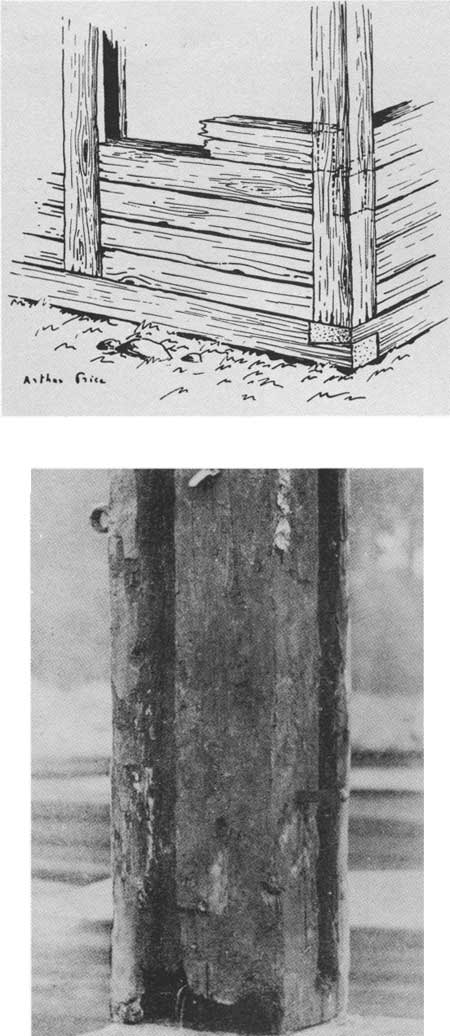
Plate VIII—Above: Diagram
Diagram of Typical "Posts in the Sill" Construction, as Used at Fort
Vancouver. From The Beaver, Outfit 276 (December, 1945), 10.
Below: Corner Post, Fort Nisqually, Showing Grooved Upright.
From The Beaver, Outfit 265, no. 2 (September, 1934), 52.
|
|
|
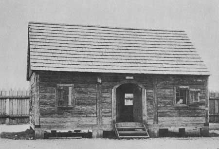
Plate IX—Granary, Fort Nisqually, Showing
Typical H.B.C. "Posts in the Sill" Construction. From Photographic Records
Office, The National Archives.
|
|
|
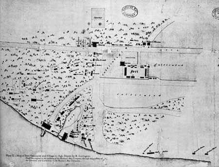
Plate X—Map of Fort Vancouver and Village in 1846, Drawn by R. Covington. From the original in the archives of the Hudson's Bay
Company through the courtesy of the Governor and Committee of the
Hudson's Bay Company. (click on image for a PDF version)
|
fova/hussey/plates2.htm
Last Updated: 18-Feb-2008
|