|
MESA VERDE
Environment of Mesa Verde, Colorado Wetherill Mesa Studies |

|
Chapter 3
description of the stands
LOWEST MESA-TOP SITE, M—1
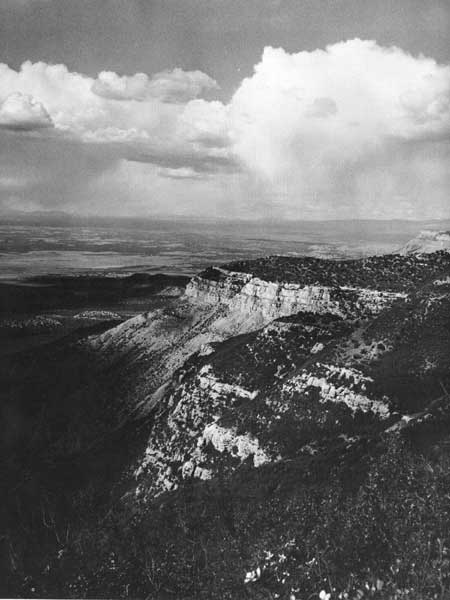
This site was near the south end of Chapin Mesa, about 5 miles from park headquarters (fig. 1). The lowest of the mesa-top sites, at 6,650-foot elevation, M—1 was on a broad, level ridgetop flanked by two shallow washes that empty into the 1,000-foot deep Mancos River canyon about 1/4 mile away.
The vegetation is a juniper-pinyon/bitterbrush woodland with sparse herbs (fig. 4). Ephemeral spring flowers are important in the ground cover. All species observed in the stand are listed in table 2; quantitative data on trees are given in table 3. Ten of the largest trees were 300 to 400 years old, with the oldest pith date being A.D. 1529. The trees are small and widely spaced, and bitterbrush (Purshia tridentata) and black sagebrush (Artemisia nova) are common in openings between them. Herbs are conspicuous only during the spring and early summer growing season. Some of the most common ones are mutton grass (Poa fendleriana), vetch (Astragalus wingatanus), and phlox (Phlox hoodii).
TABLE 2.—LIST OF SPECIES OBSERVED IN THE ENVIRONMENT MEASUREMENT SITES
| Species | Sites | |||||
| Mesa top | Canyon | |||||
| M—1 | M—2 | M—3 | C—1 | C—2 | C—3 | |
| TREE LAYER | ||||||
| Juniperus osteosperma (Torr.) Little | 1X | X | X | X | X | X |
| Juniperus scoputorum Sarg | X | |||||
| Pinus edulis Engelm | X | X | X | X | X | X |
| Pseudotsuga menziesii (Mirb.) Franco | X | |||||
| SHRUB LAYER | ||||||
| Amelanchier utahensis Koehne | X | X | X | |||
| Artemisia nova A. Nels | X | X | ||||
| Artemisia tridentata Nutt | X | X | X | |||
| Atriplex canescens (Pursh) Nutt | X | X | ||||
| Cercocarpus montanus Raf | X | X | X | |||
| Chrysothamnus depressus Nutt | X | X | ||||
| Chrysothamnus nauseosus (Pall.) Britt | X | X | ||||
| Chrysothamnus viscidiflorus (Hook.) Nutt | X | |||||
| Ephedra viridis Coville | X | X | X | |||
| Fendlera rupicola A. Gray | X | X | ||||
| Gutierrezia sarothrae (Pursh) Britt. & Rusby | X | X | X | X | ||
| Philadelphus microphyllus A. Gray | X | |||||
| Purshia tridentata (Pursh) DC | X | X | ||||
| Quercus gambelii Nutt | 2X° | X | X | |||
| Rhus trilobata Nutt. ex T. & G | X | X | ||||
| Ribes leptanthum A. Gray | X | |||||
| Stanleya pinnata (Pursh) Britt | X | |||||
| Symphoricarpos oreophilus A. Gray | X° | X | X | X | ||
| Tetradymia canescens DC | X | |||||
| Yucca baccata Torr | X | X | X | X | X | |
| GRASS AND FORB LAYER | ||||||
| Agropyron smitthii Rydb | X | X | X | |||
| Bouteloua gracilis (H. B. K.) Lag | X | |||||
| Bromus tectorum L | X | X | X | |||
| Hilaria jamesii (Torr.) Benth | X | |||||
| Koeleria gracilis Pers | X | X | ||||
| Oryzopsis micrantha (Trin. & Rupr.) Thurb | X | |||||
| Poa agassizensis Boivin & D. Love | X | |||||
| Poa fendleriana (Steud.) Vasey | X | X | X | X | X | X |
| Sitanion longifolium J. G. Smith | X | X° | X | X | X | |
| Stipa comata Trin. & Rupr | X | |||||
| Achillea lanulosa Nutt | X° | X | ||||
| Amaranthus hybridus L | X | |||||
| Androsace septentrionalis L | X | X | ||||
| Antennaria dimorpha (Nutt.) T. & G | X | |||||
| Antennaria parvifolia Nutt | X | |||||
| Arabis drummondii A. Gray | X | |||||
| Arabis pulchra M. E. Jones ex S. Wats | X | |||||
| Arabis selbyi Rydb | X | X | X | X | X | |
| Arenaria congesta Nutt. ex T. & G | ||||||
| Artemisia ludoviciana Nutt | X° | X | X | X | ||
| Aster arenosus Blake | X | |||||
| Astragalus calycosus Torr. ex S. Wats | X | |||||
| Astragalus flexuosus Dougl. ex Hook | X | X | ||||
| Astragalus lentiginosus Dougl | X | |||||
| Astragalus schmollae C. L. Porter | X | |||||
| Astragalus scopulorum T. C. Porter | X | X | ||||
| Astragalus wingatanus S. Wats | X | |||||
| Balsamorhiza sagittata (Pursh) Nutt | X | |||||
| Calochortus nuttallii Torr | X | |||||
| Castilleja chromosa A. Nels | X | X | ||||
| Castilleja linariaefolia Benth. in DC | X | |||||
| Chaenactis douglasii (Hook.) H. & A | X | X | ||||
| Chenopodium fremontii S. Wats | X | X | X | |||
| Claytonia lanceolata Pursh | X° | |||||
| Comandra umbellata (L.) Nutt | X | |||||
| Crepis cf. occidentalis Nutt | X | |||||
| Cryptantha bakeri (Greene) Payson | X | X | X | |||
| Cryptantha gracilis Osterhout | X | X | ||||
| Cymopterus bulbosus A. Nels | X | |||||
| Cymopterus purpurascens (A. Gray) M. E. Jones | X | |||||
| Cymopterus purpureus S. Wats | X | X | ||||
| Delphinium nelsonii Greene | X° | |||||
| Descurainia pinnata (Walt.) Britt | X | |||||
| Draba reptans (Lam.) Fern | X | X | ||||
| Echinocereus coccineus Engelm | X | |||||
| Erigeron divergens T. & G | X | |||||
| Erigeron flagellaris A. Gray | X | X | ||||
| Erigeron pumilus Nutt. | X | |||||
| Erigeron speciosus (Lindl.) DC | X° | |||||
| Eriogonum aatum Torr | X | |||||
| Eriogonum jamesii Benth | X | X | ||||
| Eriogonum racemosum Nutt. | X | X | ||||
| Eriogonum umbellatum Torr | X | X | X | |||
| Euphorbia fendleri T. & G | X | |||||
| Frasera albomarginata S. Wats | X | |||||
| Fritillaria atropurpurea Nutt | X | |||||
| Galium coloradoense W. F. Wright | X | X | ||||
| Gilia ophthalmoides Brand | X | |||||
| Haplopappus armerioides (Nutt.) A. Gray | X | X | ||||
| Haplopappus nuttallii T. & G | X | |||||
| Hymenopappus filifolius Hook | X | |||||
| Hymenoxys acaulis (Pursh) Parker | X | |||||
| Impomopsis aggregata (Pursh) V. Grant | X | |||||
| Lappula redowskii (Hornem.) Greene | X | |||||
| Lathyrus pauciflorus Fern | X° | |||||
| Lepidium montanum Nutt | X | X | X | |||
| Lesquerella rectipes Woot. & Standl | X | |||||
| Lithospermum incisum Lehm | X | |||||
| Lithospermum ruderale Dougl. in Lehm | X | |||||
| Lomatium dissectum (Nutt.) Math. & Const | X° | |||||
| Lomatium grayi Coult. & Rose | X | |||||
| Lomatium simplex (Nutt.) Macbr | X | |||||
| Lupinus caudatus Kellogg | X | X | ||||
| Machoeranthera bigelovii (A. Gray) Greene | X | X | ||||
| Mammillaria vivipara (Nutt.) Haw | X | |||||
| Melilotus officinalis (L.) Lam | X | |||||
| Mertensiafusiformis Greene | X° | |||||
| Microsteris humilis (Dougl.) Greene | X | X | ||||
| Mirabilia multiflora (Torr.) A. Gray | X | |||||
| Moldavica parviflora (Nutt.) Britt. | X | |||||
| Oenothera caespitosa Nutt | X | |||||
| Opuntia phaeacantha Engelm. ex Gray | X | |||||
| Opuntia polyacantha Haw | X | X | X | X | ||
| Pedicularis cent ranthera A. Gray | X | X | X | |||
| Penstemon bridgesii A. Gray | X | X | ||||
| Penstemon eatonii A. Gray | X | |||||
| Penstemon linarioides A. Gray | X | X | X | |||
| Penstemon strictus Benth | X | X° | ||||
| Petrodoria pumila (Nutt.) Greene | X | X | ||||
| Phacelia heterophylla Pursh | X° | |||||
| Phlox hoodii Richardson | X | X | X | X | ||
| Phlox longifolia Nutt | X | X | X | |||
| Physaria australis (Payson) Rollins | X | |||||
| Polygonum sawatchense Small | X | |||||
| Portulaca oleracea L | X | |||||
| Sclerocactus whipplei (Engelm. & Bigel.) Britt & Rose. | X | |||||
| Senecia multilobatus T. & G. ex A. Gray | X | X | X | X | ||
| Sisymbrium linifolium Nutt | X | X | ||||
| Solidago sparsiflora A. Gray | X | |||||
| Sphaeralcea coccinea (Pursh) Rydb | X | |||||
| Sphaeralcea parvifolia A. Nels | X | |||||
| Streptanthus cordatus Nutt. ex T. & G | X | X | ||||
| Taraxacum laevigatum (Willd.) DC | X | |||||
| Townsendia incana Nutt | X | |||||
| Zygadenus venenosus S. Wats | X | |||||
1Boldface X indicates species dominant within the stand.
2X° indicates species occurs in both the oak thickets and the sagebrush openings at M—3; those restricted to the thickets are Quercus gambelii, Lathyrus pauciflorus, Ligusticum perteri, and Pacelia hterophylla.
TABLE 3.—TREE DATA AT M—1
| A. Point quarter analysis based on 10 points | |||||||||
| Species | Number of trees |
Average distance, feet |
Total basal area, square inches |
Average B.A./ diameter |
Density trees/acre |
Relative— | Importance value | ||
| Density (%) |
Frequency (%) |
Dominance (%) | |||||||
| Pinus edulis | 22 | -- | 645 | 29/6 | 156 | 55 | 50 | 30.2 | 135.2 |
| Juniperus osteosperma | 18 | -- | 1,493 | 83/10.5 | 127 | 45 | 50 | 69.8 | 164.8 |
| Total | 40 | 12.4 | 2,138 | 54/8 | 283 | 100 | 100 | 100.0 | 300.0 |
B. Pinyon-juniper reproduction based on number of individuals that occurred within ten 4 x 50-foot belt transects | |||||||||
| Species | Number of— | Total | |||||||
| Seedlings | Saplings | Trees | |||||||
| Pinus edulis | 24 | 22 | 10 | 56 | |||||
| Juniperus osteosperma | 12 | 3 | 11 | 26 | |||||
The soils at the lower elevations of Mesa Verde are generally high in calcium carbonate, due in part to the nature of the underlying sandstone and in part to low rainfall and high temperatures. Even though soils are relatively shallow in the M—1 area, the ground surface is free of rock material. According to Parsons, the soils at this site are quite variable in depth as well as texture, but the dominant type has been classified as Penrose channery loam. Montvale fine sandy loam also occurs in small amounts. The soil profile in table 4 is typical of the M—1 soils.
TABLE 4.—SOIL PROFILE UNDERLYING THE M—1 JUNIPER-PINYON/BITTERBUSH STAND*
| Horizon | Depth, inches |
Description |
| A1 | 0—3 | Brown (10YR 5/3 dry) to dark brown (10YR 3/3 moist) channery loam; weak fine platy structure, breaking to moderate very fine granular; consistence soft dry and friable moist; many fine roots and pores; about 20 percent sandstone and shale channery; strongly calcareous; lower boundary clear and smooth. |
| Cca1 | 3—6 | Pale brown (10YR 6/3 dry) to dark brown (10YR 4/3 moist) channery loam; moderate fine granular structure; consistence slightly hard dry and friable moist; many fine roots and root casts; approximately 25 percent sandstone and shale channery; some small chalky concretions; violently calcareous; lower boundary gradual and wavy. |
| Cca2 | 6—11 | Light yellowish brown (2.5Y 7/3 dry) to brown (2.5Y 5/3 moist) channery loam; weak coarse subangular blocky structure; consistence hard dry and firm moist; some what sticky and plastic when wet; 33 percent sandstone and shale channery; a few very fine patchy clay skins show on rock surfaces; few small chalky concretions and cicada casts; violently calcareous; lower boundary clear and smooth. |
| C | 11—17 | Very pale brown (10YR 7/3 dry) to brown (10YR 5/3 moist) light clay loam; massive structure; slightly hard dry and firm moist; slightly sticky wet; fine roots somewhat matted between sandstone fragments; approximately 50 percent sandstone and shale channery; strongly calcareous; lower boundary clear and smooth. |
| R | 17+ | Interbedded sandstone and shale with numerous tongues of overlying horizon extending into cracks in rock. |
*Soil classified as Penrose channery loam.
The fine texture of the soil plays an important role in the relationship of soil moisture to the growth of the plant community. As shown in table 5, the storage capacity of growth-water in the heavy soils at M—1 is relatively high, especially when compared to that of the soils at most of the other sites.
TABLE 5.—SOIL MOISTURE CONSTANTS IN PERCENT DRY WEIGHT*
| Moisture constant | Depth, inches |
Sites | |||||
| M—1 | M—2 | M—3 | C—1 | C—2 | C—3 | ||
| Field capacity | 2 6 12 | 15.0 19.6 20.4 | 12.5 20.0 16.7 |
12.1 14.0 -- | 17.2 18.6 -- | 7.5 5.6 5.7 | 9.1 11.4 -- |
| Permanent wilting percent | 2 6 12 | 8.l 11.6 12.4 | 7.1 10.6 9.3 |
7.2 8.9 -- | 17.2 18.6 -- | 4.3 3.1 3.5 | 5.0 6.3 -- |
| Storage capacity of growth-water | 2 6 12 | 7.0 7.9 8.0 | 5.5 9.5 7.4 |
4.9 5.2 -- | 7.1 8.5 -- | 3.2 2.5 2.2 | 4.1 5.1 -- |
*Based on triplicate samples and determined by the moisture tension method.
Once the soil dries out, however, and this occurs quite early in the year, a large amount of water is required to moisten the ground to the depth where roots are located. Moreover, because of the sparse vegetational cover, even a light rain will induce splash erosion of the surface particles, causing the pore spaces to clog and subsequent rainfall to be largely lost as runoff. Thus, in the coarse to fine loamy soils found at M—1, only a small amount of the precipitation percolates into the ground; this is especially true during the summer, when rainfall is heavy. This phenomenon is shown graphically in figure 15 (see ch. 4). The autumn frontal storms of 1962 wet the soil down to the 12-inch level, whereas the 1963 summer thunderstorms were not so effective.
Data for the atmospheric and soil factors are presented in the appendix. Some of the features commonly used by ecologists to characterize environments are given in table 6.
TABLE 6.—SOME CLIMATIC FACTORS OF THE MESA-TOP SITES
| Factor | 1962 | 1963 | ||||
| M—1 | M—2 | M—3 | M—1 | M—2 | M—3 | |
| Air temperature (in degrees Farenheit): | ||||||
| January: | ||||||
| Maximum | 46 | 52 | 50 | 44 | 44 | 44 |
| Mean maximum | 37 | 38 | 31 | 34 | 32 | 30 |
| Minimum | -2 | -11 | -5 | -23 | -26 | -20 |
| Mean minimum | 13 | 13 | 16 | 11 | 8 | 15 |
| Mean | 25 | 26 | 24 | 22 | 20 | 23 |
| July: | ||||||
| Maximum | 97 | 91 | 84 | 97 | 93 | 86 |
| Mean maximum | 89 | 84 | 77 | 91 | 86 | 79 |
| Minimum | 46 | 48 | 47 | 52 | 50 | 50 |
| Mean minimum | 56 | 54 | 55 | 59 | 56 | 58 |
| Mean | 73 | 69 | 66 | 75 | 71 | 68 |
| Annual: | ||||||
| Maximum | 98 | 94 | 88 | 97 | 93 | 86 |
| Month | Aug. | Aug. | Aug. | July | July | July |
| Mean maximum | 64 | 62 | 54 | 64 | 61 | 55 |
| Minimum | -3 | -11 | -5 | -23 | -26 | -20 |
| Month | Feb. | Jan. | Jan. | Jan. | Jan. | Jan. |
| Mean minimum | 36 | 35 | 36 | 37 | 34 | 37 |
| Mean | 50 | 49 | 45 | 50 | 48 | 46 |
| Frost-free period, days | 166 | 161 | 162 | 171 | 171 | 171 |
| Last freeze in spring | 22 May | 28 May | 28 May | 12 May | 12 May | 12 May |
| First freeze in autumn | 5 Nov. | 6 Nov. | 7 Nov. | 31 Oct. | 31 Oct. | 31 Oct. |
| Relative humidity (in percentage): | ||||||
| Lowest | 1 | 5 | 9 | 4 | 8 | 13 |
| Month | May | May | May | Apr. | May | Nov. |
| Lowest monthly mean | 22 | 36 | 35 | 29 | 33 | 36 |
| Month | June | June | June | May | May | May |
| Annual mean | 43 | 53 | 51 | 50 | 52 | 54 |
| Precipitation (inches): | ||||||
| Monthly total: | ||||||
| Highest | 2.38 | 2.74 | 2.94 | 3.96 | 4.54 | 7.62 |
| Month | Oct. | Oct. | Oct. | Aug. | Aug. | Aug. |
| Lowest | 0.09 | 0.20 | 0.39 | 0.02 | 0.07 | 0.07 |
| Month | June | June | Apr. | June | June | June |
| Annual total | 9.17 | 15.80 | 18.86 | 13.88 | 15.04 | 18.81 |
| Wind velocity (in miles per hour): | ||||||
| Monthly mean: | ||||||
| Highest | 7.0 | 6.0 | 12.3 | 7.3 | 6.5 | 10.7 |
| Month | May | Apr. | Jan. | Apr. | Apr. | Apr. |
| Lowest | 4.9 | 4.1 | 8.2 | 4.4 | 4.1 | 7.5 |
| Month | Dec. | Dec. | Dec. | Jan. | Dec. | Oct. |
| Annual mean | 6.0 | 5.0 | 10.3 | 5.9 | 5.3 | 9.1 |
There was less precipitation and a greater variation between the 2 years of observations at M—1 than at the other five sites. The highest wind velocity measured was 30 m.p.h., in October, when a storm was approaching.
A mantle of snow persisted only from early January to early or mid-March. The frost-free period varied from 166 days in 1962 to 171 days in 1963. This period in each year extended from mid-May through October.
Plant growth began at M—1 earlier in the spring than at the other mesa-top stands. Several spring perennials, Arabis selbyii, Phlox hoodii, and Poa fendleriana, were in flower by late March.
This type of stand is extensive at the lower elevations on the southern part of Mesa Verde (Erdman, MS.). Evidence from vegetational analyses and from tree-ring studies indicates that the stand has been relatively undisturbed during the past 400 years and is probably climax; that is, a steady-state condition in which no further directional change in vegetation takes place under prevailing environmental conditions (Hanson and Churchill, 1961, p. 159). However, the present-day proportion of seedlings of the two tree species suggests that some change may be in progress. Among the mature trees, juniper is dominant over pine, but there are more pine than juniper seedlings. This combination of stand characteristics may indicate that pine seedlings are more successful than juniper in getting established but their survival rate is lower, so that the overall proportions are constant. Or it is possible that the present regional climate may be favoring a subtle shift toward pine dominance (Erdman, MS.). There are differences in the germination characteristics of the two species. Pinyon germinates as soon as optimum moisture and temperature conditions occur (Meagher, 1943), whereas juniper requires exposure to low temperatures that occur only in winter (Johnsen, 1959). Consequently, one might expect to find more pine seedlings, at least in some seasons. Unfortunately, there are no data on seedling survival.
The occurrence of bitterbrush on these heavy soils seems to be an exception to recent findings relating to the ecology of this species. Nord (1959, p. 2) states that in California this shrub does not generally develop where the soil is calcareous within 3 feet of the surface and is either imperfectly or poorly drained.
Bitterbrush, so common in this stand-type, is undoubtedly an important factor in the abundance of deer, as it is one of their favorite browse plants.
| <<< Previous | <<< Contents>>> | Next >>> |
archeology/7b/chap3.htm
Last Updated: 16-Jan-2007