Driving Directions to the South Florida Collections Management Center in Everglades National Park

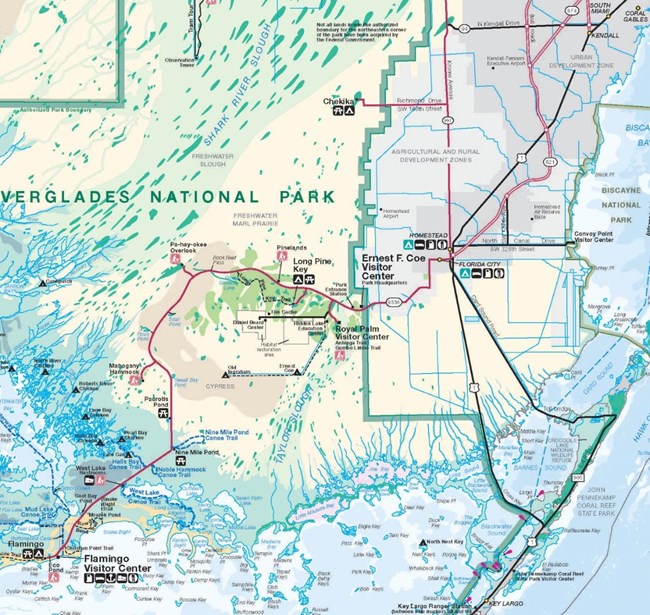
Map of Everglades National Park
Note about transportation:
There is no public transportation to the center. Visitors may be able to arrange taxis, Uber, or Lyft to the Ernest Coe Visitor Center at the Homestead entrance to the park, but it is unlikely that a driver will take you to the Robertson or Beard centers, and even less likely that you can arrange for a pickup from our location in the park.

Note about cellular phone service and GPS:
Depending on your phone carrier, you may or may not have cellphone service once you pass the park entrance station. We suggest that you do not rely on GPS directions to the center. Instead, follow the map and directions below.
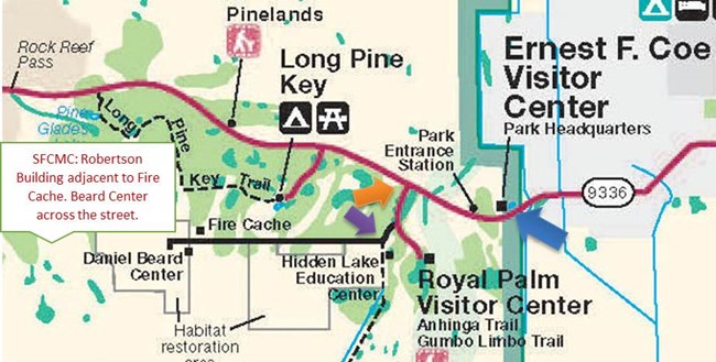
Map to the South Florida Collections Management Center (SFCMC)
Detail of Everglades National Park map showing location of the Daniel Beard Center.
1. Enter Everglades National Park at the east entrance after passing through Homestead and Florida City on State Road 9336. (blue arrow on map)
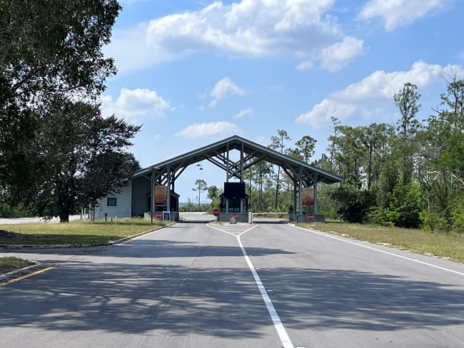
Homestead entrance station to Everglades National Park
Homestead Entrance Station to Everglades National Park. State Road 9336 becomes the Main Park Road after this point.
2. Pass through the park entrance station and continue on the main park road for approximately 1.6 miles.
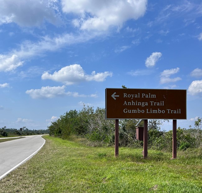
First available turn from Main Park Road, sign with left arrow pointing toward Royal Palm, Anhinga Trail, and Gumbo Limbo Trail
The first available left turn from the Main Park Road. Sign has a left arrow pointing toward Royal Palm, Anhinga Trail, and Gumbo Limbo Trail.
3. Look for the sign on the right for the turn toward Royal Palm. Turn left from the turn lane there and proceed approximately 0.9 miles to the next turn.
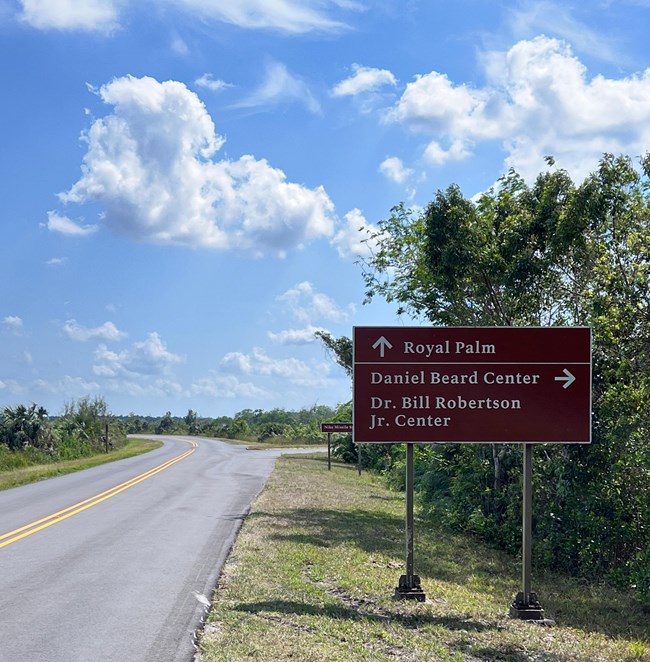
Right turn to Nike Missile Base
Prepare to turn right when these signs are visible on the right.
4. Before the first available right turn are signs directing visitors to the Beard and Robertson centers and the NIke Missile Base. Turn right here and proceed around the curved road approximately 0.4 miles.
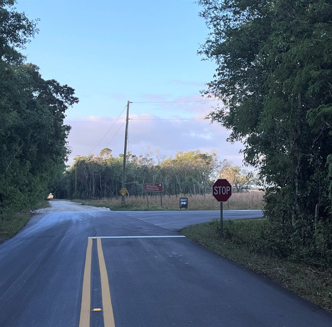
Stop sign showing where to turn right
Stop sign indicates right turn onto Research Road.
5. At the stop sign, turn right onto Research Road. This long, straight road reaches the Dr. Bill Robertson Center on the right in approximately 3.8 miles. (The purple arrow on the map, above, indicates the location of the stop sign.)
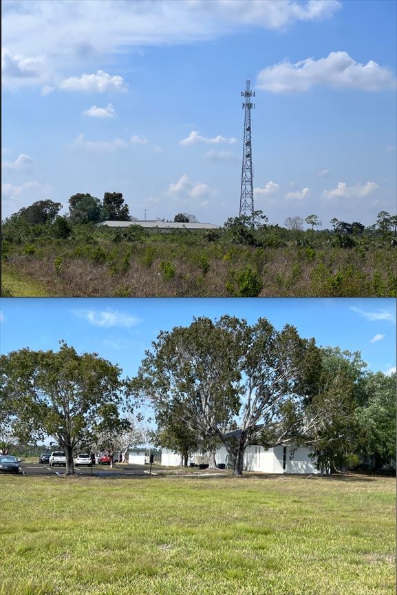
Bill Robertson Center composite image
The Dr. Bill Robertson Center is on the right side of the road with a large telecommunications tower (top image). The bottom image shows the parking area for researchers. Entrance is in the back of the building.
6. The Dr. Bill Robertson Center is nestled among the trees to the right. If this is your destination, turn into the driveway on the right and park in the large lot on the right. Arrange your arrival with the archivist for access to the building.
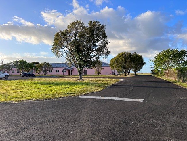
Daniel Beard Research Center
The Daniel Beard Center is the pink building on the left after you pass the Robertson Center.
7. If your destination is the Daniel Beard Center, continue driving on Research Road for another 0.1 miles. You will see the pink one-story building on the left. Turn into the driveway and park in the front parking lot. Arrange your arrival with museum staff for access to the locked building.

Latitude/longitude: 25.389318/-80.681886
GPS coordinates: 25° 23' 21.5448'' N 80° 40' 54.7896'' W

Use of lat/long or GPS is not guaranteed.

Last updated: March 28, 2024