
Baltimore Sun Historic Photos/TCA Monocacy National Battlefield is a fragmented park. It is divided by roads, a river, and a railroad. These obstacles are not a distraction from the battlefield’s story, but instead a key element to it. The Georgetown Pike [Urbana Pike], the B&O Railroad [CSX] line, and the Monocacy River are among the primary reasons that the battle occurred where it did. Even the late comer I-270 reflects the connection between Frederick and Washington, DC, that led Jubal Early to choose the route. While these features contribute and shape our story, they also complicate our understanding of it and make it impossible to safely travel the battlefield on foot or even see critical features of the landscape. In 2017, the National Park Service published the Monocacy National Battlefield Public Access Plan Environmental Assessment (Access Plan) to explore options for connecting the fragmented pieces of the battlefield. The purpose of the plan was “to develop a comprehensive plan that promotes the public’s access to and understanding of the battlefield in order to enhance the visitor experience and increase opportunities for visitors to connect with the park’s resources, history, commemorative aspects, preservation activities, and significance, while minimizing impacts to cultural and natural resources.” The plan proposed and analyzed the creation of almost eight miles of new trails, construction of pedestrian bridges, a land bridge, and clearing of viewsheds. The plan also addressed the barrier created by I-270 between the Thomas and Worthington farms. While the first shots of the battle rang out on the Georgetown Pike north of the bridge, the outcome was decided on the Thomas and Worthington farms. With their access to the bridge over the river blocked by Union troops, Confederate cavalry began searching for alternative ways to cross. Around mid-morning, they found the Worthington Ford and began to cross the Monocacy. Unable to fight on two fronts with his limited troops, Major General Lew Wallace ordered the bridge over the river burned and refocused his troops to the Thomas Farm. With Confederate forces based around the Worthington House and Union command at Gambrill Mill, the fight for control of the Thomas Farm surged and ebbed throughout the afternoon. Around 3:30 pm, having gained and lost the Thomas House, Confederates launched their final attack throwing three fresh brigades at the badly outnumbered and exhausted Union line. With his men running out of ammunition, Wallace gave the order to retreat around 4:30 pm. It was during this third wave of the fighting that most Confederate casualties occurred: 698 of an estimated 900. Without a doubt, the construction of I-270 had a significant impact on the Monocacy Battlefield. Built in the 1950s, before the National Environmental Policy Act (NEPA), I-270 construction caused the loss of archeological resources and the disturbance of the hallowed ground where men bled over the fate of our nation. The interstate also physically divided the Thomas and Worthington farms and as a result complicated our understanding of the events of July 9, 1864. Over time, the growth of trees along roadways and fences severed the visual connection between the two farms and further obscured the role of the landscape in the battle. View from Worthington 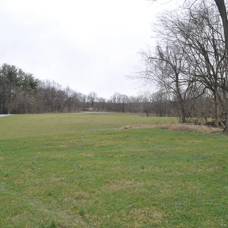
Left image
Right image
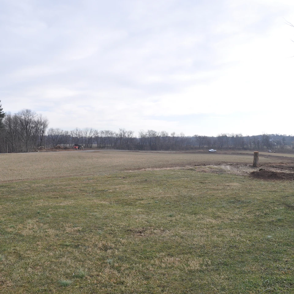
The 2017 Access Plan identified reconnecting the Thomas and Worthington farms as an important tool to provide visitors the opportunity to understand the close connection between the farms and how the battle unfolded. Since removing I-270 was not a realistic option, the Access Plan analyzed reestablishing the visual connection between the Worthington and Thomas houses. Researchers located historic photos from the early 20th century that revealed clear views between the two houses. The photos also revealed a kitchen garden at Worthington rimmed with Osage orange trees. The garden plot continued to be visible in aerial photos of the construction of I-270, indicating that the encroachment of trees was a fairly recent occurrence. Using GIS, resource managers confirmed that the removal of a limited corridor of trees would restore the line of site between the houses since that section of I-270 is below grade. Field work further refined and limited the area of trees to be removed on both farms. Tree work began in the fall of 2020. The work was timed to minimize the impacts to native birds and bats that roost in trees. Contractors began on the Worthington Farm, pushing back the tree line that had crept over the last 50 years from the base of Brooks Hill towards the entry lane. Removing trees revealed the remnants of the Osage orange hedge row around the former garden, as well as middens (aka historic trash pits) associated with the migrant workers housed at Worthington during the mid 20th century. The park archeologist Alex Vindas Cruz monitored the work to minimize impact to the archeological sites. Landscape architects from the regional office evaluated the Osage orange trees and identified trees for retention. The Osage orange trees were then cropped to promote regeneration. Non-historic trees were also removed along the Worthington entry road and the border with I-270. On the Thomas Farm tree removal focused on the area adjacent to I-270 and historic fence lines around fields. In addition to cutting trees, contractors ground the stumps to allow the park to replant the areas more easily. As with any remodeling or renovation project, the impacted area looked worse before it began to look better. Many visitors were surprised and distressed to see trees being cut in the park. Moving forward, the disturbed areas will be replanted with native grasses and low growing shrubs to maintain the open viewshed. This spring, park staff planted native grasses to stabilize slopes and minimize establishment of invasive species. These replanted areas will improve habitat for native birds that prefer to nest in grasslands rather than trees. The Osage orange trees should resprout and the historic hedgerow will be maintained between four to six feet in height. One unintended consequence of the project was the realization that the replica cannon at Worthington House will need to be reoriented; it is currently aimed at I-270 instead of the Thomas House. In 1934, when Congress passed legislation to establish Monocacy National Military Park the battlefield had changed very little in 70 years that had lapsed. By the time funding was appropriated in the late 1970s to acquire land for the battlefield, the pressure of development was already beginning to show. The construction of I-270 in the 1950s through the heart of the battlefield confirmed the importance of the location and further fragmented the landscape. The National Park Service developed the Monocacy National Battlefield Public Access Plan to increase opportunities for visitors to connect to the park’s resources, history, preservation activities, and significance. By adding trails and restoring the visual connection between the Thomas and Worthington Farm, the Access Plan seeks to unite a battlefield fragmented by humans and nature. View of Worthington from Thomas cutout 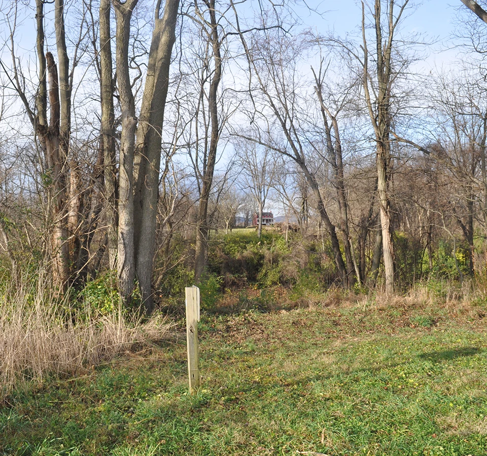
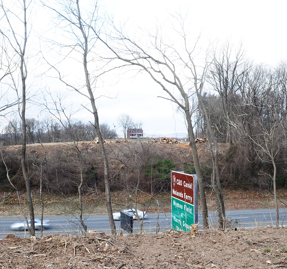
Left image
Right image
|
Last updated: April 23, 2021