IntroductionNational Park Service scientists regularly conduct vegetation surveys to analyze forest types and species diversity in our parks. Surveys in the upper Midwest are conducted by the Great Lakes Inventory and Monitoring Network. They provide park managers a baseline inventory of species, and their findings are publicly available. Knowing what kinds of plants we have helps us understand:
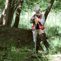
Resource managers use this information to make informed decisions about park lands, which is crucial to following our mandate to protect our national parks and provide an unimpaired visitor experience. How is a Survey Conducted?Scientists at the Great Lakes Network map out the study area, and create a random array of plots. About 35 plots will be studied, and each plot is the same size (50 meters by 100 meters) so that the same steps can be carried out at each location. Working in teams, the scientists and park rangers mark the plots using GPS coordinates. The survey records data along three lines through the plot at the top (north) side, through the middle, and at the bottom (south). Scientists note soil moisture level and nutrient availability, tree species and health, downed trees, shrubs and saplings, groundcover, and what deer are eating. The same data are recorded for each site. In six years, a team of scientists will return again and study the same areas to track changes. The scientists at the Great Lakes Network compile data and then write reports during the winter. Our report will be available next year. What We do with the SurveyThe Mississippi National River Recreation Area is a partner park, which means we don't own much land along the river. On the land we do manage, we can directly implement the report's recommendations. In other locations, we can share the findings and recommend strategies. There are some things we already know: we have lots of invasive plants such as buckthorn, garlic mustard, spotted knapweed, narrow-leaved bittercress, and purple loosestrife. This vegetation study will show us if our removal efforts are working, and what areas we should focus on. Overall, the survey will give us accurate numbers and a starting point to compare against as we plan for the future. |
Last updated: February 14, 2019
