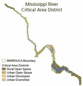
-prevent and mitigate irreversible damage to this resource; preserving and enhancing its natural, aesthetic, cultural, and historical value for public use; -protect and preserve the river as an essential element in the national, state and regional transportation, sewer and water and recreational systems; and -protect and preserve the biological and ecological functions of the corridor. The history of the laws and rules that apply to the Critical Area began when the Minnesota legislature passed the Critical Area Act in 1973. The Critical Area Act requires that each government having jurisdiction over land within the Critical Area boundaries devise a plan that defines how it will act to meet the goals and purposes of the Critical Area Act. Property owners are affected by these plans and laws because they define how land near the Mississippi River may be developed. The history of the laws and rules that apply to the Critical Area began when the Minnesota legislature passed the Critical Area Act in 1973. The Critical Area Act requires that each government having jurisdiction over land within the Critical Area boundaries devise a plan that defines how it will act to meet the goals and purposes of the Critical Area Act. Property owners are affected by these plans and laws because they define how land near the Mississippi River may be developed. In 1976, four corridor districts were established that identify different types of land use along the river. Each district has its own set of guidelines, which are consistent with natural characteristics and existing development. State Executive Order 79-19 details the rules and guidelines that each community must incorporate in its Critical Area plan. Local governments, the Metropolitan Council, the Minnesota Department of Natural Resources, and the National Park Service are partners in managing land use along the Mississippi River through the Critical Area and Mississippi National River and Recreation Area programs. |
Last updated: April 10, 2015
