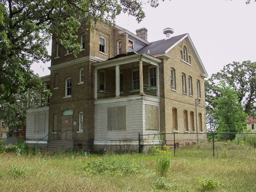
IntroductionThe Mississippi National River and Recreation Area is engaged in planning a number of projects. Fort Snelling Upper Post –Program Change for Historic Building Re-UseThe Minnesota Department of Natural Resources (DNR) has requested the National Park Service (NPS) to transfer a 141-acre parcel of Fort Snelling's Upper Post from the Federal Lands to Parks program to the Historic Surplus Property program. As part of the program change, the DNR and NPS have prepared a Draft Program of Preservation and Utilization (PPU) and a draft of required changes to the land deed. The Final PPU will accompany the deed and is a binding element of the deed that the NPS must approve. Also, a Draft Programmatic Agreement (PA) has been prepared which will address the program change and establish a programmatic review process for future developments that might occur on the Upper Post as outlined in the PPU. The NPS recognizes that the program change is an undertaking per Section 106 of the National Historic Preservation Act of 1966, as amended, and is seeking public input. Public comment period is open through June 27, 2016. Copies of the draft deed, PPU and PA are available at: https://parkplanning.nps.gov/fortsnellingupperpost. Comments can be submitted on-line as well. Situated at the confluence of the Mississippi and Minnesota Rivers, Fort Snelling is a National Historic Landmark. Construction on the fort began in 1820 as a U.S. military frontier post to protect trade and maintain peace along the northwestern frontier. Expansion beyond the walls of the frontier post into the area currently referred to as the Upper Post began in the late 1870s. Water Resources Information and Issues Overview ReportIn 2004, the Mississippi National River and Recreation Area (MNRRA) requested technical assistance from the Water Resources Division (WRD) of the National Park Service. The MNRRA and WRD developed the Water Resources Information and Issues Overview Report, a document that attempts to characterize water resources in MNRRA, reports the outcomes of a two-phase water resources scoping effort undertaken in 2005, and describes the subsequent analysis and conclusions of MNRRA and WRD staff. Open Space Protection OpportunitiesThe National Park Service has developed the Open Space Protection Opportunities, a suite of informational tools that includes maps, a guidebook, and spatial data for use in a geographic information system. This information illustrates open space protection and restoration opportunities in the Mississippi National River and Recreation Area. |
Last updated: November 2, 2023
