NPS Photo
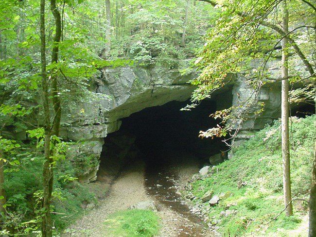
Located in northeastern Alabama, Russell Cave has one of the longest and most complete archeological records in the eastern United States. Artifacts indicate intermittent human habitation for almost 9,000 years. Varying styles of spears and arrow points show that different bands of Indians used the cave as a permanent home, as winter quarters, or, in the case of nomadic tribes, as a stopover. Russell Cave National Monument is 310 acres in size and contains the cave, a stream, sinkholes, and sandstone outcrops.
The Cumberland Piedmont Network I&M program has provided this park with a vegetation community classification and map, a wetlands inventory, and updated vascular plant and vertebrate species lists. During the vegetation community classification work, 10 distinct associations were documented and mapped, including an uncommon mesic limestone oak forest.
The network monitoring program at this park includes six vital signs involving repeated visits to established sites following procedures set forth by each monitoring protocol. These six vital signs are: cave aquatic biota, cave bats, forest vegetation communities, invasive species early detection, ozone/foliar injury, and water quality. Water quality monitoring began in 2005 and continues on a monthly schedule for two years "on", five years "off", at three sites. Forest monitoring began in 2011–2012 with the establishment of 16 long-term monitoring plots. Additional plots will be established in upcoming years, followed by a five-year revisit schedule, occurring in mid-May. Ozone levels and foliar injury are assessed on-site every six years, beginning in 2011. The Invasive Species Early Detection protocol was completed in 2012 and will be used by field crews to monitor for priority exotics during their scheduled field work. Cave bat monitoring began in 2016 and continues annually for summer counts and every other year for winter counts. The cave aquatic biota monitoring protocol was completed in 2018.
Park managers are using inventory and monitoring data to create resource stewardship strategies for achieving desired future conditions. The links to inventory and monitoring reports are provided on this page.
For more Information contact:
Steve Thomas, Network Program Manager, CUPN offices at Mammoth Cave NP
Last updated: January 12, 2021
