
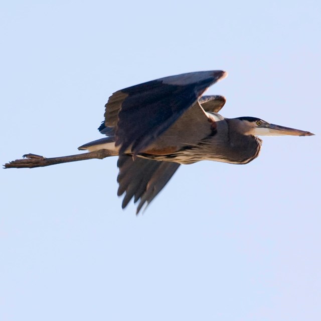
NPS/Tim Pine
The Rio Grande Wild and Scenic River includes 305 km (196 miles) of the Rio Grande River which begins its 2,000-mile journey to the Gulf of America from springs and snow melt high in the southern Rocky Mountains of Colorado. As it flows toward the Gulf, much of its waters are diverted for flood control, irrigation, power generation, municipal uses, and recreation. This often results in a dry riverbed between El Paso and Presidio, Texas. The Mexican Rio Conchos, originating in the Sierra Madre of western Chihuahua, contributes a significant amount of the water to the Rio Grande downstream from Presidio. Springs help sustain the year-round flow through the Lower Canyons in Big Bend National Park. The average precipitation at Boquillas, Texas, on the Rio Grande is around 25.4 centimeters (10 inches).
Rugged canyons, lush riparian areas, rapids, and unspoiled views contribute to the scenic allure of this area. Near its upstream end, the Rio Grande has sliced through the surrounding rocks to form steep-walled, sometimes narrow canyons. In the Lower Canyons portion of the Rio Grande, the river and its tributaries lie 152 to 457 meters (500 to 1,500 feet) below the surrounding plateaus.
The Rio Grande Wild and Scenic River corridor represents an exceptional example of Chihuahuan Desert fauna in association with species that depend on the rare aquatic and riparian habitats of the river. The flora and fauna of the Lower Canyons of the Rio Grande have not been altered greatly by man-made influences. The rugged nature of the region reduces the ability of livestock to graze the area, although goats have probably altered the vegetation in some areas. Almost no systematic inventories have been conducted in the Rio Grande Wild and Scenic River, but one limited survey of mammals found 43 species (including 13 bat species) and another four species were thought to possibly occur. A vegetation mapping project is also underway and will produce an initial list of plants for the park. We monitor river channel characteristics at this park.
-
 Species Lists
Find species lists for this park here
-
 Climate Analyzer
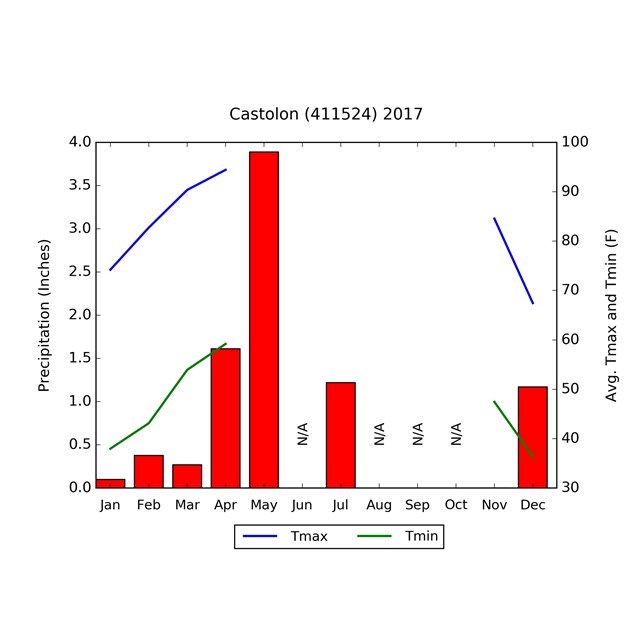
Find climate data for this park here
Reports & Articles
Read more about our work at this park in the resource briefs (short summaries), monitoring reports (detailed results), and web articles below. Inventories (baseline reports and lists of natural resources) and protocols (monitoring procedures) can be found on our reports & publications pages.Source: NPS DataStore Collection 5482. To search for additional information, visit the NPS DataStore.
Source: NPS DataStore Saved Search 3514 (results presented are a subset). To search for additional information, visit the NPS DataStore.
Source: NPS DataStore Saved Search 1041 (results presented are a subset). To search for additional information, visit the NPS DataStore.
Quick Reads
Last updated: February 26, 2025