Terrestrial Ecosystems
Mountains and Uplands
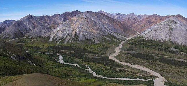
In the mountainous regions of the Arctic parklands, vegetation communities range from the polar desert of the high, barren summits through various forms of alpine tundra to extensive shrublands and, in the more inland areas, upper reaches of boreal forest formed mainly of white spruce (Picea glauca). Polar desert communities are similar in composition to those found in High Arctic regions such as the northern Canadian Arctic Archipelago. Vascular plants are mainly circumpolar species and almost entirely herbaceous. Moss patches are extensive in moist areas and lichens cover rock faces.
Ken Hill
Alpine Tundra
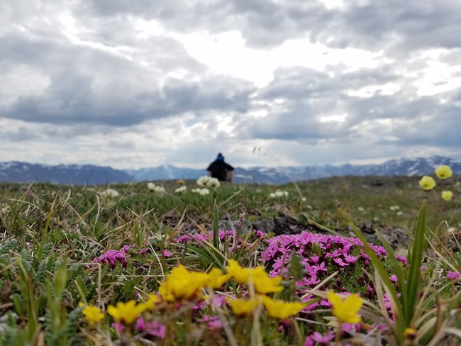
Alpine tundra includes a variety of vegetation dominated by herbaceous plants and low shrubs associated with altitude, slope steepness and exposure, soil and substrate structure and chemistry, and moisture availability. Many of the rare species of plants are found in alpine tundra locations, where they may be locally abundant, but widely separated from other colonies. Alpine tundra provides important foraging areas for large herbivores such as Dall’s sheep (at higher elevations), caribou, and, where they occur, muskox. Some smaller herbivores, such as marmots, are largely confined to alpine tundra. Changes over time in alpine tundra tend to be subtle. Some of the greatest diversity in alpine tundra species composition occurs in seepage areas, which are usually related to persistent snow beds. Alpine tundra generally becomes richer in shrubs at lower elevations where it merges with shrubland. Alternatively, it may grade more or less imperceptibly into the tussock tundra and wet meadows characteristic of lowland tundra.
Shrubland
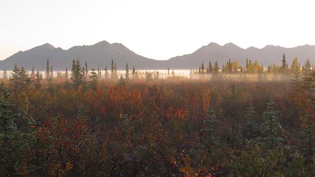
Shrubland is characteristic of the lower slopes of mountains, but is especially well developed immediately above (or beyond) treeline in the Brooks Range. The species composition of shrubland varies widely, but is often correlated with the direction of slope exposure. Cool, moist slopes are generally dominated by dense alder (Alnus crispa) thickets. Several species of willow (Salix spp.) occur widely in shrubland, and the exact species compositions seems to depend on a variety of factors such as elevation, moisture availability, soil type, slope stability, and history.
Boreal Forest
Boreal forest (or taiga) is an important component of the vegetation at low elevations in Kobuk Valley National Park and Gates of the Arctic National Park & Preserve south of the Brooks Range. Spruce (Picea glauca and P. mariana) and birch (Betula papyrifera) are the most common tree species, with aspen (Populus tremuloides) and poplar (P. balsamifera) present locally. A complex mosaic of stands with different species and unforested areas as a result of site conditions and fire effects. Near Arctic treeline, white spruce stands are found along the lower reaches of some watercourses. Isolated individual trees are found in the lower reaches of shrubland, where trees may be advancing. In addition to spruce forest, there are often small stands of cottonwood occurring well beyond or above the conifer treeline. In some areas, there are also small riparian poplar woodlands that may host isolated populations of insects and breeding birds that are otherwise typical of the boreal forest.
Ken Hill
Arctic Lowlands
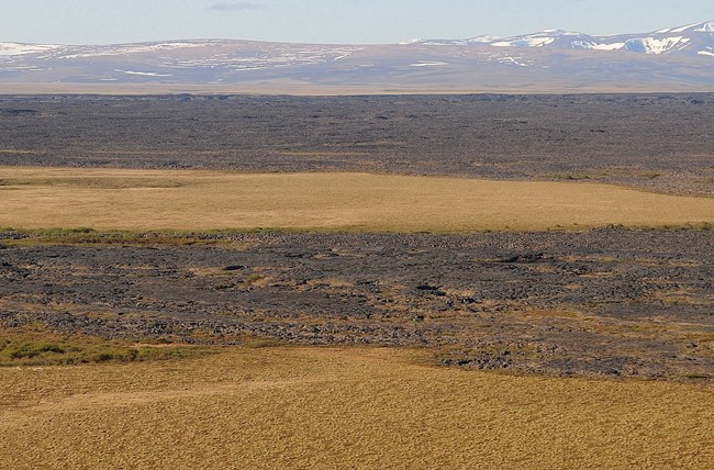
The geomorphic features of lowland areas are generally the result of direct glacial deposits (moraine), alluvial deposits associated with streams, mass wasting downslope, and aeolian deposits, most of which are now stabilized. Thus, most lowland ecosystems are developed on landscapes that feature deep deposits of unconsolidated material. Since the mean annual temperatures throughout the Arctic parklands are well below freezing, water contained in this material is usually frozen that is within the zone of continuous permafrost. Permafrost landscapes on unconsolidated deposits are often quite dynamic. In addition to the active layer—the seasonally thawed soil above the permafrost—a number of situations exist in which freezing and thawing processes create major alterations and instabilities in permafrost terrain. These include ice-wedge polygon formation and other types of processes that form patterned ground. Of particular interest are thermokarst processes, the result of the thawing of ice-rich frozen ground that often results in soil slumps, the creation of ponds and migration of drainage channels, and the draining of older thaw lakes. Thermokarst processes are known to be increasingly active in many polar regions in recent decades due to climate change.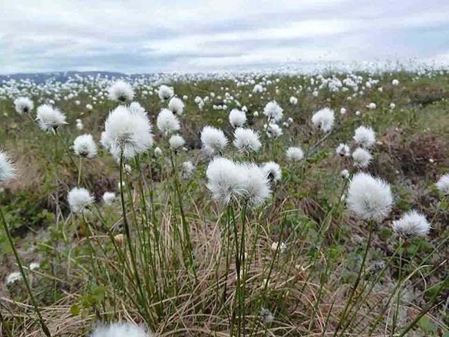
The most widespread type of vegetation in the lowlands is sedge meadow, and it generally consists of two types: wet meadows and tussock tundra. Tussock tundra covers enormous areas of rolling terrain, such as those that occur throughout the middle Noatak drainage. The dominant plant species is a cottongrass (Eriophorum vaginatum), which forms dense, peaty tussocks, each surrounded by a moist, shaded moat. These areas provide important habitat for caribou during much of the year. They are also populated by a wide array of small mammals and breeding birds.
Wet meadows are usually associated with flat, poorly drained terrain with permafrost. The vegetation consists largely of sedges (Carex spp.). Water stands on these meadows during much of the year, and they form a transition between aquatic and terrestrial environments. Wet meadows are often affected by changes in the permafrost regime, including natural cycles that tend to create and drain lakes and ponds.
Ken Hill
Freshwater Ecosystems
Large Rivers
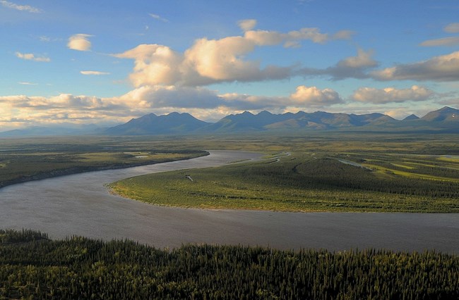
Arctic parklands contain many large, open river systems, that meander through broad valleys and contain numerous side channels and sloughs, including the Noatak and Kobuk rivers that drain west into the Kotzebue Sound and the Chukchi Sea. Many of the tributaries to these rivers originate in the Brooks Range as clear-water or silt-rich glacier-fed streams. These large river systems serve as conduits for carbon, nutrient, and trace metal transport, connecting the surrounding watershed with areas further downstream. In addition, many anadromous fish, birds, and large mammals use these large river corridors for migration or foraging, providing yet another opportunity for exchange of energy and nutrients up or downstream.
Headwater Streams
Mountain, tundra, and spring-fed streams occur in Arctic parklands. Mountain streams are either glacier-fed or fed by precipitation and snowmelt. Whereas, tundra streams are fed mainly by snowmelt and precipitation and are found in the foothills and coastal plains. Mountain and tundra streams experience extreme fluctuations in flow with high discharge in spring and summer and little flow in the winter, allowing many of them to freeze. Spring-fed streams receive groundwater below or within the permafrost layer and flow year-round. These perennial streams contain a large number of aquatic species, most likely serving as refugia for taxa that are not freeze tolerant.
Lakes
Lakes are one of the most dominant features of the Arctic parklands; there are many of varying sizes. Many large deep lakes in this region are the result of glacier processes or volcanic explosions. Large lakes in these parks provide important habitat for aquatic primary producers, zooplankton, macroinvertebrates, fishes and waterbirds.Thousands of shallow lakes and wetlands make up the landscape of these parks providing important habitat for ungulates, birds, and furbearers. These dynamic environments can be influenced by the thaw of the permafrost beneath them.
Coastal Ecosystems
Coastal ecosystems of Bering Land Bridge National Preserve and Cape Krusenstern National Monument extend over approximately 946 mi (1,514 km) of coastline along the Bering and southern Chukchi seas. Network parks do not manage offshore waters; however, the boundary between marine and coastal ecosystems is less distinct biologically than it is geographically. Marine processes and events strongly affect the coastal environment, and vice versa. This is particularly true in the Arctic, since the surrounding seas are shallow.
Rocky Shores and Exposed Tundra
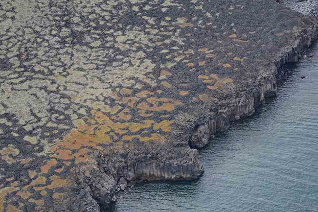
Rocky shores occur mainly along the Kotzebue Sound coast of Bering Land Bridge National Preserve. These shores are generally low-lying and are formed from lava flows of various ages. Above the inshore limit of storm beaches and beach deposits, the vegetation is often affected by salt carried onshore by wind; a few species of lichens and vascular plants are encouraged by or confined to saline situations. Exposed (eroded) tundra is found in areas where lagoons and barrier beaches have not developed. The coastal environment is often confined to a relatively narrow strip of beach. In some cases, the sea may even undercut deep deposits of ice-rich unconsolidated sediments, so that the interface between the sea and the terrestrial environment is a narrow zone of collapsing bluffs.
Tundra coastlines are generally receding in the Arctic coastal parks. The main phenomena associated with the incursion of the sea is the loss of terrestrial material and the dispersal into the sea of sediments and nutrients that have been contained in the largely frozen terrestrial environment.
Lagoons and Barrier Beaches
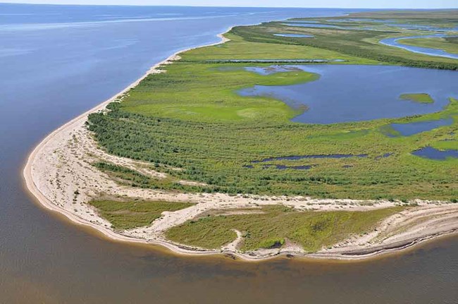
Barrier beaches and lagoons encompass Bering Land Bridge National Preserve’s northern coast and most of Cape Krusenstern National Monument’s coast. Cape Krusenstern has an extensive barrier beach formation of enormous archaeological significance. In contrast to tundra coastlines, barrier beaches are often aggrading, and many have been doing so for several thousand years. The ridgetops generally support narrow margins of vegetation dominated by lyme grass (Elymus arenarius), especially so in the dunes. The swales are variable; some are water filled during much or all of the year, while others are mostly dry.
Coastal lagoons make up about a third of Alaska’s Arctic coastline. They are a critically important ecosystem in the region because they support bird, fish, and invertebrate populations, and are used by both terrestrial and marine mammals. They also support seasonal traditional subsistence activities for Alaska Natives and serve as navigational pathways throughout the year by local village residents. These lagoons are shallow, semi-enclosed, brackish waterbodies that have conditions between fresh and marine waters. Some are actually open to the ocean by way of passages through the barrier-beach complex, making them highly saline. Streams originating inland feed the lagoons and affect their salinity. These lagoons are highly dynamic systems where water quality changes drastically as connections to the marine environment open and close. The shores and shallow portions of lagoons support extensive wet meadows; these are often punctuated by small ponds.
Five major lagoons are within the boundary of Bering Land Bridge National Preserve – Lopp, Kupik, Shishmaref, Ikpek and Arctic and sediment transport is beginning to form a sixth in the shallow, protected waters behind Cape Espenberg. There are eight major lagoons described within the boundary of Cape Krusenstern National Monument – Aukulak, Imik, Ipiavik, Kotlik, Krusenstern, Port, Taseycheck, and Sisualik.
Ken Hill
Estuarian Ecosystems
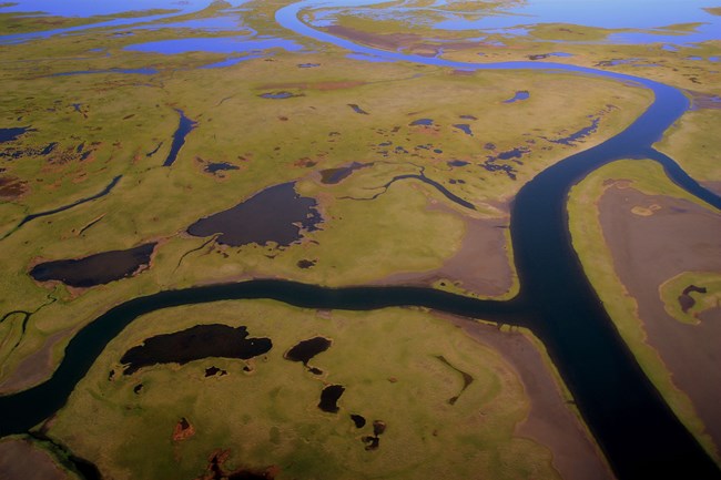
Estuaries are the most productive ecosystems in the world and are generally associated with sizeable streams. The high-flow streams provide coarse sediments of sands and silts that create mudflats in low-lying areas where there are heavily vegetated marshes. The high sediment load can also result in relatively high nutrient levels in shallow waters and marshes. Connectivity with larger streams may deliver anadromous fish to these habitats. The estuaries and lower reaches of feeder streams may provide important habitat for young salmonids. Like lagoons, estuaries are rich in invertebrates and small fish making them important stopover areas for migrating waterbirds.
Last updated: May 31, 2018
