
|
|
|
2007 ESRI UC Displays |
 |
||
|
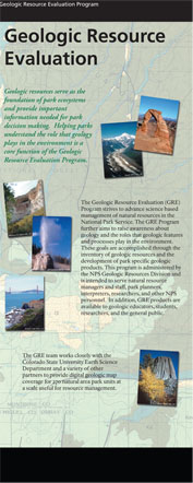
Geologic Resource Evaluation
Getting Started: Creation of park specific digital geologic data begins with the assembly of index maps showing the area of interest for each park and identifying the extent of published geologic maps. NPS-GRD staff use the USGS on-line National geologic maps database (http://ngmdb.usgs.gov/ngmdb/) as the primary resource for identifying published geologic maps relevant to each park. A table of selected published maps is generated for the area. While numerous published maps at various scales encompass NPS areas, complete and adequate digital geologic map coverage is not always available. The GRE team holds scoping meetings at parks to review available data on park geology and discuss geologic issues. Through this process, the team evaluates the extent and quality of existing geologic maps and park specific geologic resource management issues. The GRE team holds scoping meetings at parks to review available data on park geology and discuss geologic issues. Through this process, the team evaluates the extent and quality of existing geologic maps and park specific geologic resource management issues. Digital Geology: When geologic maps are identified for GRE Program use, hard copy maps are scanned, geo-referenced, and digitized. If source map data is available in a digital format, it is directly converted to the GRE GIS format. The present GRE GIS format for digital geologic data is based on the ESRI geodatabase model. This robust model allows the NPS to store spatial data within a relational database management system. Geodatabases also allow attribute validation rules, relationship classes, and topological rules that maintain data integrity within and between data layers. Further, this model supports storage, mapping, and analysis of complex geologic relationships. GRE staff create digital geologic maps that have the look and feel of source maps, yet allow for digital presentation and GIS analysis. Published source maps often include useful ancillary information such as rock descriptions, cross section graphics, local and regional geology, and references. The GRE team captures this information in a Windows helpfile that displays additional source map information in an interactive and searchable format. Creating digital geologic-GIS data requires manual digitization of source maps or conversion of existing digital data into the NPS GRE Geology-GIS Geodatabase Data Model using custom tools and existing ArcGIS functionality. Rigorous quality control methodology ensures the validity of output GIS data. When possible, digital geologic maps are compiled to create a single, park-wide digital geologic map. Prior to digitizing, geologic features(such as geologic units, faults, and attitude measurements) are identified on the source map and assigned to data layers. Lines on the source map are captured into a single data layer with limited attribution and later, differentiated into appropriate data layers. This method makes capturing coincident features, such as faults and geologic contacts possible. Lines that comprise the boundaries of polygonal geologic features, like geologic units, are used to construct polygons. GRE team members parse components of the geologic data into assigned data layers and bring them together in a geodatabase. Point features are captured and attribution is completed for line and polygon features. All attribution follows the NPS GRE Geology-GIS Geodatabase Data Model's guidelines for capturing geologic data. The data model applies topology rules that ensure coincidence between geologic data layers and geometric properties within a single data layer. Relationships between tables and data layers are also established by the data model. Finally, each layer undergoes quality control. The GRE GIS team delivers products in geodatabase, shapefile, and coverage formats. In keeping with the goal of preserving the original source map information, all source map text and graphics are captured in a help file providing detailed feature descriptions and keyword searchability. FGDC compliant metadata completes the package by recording reference, processing, and geospatial information. Content by Melanie Ransmeier and Georgia Hybels NPS GRD. Links of interest:
For NPS go to inside for more information about the conference |
|||
| ParkNet | US Department of the Interior | FOIA | Privacy Policy | Disclaimer | FirstGov |