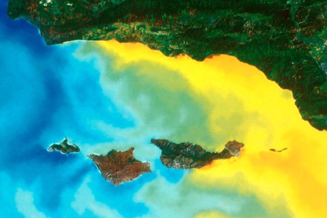
California Current San Miguel and Santa Rosa islands are the furthest west of California’s Channel Islands. These islands are bathed by the California Current, which sweeps cold water from the Gulf of Alaska down along the coast of North America. As a result, the marine life around these islands resembles that found off the coast of northern California, Oregon and even Washington state. Some common species at the Channel Islands that are associated with colder water temperatures include the black rockfish, sunflower sea stars, and red abalone. Southern California Counter-current The Southern California Counter-current brings warm water from Baja California up along the mainland coast, swirling around Santa Barbara, Anacapa, and eastern Santa Cruz Islands. This warmer water supports biological communities reminiscent of southern California down to northern Mexico. Some common species that associate with warmer water temperatures include the Garibaldi fish, California spiny lobster, and the California moray eel. 
Upwelling During the spring and summer months, San Miguel and Santa Rosa Islands benefit from additional cold, nutrient-rich waters that rise from the depths of the ocean to the surface through a process known as upwelling. Upwelling occurs when winds parallel to the coast and the rotation of the earth work together to push warmer surface water offshore. This allows for the colder water from deeper in the ocean to be pulled up towards the surface. This nutrient-rich soup is utilized, along with sunlight, by tiny photosynthesizing microorganisms which serve as the base of a complex food web. These tiny organisms sustain all life around the Channel Islands even directly supporting the largest animals on Earth – blue whales! A series of deep ocean basins and ridges to the south and west of park waters also contain a wealth of nutrients. These nutrients become accessible in the winter months when changing winds cause upwelling along the southern shores of the northern islands and water from the basins is drawn to the surface. 
|
Last updated: February 1, 2017
