|
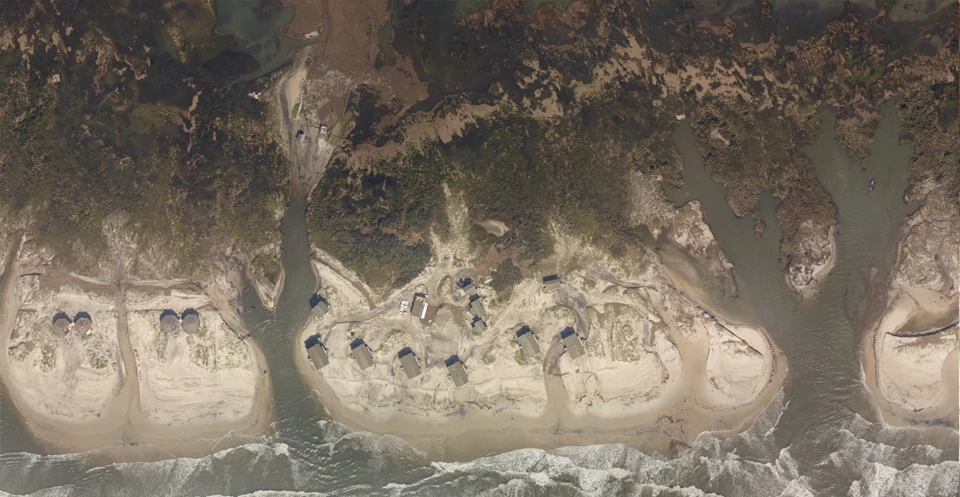
Hurricane Dorian Damage at Long Point Cabin Camp in 2019 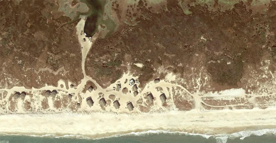
Left image
Right image

NPS Photo Before, during, and after a storm, please monitor this page, our Facebook and Instagram and our Current Conditions page for information about park conditions. During named storms, the storm area in Cape Village, and Long Term Parking on North and South Core is open for visitors to use. Vehicles camping and park in the dunes is still prohibited. There is no designated storm shelter location on Shackleford Banks. 08/22/2025 - The National Park Service is assessing for any impacts due to Hurricane Erin. Currently, very few damages to park facilities or resources have been found. But there is a lot of standing water in various areas that will need time to dry out. As of today, August 22, 2025:
For Saturday, August 23, 2025:
For Sunday, August 24, 2025:

NPS Photo 
NOAA 08/20/2025 - 1. Erin is expected to produce life-threatening surf and rip currents along the beaches of the Bahamas, much of the east coast of the U.S., Bermuda, and Atlantic Canada during the next several days. Beachgoers in those areas should follow advice from lifeguards, local authorities, and beach warning flags. 2. Storm surge flooding and tropical storm conditions are expected in the North Carolina Outer Banks beginning later today or tonight. The storm surge will be accompanied by large waves, leading to significant beach erosion and overwash, making some roads impassible. Tropical storm conditions are possible on Thursday along the southeastern coast of Virginia. 3. Tropical storm conditions are possible on Bermuda on Thursday and Friday. 4. Interests elsewhere along the U.S. Mid-Atlantic and southern New England coasts, and Atlantic Canada, should also monitor the progress of Erin as strong winds are possible Thursday through Saturday. 
News Releases |
Last updated: August 22, 2025