Last updated: August 23, 2017
Article
Colorado: Yucca House National Monument

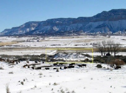
within the yellow box.
Image courtesy of National Park Service
Yucca House National Monument on the lower eastern slopes of the Sleeping Ute Mountains protects one of the largest archeological sites in Southwest Colorado, which dates from the Great Pueblo Period. Here, from 1150 to 1300 A.D., the Ancestral Puebloan people of Southwest Colorado established an important community center. The preservation of Yucca House ensures that visitors can learn about and archeologists will be able to continue to study this unexcavated site. The site has the potential to yield important information about the Ancestral Puebloan society of Mesa Verde that will contribute to understanding this culture’s history, religion, sociopolitical structure, why the people left the area in the late 1200s, and their overall impact on the present day Pueblo peoples.
The first written account was by Professor William Holmes, who surveyed the region in 1878 and designated this site as the “Aztec Springs.” Archeologists renamed this Ancestral Puebloan site to clarify that the Aztec Indians did not build the community there. Named for its location at the base of the Sleeping Ute Mountains, which the Ute Indians and other tribes refer to as the “mountain with lots of yucca growing on it,” Yucca House National Monument consists of two major sagebrush-covered mounds and several smaller Pueblo Indian ruins clustered throughout the monument grounds.
The largest of these Pueblo mounds is at the base of Ute Mountain, on the western side of the complex. Approximately 80 by 100 feet wide, this rectangular shaped mound with rooms on all four sides is the largest Pueblo ruin at Yucca House National Monument and the tallest of all the Pueblo mounds. Generally referred to as the “Upper House” because of its high elevation, this large Pueblo mound measures between 15 to 20 feet high. At the center of this rectangular site are three depressions that are believed to contain the ruins of two to three small kivas.
Approximately 600 feet to the east of the Upper House is the second major Pueblo mound of Yucca House. Known as the “Lower House,” and sometimes referred to as the East Ruin, this structure is an L-shaped pueblo with at least eight rooms located along the northern wall. Together, these rooms measure more than 50 feet long and between eight to ten feet high, making the northern side the highest portion of this mound. A rock wall surrounds a main plaza within the Lower House mound. Enclosed in this wall is a large circular depression with a 50-foot diameter, which may have been the site of a Great Kiva or a ceremonial dance platform.
North of the Lower House and surrounding the Upper House are smaller Pueblo mounds or houses that together form the National Monument’s West Complex. Although these rubble mounds do not offer a clear delineation of the number of structures surrounding the Upper House, studies estimate that up to 600 rooms and over 100 small kivas were in the West Complex. At the highest elevation of this complex is evidence of a Great Kiva, which archeologists believe may have served the entire pueblo community living at Yucca House. Also located within the West Complex is the active spring that presently runs between the Great Kiva and Upper House.
It is not known whether the spring flowed at Yucca House during the time of the Great Pueblo period, but the Ancestral Puebloans characteristically established their villages near a reliable water source. As an agriculturally based society, the ancestral Puebloans required water to sustain their community. The spring allowed the community to irrigate their crops and helped attract the native wildlife. The Ancestral Puebloan diet consisted not only of corn, beans, squash, and yucca, but also of deer and smaller animals that the people hunted. The people of the Great Pueblo period also used water to mix mud mortar, which the Ancestral Puebloans needed to make their elaborate black pottery and to cement the limestone structures throughout the monument.
Although the Pueblo community of Yucca House built most of these structures with limestone blocks, some of these ruins—particularly those in the Upper House—have traces of adobe. Despite this being a characteristic of southwestern Pueblo architecture, the use of adobe was unusual for structures dating before the 1200s. The adobe in the Upper House ruins might suggest that other cultural groups traded and interacted with the ancestral Puebloan community of Yucca House. Questions still remain concerning the architectural influences and association between the Chacoan culture of the neighboring Mesa Verde pueblos and the Yucca House community, but the ruins at Yucca House National Monument offer great insight into the Ancestral Puebloans of the American Southwest.
Yucca House is surrounded by private land and only accessible by gravel or dirt road. People who wish to visit the monument should contact the staff at Mesa Verde National Park for directions and advice on planning a visit. Please be courteous toward the private landowners and close all gates behind you as you enter to prevent livestock from escaping. Presently there are no visitor facilities or services at the national monument, and the closest gasoline station, food vendors, restrooms, and lodging facilities are located in Cortez, Colorado.
Yucca House National Monument, a unit of the National Park System, is located off MC County Road B accessible at the intersection of Hwy. 160 and Hwy. 491 in Mesa Verde, CO. Click for the National Register of Historic Places file: text and photo. The monument is open year-round. There is no admission fee. For more information, visit the National Park Service Yucca House National Monument website or call 970-529-4465 for directions.
