Last updated: January 13, 2017
Article
Fuels Treatments Help Save Homes and Park Buildings from Wildfire

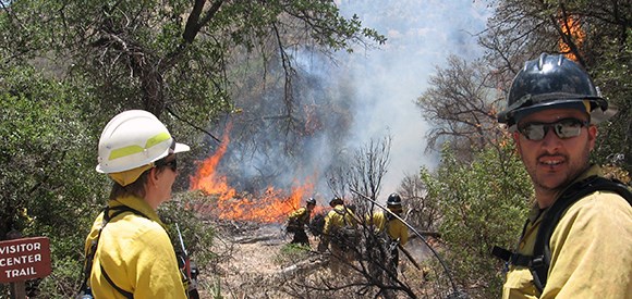
In June 2011, the Monument fire started in the southeast corner of the Coronado National Memorial. The fire was suppressed aggressively from the time of discovery, but drought conditions and a severe freeze in the preceding winter made the brush and grass extremely flammable. The fire escaped initial attack, spread rapidly, and burned northward through the Huachuca Mountains and down into nearby towns. Over two weeks, it burned over 30,000 acres and destroyed 84 structures, including many homes and businesses.

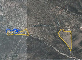
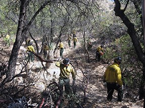
Fuel reduction treatments completed within the memorial in the years leading up to this fire helped save homes and other structures. The National Park Service has a long-term plan in place to reduce hazardous fuels at the memorial, including survivable space around the memorial's structures, as well as private homes on inholdings within the memorial boundary. Fuels treatments began there in 2007. To protect the visitor center, administrative buildings, and park housing, brush was thinned in a collaborative effort by fire crews from the National Park Service and US Forest Service. Six separate treatments were conducted through 2011.

In addition, fire crews conducted an 11-acre prescribed burn directly across the road from the visitor center in 2009. That same year, to protect two private homes near the park entrance, a 30-acre prescribed fire was carried out to reduce hazardous fuels adjacent to them.
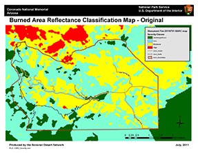
Treated areas had among the lowest burn severities from the 2011 wildfire (see map). The thinning conducted over seven years and the prescribed fire around the visitor center reduced the overall fuel load, removed small brush and lower limbs on trees that could allow fire to climb into the tree canopy, and removed or reduced surface fuels. Fire crews present during the wildfire said that the reduced fuels around the administrative area made it possible for them to conduct a burnout operation and take away fuels ahead of the wildfire. Minor work was all that was necessary to allow the structures to survive the wildfire. The prior work also improved the safety of firefighters who were attempting to protect the structures.

This long-term planned effort to reduce fuels around the memorial’s headquarters and private homes helped create a more fire-adapted human community. The work lowered risk in the Wildland Urban Interface, improved the odds in these structures surviving a devastating wildfire.
Contact: Perry Grissom, fire ecologist
Email: e-mail us
Phone: (520) 733- 5134
