Last updated: December 14, 2017
Article
Assessing Wildfire Hazard at Saguaro National Park

Saguaro National Park (NP) is supporting the development of a community wildfire protection plan (CWPP) for Pima County, in southern Arizona. The 9,189-square-mile county is slightly larger than the state of New Jersey and has just under one million inhabitants. There are 32 communities in the county, but a sizeable proportion of the population lives in unincorporated areas.
Initially, communities in Pima County were developing separate CWPPs to identify and mitigate hazardous fuels and to protect structures. Saguaro NP had been working with the Rincon Valley Fire District and the Rincon Institute/Sonoran Institute, a nonprofit conservation organization working to protect the natural resources of the area, integrating community and conservation.
The partners with broader responsibility, the Pima County Office of Emergency Management and Homeland Security and the Arizona State Forestry Division, began to feel that a different approach was needed. They felt that a larger, unified effort would be more effective and provide all county residents with an equal opportunity to address wildland fire potential in their communities. Fire agencies, communities, tribes, and federal partners agreed, and this new partnership began work on a single, countywide plan. Separate teams will coordinate the work for the four different planning zones within the county. The county hired a contractor, Logan Simpson Design, Inc., for some of the tasks. Logan Simpson has completed twelve CWPPs in the Southwest in the last five years.
One of the first steps in the CWPP process is assessing wildland fire risk. Saguaro NP provided $8,000 to pay for part of this risk assessment. Other agencies involved in funding the assessment and other parts of the CWPP were Pima County, the Bureau of Land Management, Arizona State Forestry, and the Federal Emergency Management Agency. Involvement of all these partners working on one project and pooling resources increased cost-effectiveness and created efficiencies of scale, while still accomplishing detailed local planning.
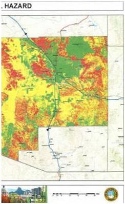
The completed risk assessment concluded that more than 46 percent of the county is at high to moderate risk of wildland fire. The next steps include forming work groups for each planning zone, determining if additional communities should be identified as being “at risk,” establishing treatment priorities, and recommending actions. Saguaro NP remains involved in the process, supporting efforts to protect the resources of the park, businesses, critical infrastructure, and the lives, property, and well-being of county residents.
Contact: John Thornburg
Email: e-mail us
Phone: (520) 733-5130
