Last updated: August 18, 2025
Article
Who lives here?
Learning from species occurrence data to help conserve the amazing creatures that call the parks home
By Christina Martin and Michelle Boone, Inventory and Monitoring Program
August 2025
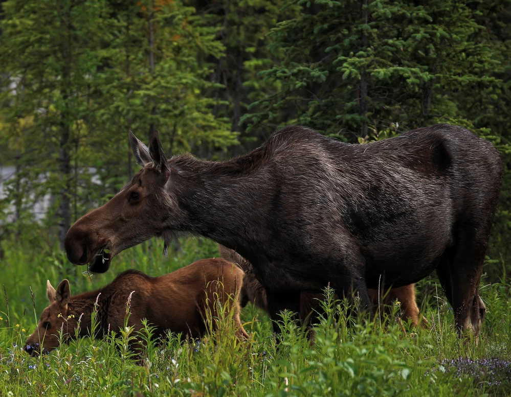
NPS/Emily Mesner
Getting Started: Tracking Species in National Parks
The National Park Service (NPS) Inventory and Monitoring Division collects information about the natural resources in parks—like plants, animals, soils, and geologic features—to help park managers make informed decisions. One important type of information researchers gather is species occurrence data, which informs whether a species is present or absent in a park. While it may seem simple, collecting and interpreting occurrence data is tricky business!
Because park staff have many responsibilities and limited time, the NPS works with partners to help collect this information. These partners include scientists from universities, non-profits, tribes, private companies, and other agencies. Together, they design surveys and collect species data that supports conservation and management of national parks across the country.
Spotting Wildlife: What Does Detection Mean?
Knowing what species are in a park is the first step toward protecting them—especially rare, threatened, or endangered ones. It’s also important to notice when species that are expected to be present are missing. An absent species can be a warning sign that something is off in the environment, like a degraded habitat or a new stressor that’s making it hard for them to survive.
Here’s the catch: if a species isn’t spotted (detected) during a survey, that doesn’t necessarily mean it’s not there. Sometimes, species are just missed during surveys. This is called imperfect detection—when something is there but not found.
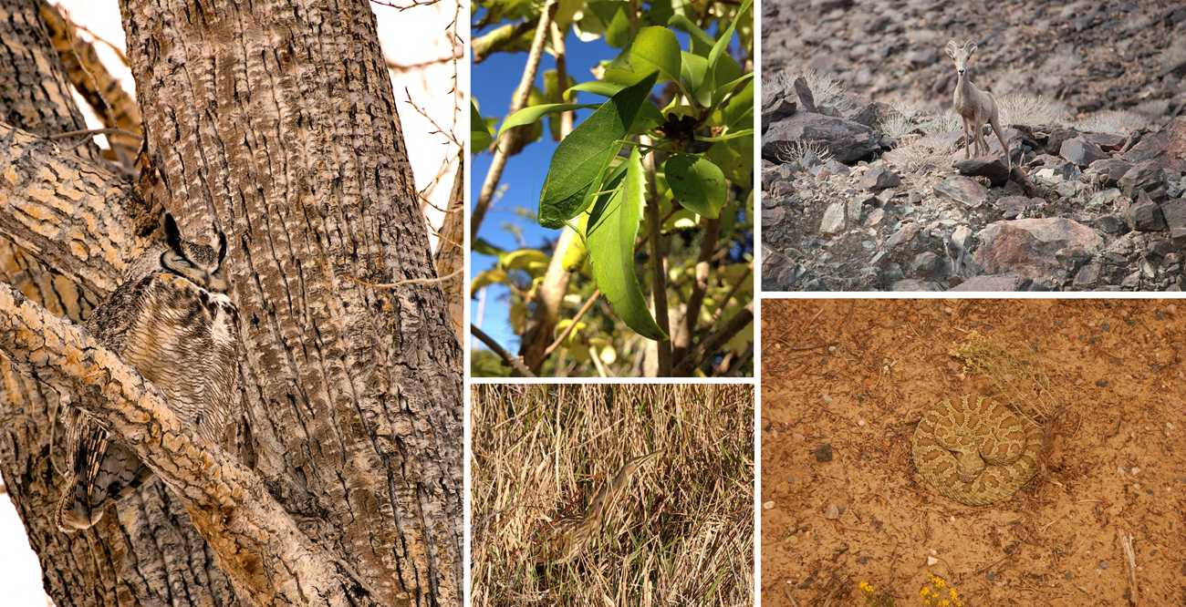
NPS/Patrick Myers (owl), NPS (katydid, wetland bird, sheep, snake)
Measuring Confidence: What is Detection Probability?
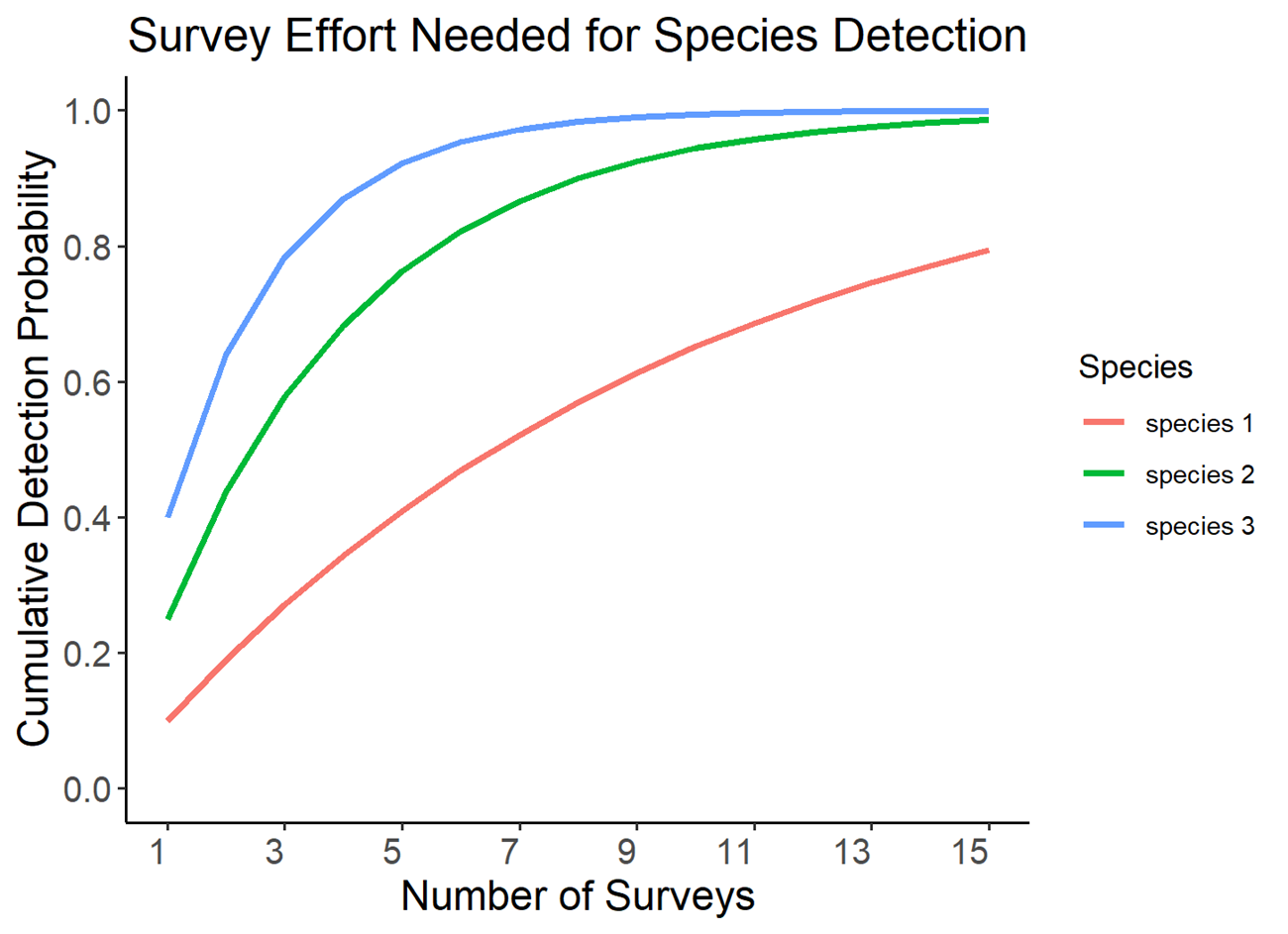
To make sense of imperfect detection, scientists use a concept called detection probability. This is the likelihood of finding a species during a single survey, if it’s actually there. Doing more surveys boosts the cumulative detection probability—in other words, the more times surveyors look, the more confident they can be about whether a species is present or not. As cumulative detection probability gets closer to 1 (or 100%), the benefit of adding more surveys decreases. At that point, surveyors have already made enough visits that the chance of missing the species, assuming it's there, is very low (see cumulative detection graph below).
Even after many surveys, there’s always a small chance that a species could be present but not detected. That’s why scientists can rarely say a species is truly absent. With enough survey effort, they can be very confident—sometimes 99.9% sure—that it’s not there.
NPS/Michelle Boone
How Do We Collect This Data?
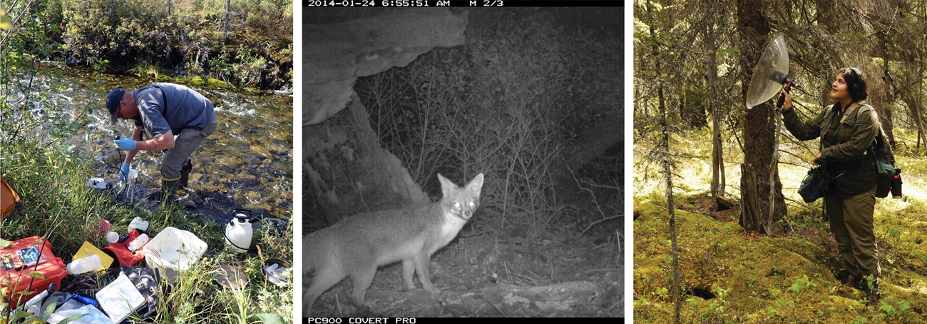
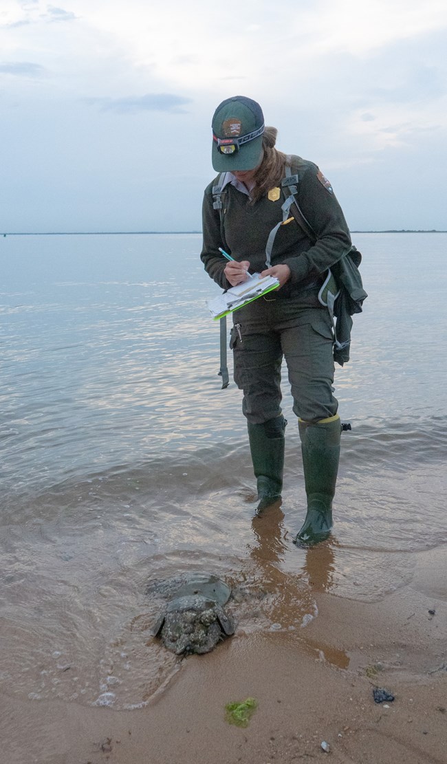
Scientists use many tools to figure out which species are present in national parks. These include visual surveys, acoustic surveys (recording and analyzing sounds), camera surveys, and drone surveys. They also use environmental DNA (eDNA) sampling to detect traces of species’ DNA in water or soil. While technology keeps advancing and opening new possibilities, traditional methods still have merit.
NPS
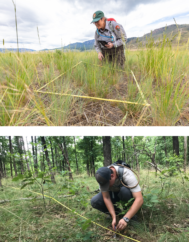
There are also different ways to structure surveys. Some are timed, meaning surveyors search an area for a set amount of time. Others cover a specific location—like a transect or polygon—and end once the entire area has been checked. These two methods are often used together. Another approach is to end the survey after the first detection of the target species.
NPS/Jacob W. Frank (upper), NPS (lower)
In addition to presence data, surveyors often record other details—called covariates—to help interpret results. These might include weather conditions (e.g. temperature, humidity, wind speed), site information (e.g. habitat type, slope, vegetation), and survey details (e.g. time of day, date, number of surveyors). Many surveys also track park management activities that may affect species occupancy, like mowing, grazing, or controlled burns. All of this extra information can shed light on a species’ habitat needs or occupancy patterns. It can also improve the accuracy of occupancy models, which predict how many sites in a park are likely to be occupied by a species and the likelihood of detecting the species if it's there.
NPS/Tyler Kuliberda
Why Study Design Matters
A well-planned study is essential for understanding which species live in a park. Several factors must be considered: how the target species behaves, the type of habitat it uses, available technology, the project budget, the number of trained surveyors, among others.
If these factors aren’t carefully considered when making the study design, surveys might miss species that are present. For example, camera traps that detect animals the size of rodents or larger might miss insects or other tiny species. Similarly, surveys conducted at the wrong time of day or year might overlook species that are only active under certain conditions. These mismatches can lead to the mistaken conclusion that a species is absent when it was actually present but went undetected.
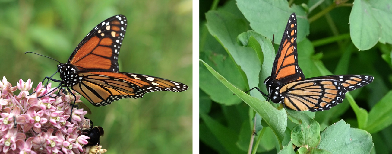
Even with a solid study design, things can still go wrong. Equipment might fail, like when camera traps get buried in snow and can’t record passing animals. Misidentifications can also cause problems, especially when species look or sound alike. Careful planning, thoughtful method selection, and thorough training all help reduce these risks and make species data more accurate and useful for conservation.
© Kelsey Stoll (left), NPS/Christina Martin (right)
Putting Data to Work: How Parks Use Species Occurrence Findings
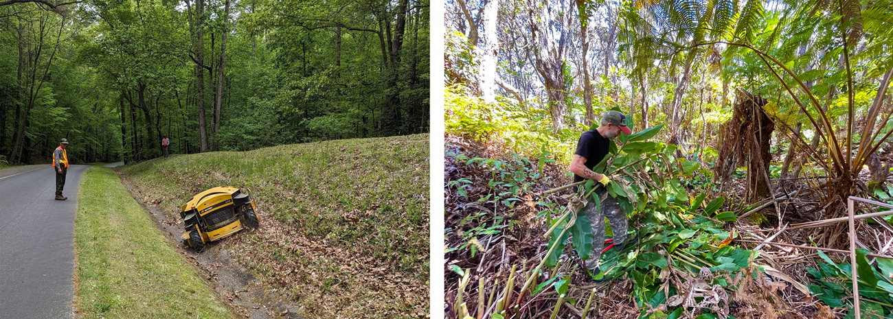
Knowing which species live in a park—and when and where they’re active—helps park staff make informed, conservation-minded decisions about how best to manage natural resources. Staff face a wide range of responsibilities, from controlling invasive species and managing wildfire risks to overseeing construction projects and protecting water and habitat quality. Species occurrence data is a critical tool in guiding these efforts to ensure management actions are timed and targeted in ways that minimize harm to sensitive wildlife.
For instance, park managers may need to strike a balance between preserving pollinators and removing invasive plants. If surveys show that bees rely on a wooded area for food in the spring but no longer visit it by summer, staff might choose to delay removing invasive vegetation until after the bees have finished foraging there. This timing helps ensure that bees aren’t deprived of a critical food source during their most active period. By scheduling management actions around species activity, parks can protect key wildlife while still addressing long-term conservation goals like invasive species control.
NPS (left), NPS/J. Wei (right)
Real-World Examples
Mussel Occurrence Guides River Management at Ozark National Scenic Riverways
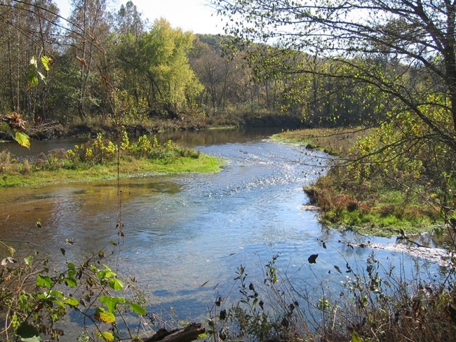
Freshwater mussels are vital to river health, filtering water and providing habitat for other species. But many are in decline, and in Missouri’s Ozark National Scenic Riverways, scientists don’t always know where these sensitive species still remain. With many past surveys focused on just a handful of spots, large stretches of the park’s rivers have gone unexplored. That’s a problem when trying to protect rare or endangered species like the slippershell (Alasmidonta viridis) or the purple lilliput (Toxolasma lividum), which can be easy to miss even when they’re right under your nose.
NPS
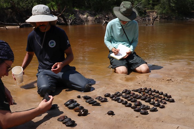
To find out where the mussels are located, researchers snorkeled through dozens of randomly selected sites along the park’s rivers, searching for mussels by sight and touch. They also recorded factors like water depth, flow, and bottom type—environmental clues that help explain where mussels are most likely to live.
Since mussels can be hard to detect, especially rare ones hidden in gravel or murky water, the team used occupancy modeling to fill in the gaps. By combining field observations with habitat data, they could estimate which species were likely present, even when none were spotted. This method offers a clearer, more complete picture of mussel distribution and lays the groundwork for meaningful long-term monitoring.
NPS/Scott Sharaga
These results will help park managers make informed, science-based decisions about river use and restoration. For example, if a new boat ramp or river access point is being considered, survey data can help identify areas to avoid, such as those that are mussel-rich or home to sensitive species. The findings may also guide restoration efforts, like reintroducing mussels raised in captivity or supporting fish species that mussels depend on. Over time, repeated surveys will reveal trends in mussel distribution and abundance, offering valuable insights for long-term conservation in the park and beyond.
Black Rail Occurrence Informs Fire Management at Padre Island National Seashore
NPS/Tabitha Olsen
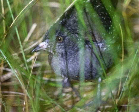
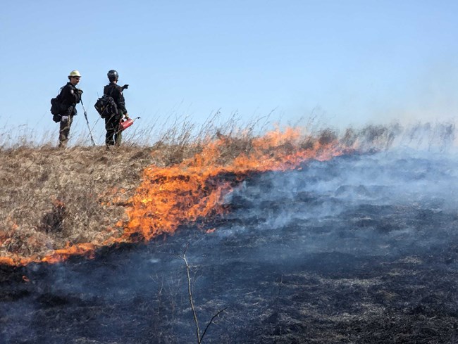
The Eastern Black Rail (Laterallus jamaicensis jamaicensis), a federally threatened marsh bird, depends on vegetation for shelter. Meanwhile, park managers use prescribed fire to maintain healthy ecosystems by preventing overgrown marshes and uncontrolled high-intensity fires. But does prescribed fire help or harm Black Rails?
To answer this, researchers at Padre Island National Seashore (NS) and Texas A&M University conducted surveys to determine if Black Rails are present during the breeding season. If present, the goal was to estimate how likely they are to occupy different habitat types. This information would help guide prescribed fire efforts in a way that supports both marsh health and Black Rail conservation.
Black Rails are notoriously difficult to detect, so scientists used call-playback surveys, broadcasting recorded Black Rail calls to encourage responses. They supplemented this with passive recording units to capture calls over time and trail cameras to spot the birds in key habitats. Despite these efforts, detections were rare.
Due to the small sample size, the researchers couldn’t draw firm conclusions about Black Rail habitat occupancy at Padre Island NS. However, they found that Black Rails tend to occupy areas with high amounts of grassy and herbaceous vegetation—conditions relatively scarce at Padre Island NS compared to other known Black Rail habitats on the Texas coast. This lack of suitable vegetation may help explain the low number of detections.
NPS/Robert Hartwig
The researchers did identify a consistent seasonal pattern: Black Rails were only detected from mid-February to early May. This suggests that prescribed burns should occur outside of this time window to avoid disturbing breeding and to allow time for vegetation to regrow before nesting begins. These findings align with the existing prescribed fire plan at Padre Island NS, providing scientific evidence to back the current protocols. They also lay a foundation for continued monitoring to ensure Black Rails remain a part of the park’s marsh ecosystem (Butler and Olsen 2025).
Pollinator Occurrence Shapes Mowing Schedules at Sleeping Bear Dunes National Lakeshore
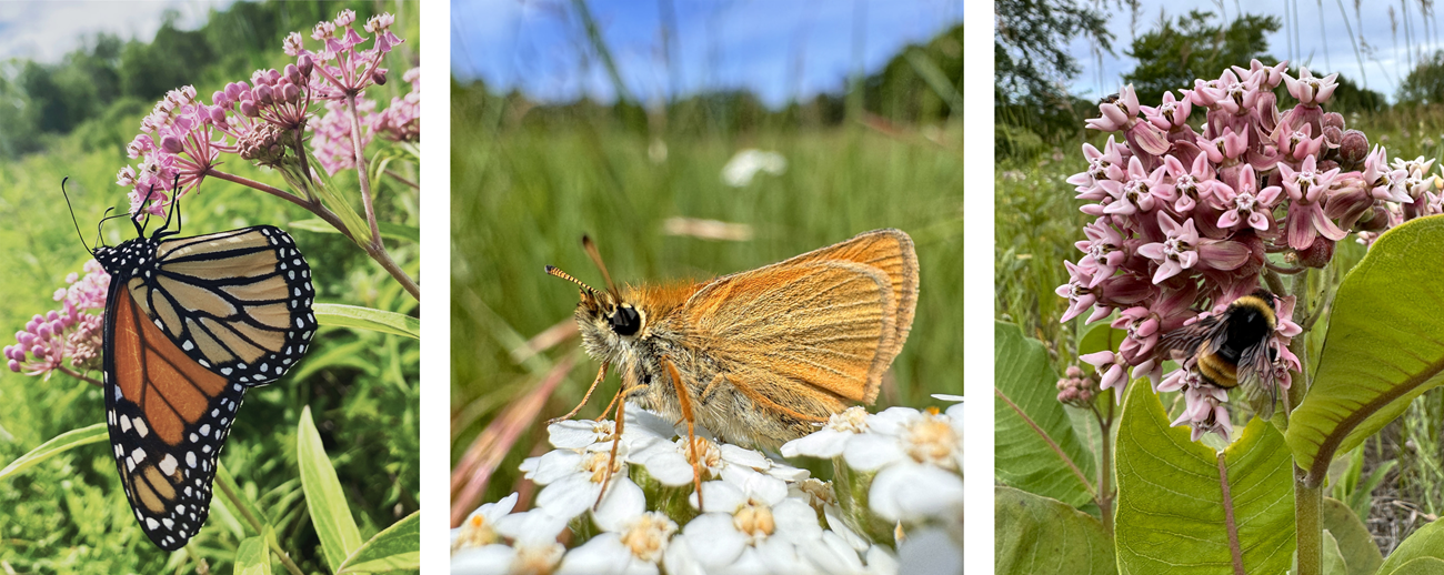
Sleeping Bear Dunes National Lakeshore (NL) in Michigan is located within the range of multiple pollinators of conservation concern, including the yellow-banded bumble bee (Bombus terricola), American bumble bee (Bombus pensylvanicus), and monarch butterfly (Danaus plexippus). Many of these species rely on flowering plants found in the park’s historic farmstead fields, some of which are routinely mowed for maintenance.
To understand how mowing affects pollinators, researchers from the Michigan Natural Features Inventory surveyed butterflies and bumble bees in both mowed and unmowed areas. They also included nearby semi-natural sites through a project with the U.S. Fish and Wildlife Service (USFWS) for broader context. For each bumble bee and butterfly observed, the team documented the flower it visited.
NPS/Logan Rowe
The study detected monarch butterflies and four bumble bee species of conservation concern. Notably, B. pensylvanicus—a state-endangered species—was recorded farther north than ever before in Michigan, setting a new county record. Most bumble bees were found in unmowed or USFWS sites, likely due to greater floral abundance. Monarchs, on the other hand, were more common in mowed areas.

NPS/Logan Rowe
The results of this study, combined with findings from academic literature, offer valuable guidance on the ideal timing and frequency of mowing to support pollinator populations. Mowing is commonly used to control invasive vegetation, which can, in turn, promote native plant diversity and improve habitat for pollinators. When timed thoughtfully, moderate levels of disturbance may even benefit certain species. For instance, monarch butterfly larvae feed exclusively on milkweed, which loses nutritional value as it matures. Mowing milkweed in midsummer can stimulate fresh growth with higher nutritional quality and fewer predators, ultimately benefiting monarchs (Haan and Landis 2019). These insights can help park managers fine-tune mowing schedules to meet both vegetation management and pollinator conservation goals at Sleeping Bear Dunes NL.
NPS
Final Thoughts: Why This Work Matters
Species inventories give us a clearer picture of the amazing wildlife in our national parks. By understanding who’s living there and who might be missing, we can take thoughtful steps to protect these places for future generations!

NPS (bison, alligator, elk), NPS/Jamie Ratchford (eagle), NPS/Claire Abendroth (beaver), NPS/J. Stringfield (bear)
Citations
Butler, C. J., and T. W. Olsen. 2025. Inventory of eastern black rail (Laterallus jamaicensis) to inform Padre Island National Seashore prescribed fire management. Science Report NPS/SR—2025/315. National Park Service, Fort Collins, Colorado. https://doi.org/10.36967/2311590
Haan, N. L., and D. A. Landis. 2019. The importance of shifting disturbance regimes in monarch butterfly decline and recovery. Frontiers in Ecology and Evolution, 7, 191. https://doi.org/10.3389/fevo.2019.00191
