The movements of wild animals have been observed for centuries, inspiring curiosity and creative storytelling in people around the world. Nearly one hundred years ago scientists began marking wildlife – tying bands to bird’s legs and carving notches in turtle shells – to systematically study the distance and direction an animal traveled. Advancements in tracking technology since then have helped scientists better understand general movement patterns but there is still much to learn about how and why animals move across a landscape.
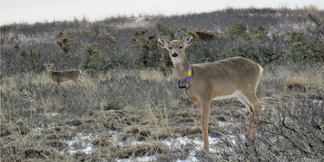
At Fire Island National Seashore, the U.S. Geological Survey and State University of New York School of Environmental Science and Forestry fitted female white-tailed deer with GPS-enabled radio-tracking collars in 2014 for a three-year White-tailed Deer Movement Study.
Designed to automatically release from the deer after about 12 months, the collars had a small unit attached that records location data at regular intervals. The collars also carried a radio frequency transmitter which allows park staff to track the animals and monitor their health and safety on a weekly basis during the 12-month period.
The Deer Movement Study was part of a larger, three-year research project developed in response to Hurricane Sandy. The project assessed the re-establishment of maritime vegetation at four locations impacted by sand deposition, salt water intrusion, and canopy mortality. The research also focused on how white-tailed deer influence post-storm vegetation re-establishment at these locations.
The Deer Movement Study complements existing deer population and vegetation monitoring efforts essential to the implementation of Fire Island National Seashore’s Final Deer Management Plan/Environmental Impact Statement.
Last updated: December 22, 2016
