Last updated: February 28, 2020
Article
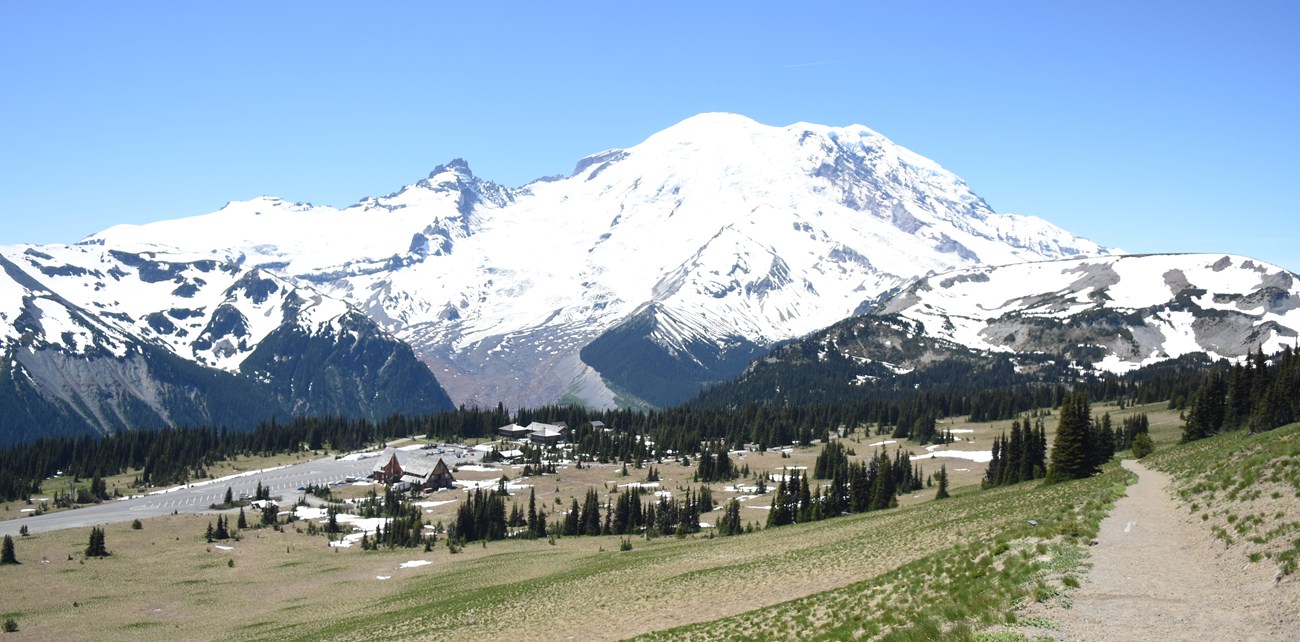
White River and Sunrise: the captivating northeast corner of Mount Rainier National Park
NPS/ C. Meleedy Photo
NPS/S. Siegers Photo
Over the last 40 years, archeologists have been able to find artifacts left behind by some of the first peoples to be lured to the lush subalpine areas in the park and around the Sunrise area in particular. Rich with many food sources, generations of native people traveled up river valleys and over mountain passes to hunt animals and gather plants. Leaving behind stone flakes from tool making and other evidence, we know that native people have been visiting and using areas of the park like Sunrise for at least the last 7,000 years.
NPS/ L. Lane Photo
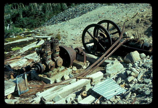
Almost 200 years ago, European Americans from the Seattle and Tacoma areas started coming up the White River to explore Mount Rainier for a very different reason: mining. Looking for copper, gold, and silver, owners and employees of the Mount Rainier Mining Company started in 1902 to lay claim to land in Glacier Basin, an area at the upper end of the White River valley. Over the years, they tried several different mines within this area, constructing a tramway, work buildings, and an access road. Examining their paperwork, rangers of the time found that the miners actually mined very little ore. During the same period, the original owners were sentenced by the State of Washington to 18 months and $1,000 fine for mail fraud of investors in the Seattle area. Congress passed legislation in 1908 preventing further mining claims within the park, and remaining claims were slowly bought back over the following decades. Ownership changed hands and some work proceeded into the 1950s before mining proved too unprofitable. Because of bankruptcy and back taxes problems with the owners, the National Park Service was not able to buy the last claims in Glacier Basin until 1984. Mother Nature shut down the mines far earlier than that as rockslides, cave-ins, and snow destroyed all of the buildings and mine shafts. What little remains of the mining operations in Glacier Basin can still be viewed today by hikers.
NPS Photo
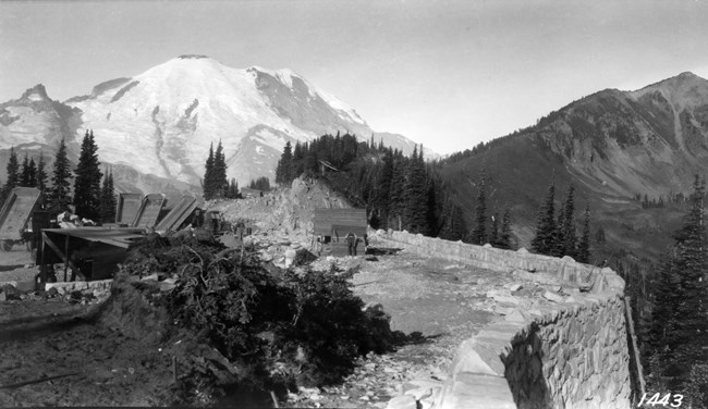
Road building also came through this corner of the park. The State of Washington began construction of State Highway 5 (soon to renamed 410) heading east from Yakima, over the Cascade Mountains towards Enumclaw in 1916. Finished in 1931, this road provided much better access to the northeast side of the park, allowing construction of a ranger station and a campground along the White River.
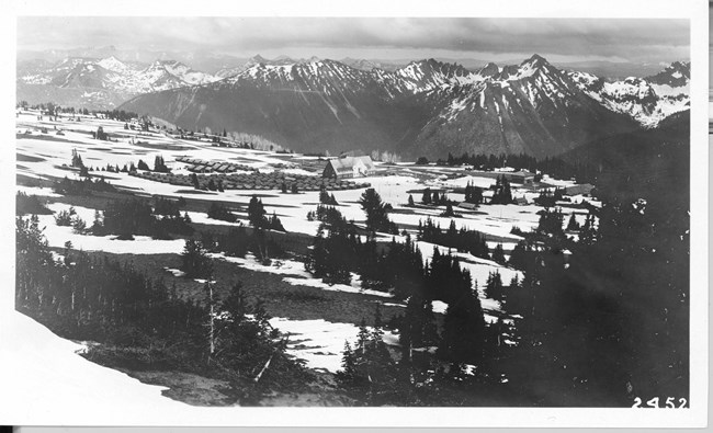
Taking advantage of this, National Park Service planners and local business men designing the future development of the park and its new master plan decided to create an alternative to Paradise in Yakima Park, later renamed Sunrise. The 1926 Master Plan envisioned a road up from the White River campground to the meadows at Sunrise with more campgrounds, cabins, and a great lodge. The road to Sunrise was finished in 1931 and construction of a building for park rangers, three campgrounds, rental cabins, and the first part of the lodge commenced.
NPS Photo
NPS/ K. Bacher Photo
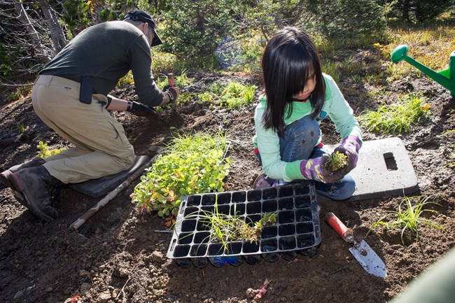
Since World War II, visitors and rangers slowly recognized the damage of overuse on the beautiful subalpine meadows at Sunrise. The location of the rental cabins took decades of natural growth and replanting to erase the scars left by the cabins and roads. The campgrounds at Sunrise were closed over the years, their buildings taken down, and those areas replanted to look more like the meadows they had been. Some traces can still be seen behind the Day Lodge and in the picnic area.
Though the 1926 Master Plan was never completely implemented at White River and Sunrise, other developments have taken place over the decades. Isolated from the rest of the park, both areas rely on their own independent water systems as well as power and septic. Over the years, these off-grid systems have not only been started up each summer and winterized each autumn, they have also been upgraded to be as sustainable and efficient as possible. Now considered historic, the buildings have been rehabilitated to deal with the stresses of great snow storms that strike each winter. Connected to the rest of the park only by the road, each year the Sunrise and White River areas sleep through an almost 7-month-long winter until the snow plows open the road again in June.
NPS/ P. Wold Photo
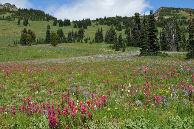
Today, some of this history is very hard to see. Few artifacts remain, but if you find any please leave them in place so that others can also learn from them in the future. While the 1926 Master Plan was never fully realized at Sunrise and White River, the roads, buildings, and trails that were built provide access to some of the most interesting places in Mount Rainier National Park. These places grace us with so much in their majestic mountain views and magnificent wildflower meadows as they continue to entice new generations of people.
For more information about the White River and Sunrise areas.
