Water quality data are used to characterize waters, detect trends over time, and identify emerging problems. In Southern Colorado Plateau Network (SCPN) parks, water quality is monitored as an indicator of aquatic ecosystem integrity, as a component of watershed condition, and to document water quality conditions in relation to state and federal regulations.

NPS
Perennial streams are rare on the Colorado Plateau, and most streams in the region are intermittent or ephemeral, and remote. As a result, water quality data on SCPN streams are sparse. However, managers need information on status and trends for streams in their parks in order to develop plans and take actions to maintain or restore surface water quality, as well as to work cooperatively with other agencies to protect park waters. SCPN monitoring efforts will add park data to ongoing state water quality monitoring programs, thus contributing to a broader regional understanding of aquatic conditions.
Long-term Monitoring
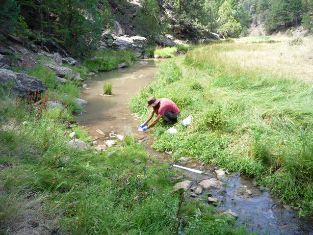
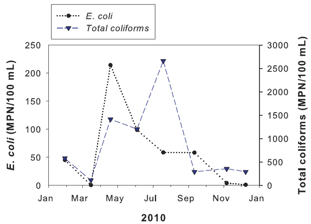
Water quality is monitored quarterly at selected streams in five SCPN parks. Core parameter data, including temperature, pH, specific conductance, dissolved oxygen, turbidity, and discharge, are collected at all monitoring sites. Additionally, samples are collected to determine the status and trends of water quality constituents, including bacteria, nutrients, major ions and trace metals. Aquatic macroinvertebrate samples are also collected at several sites. Pilot studies were initiated in 2007 and water quality monitoring was implemented in 2010.
|
SCPN Park units monitored for water quality |
|
|
Park |
Streams |
|
Bandelier NM |
Capulin Creek, Rito de los Frijoles |
|
Canyon de Chelly NM |
Tsaile Creek, Chinle Wash |
|
Glen Canyon NRA |
Escalante River, Coyote Gulch |
|
Grand Canyon NP |
Bright Angel Creek, Garden Creek |
|
Mesa Verde NP |
Mancos River |
Management Applications
Water quality in streams is influenced by physical conditions, including geology and vegetation, and may be altered by natural disturbance events, such as catastrophic fire, flooding, or drought, or by a variety of anthropogenic activities. Significant contamination of surface waters can be harmful to aquatic biota and may pose health risks to recreational visitors. The first few years of water quality data collection will document current conditions in SCPN streams. Over the long term, this data will be used to meet objectives that include (1) protecting water bodies under the provisions of the Clean Water Act, (2) documenting water quality parameters that are vulnerable to alteration from various sources of contamination or land-use practices, and (3) establishing which water quality parameters may be most useful for indicating ecosystem integrity of streams in SCPN parks.

For More Information
Reports & Publications
https://science.nature.nps.gov/im/units/scpn/monitor/waterQuality.cfm
Contact
Stacy Stumpf, Stacy_Stumpf@nps.gov
Prepared by the Southern Colorado Plateau Network Inventory and Monitoring Program, 2012.
Last updated: January 12, 2023
