Media Included
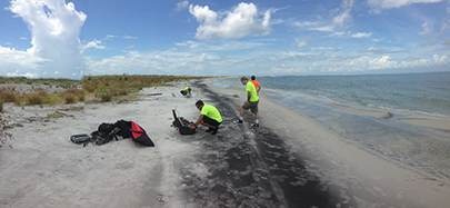
- Deployment of Altavian NOVA Block III UAS - Video shows the deployment of a small fixed-wing aircraft that has a still-image camera onboard. It was used to photograph the Camille Cut, a 1969 breach caused by Hurricane Camille that separated Ship Island into East and West Islands in the Mississippi District of the National Seashore.
In September 2014, Gulf Islands National Seashore successfully used an uncrewed aircraft (UAS) to assist on a research project.

Woolpert, Inc.
After gaining approval through the Associate Director of Visitor and Resource Protection, Woolpert, Inc., a company under contract to the U.S. Army Corps of Engineers (USACE), operated the UAS.
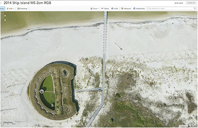
Earlier in the year, Woolpert had submitted a research application to GUIS to collect imagery of the Camille Cut of Ship Island to create an orthorectified image, an aerial photograph geometrically corrected such that the scale is uniform, with true map coordinates that can be used in a Geographic Information System (GIS).
A Successful Mission

NPS
A Congressionally-mandated planning effort led by USACE, the Mississippi Coastal Improvements Program identifies actions to protect the Mississippi mainland from future hurricane damage. The NPS is a cooperating agency on the project and has been extensively involved in planning and compliance. The Camille Cut is the 1969 breach caused by Hurricane Camille that separated Ship Island into East and West Islands in the Mississippi District of the National Seashore.
The mission was a success with perfect flying weather through the week. Cassity Bromley, Resource Chief at Gulf Islands National Seashore said "The view of Ship Island generated from this project is amazingly detailed, and will be a powerful tool in monitoring changes to the islands." Imagery from the mission is available to the NPS and the public on the USACE website.
Last updated: October 8, 2024
