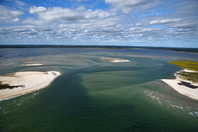
North of Fire Island, Great South, Narrow, and Moriches Bays form an estuarine system - a place where fresh water draining from Long Island mixes with saltwater from the ocean. Prior to Hurricane Sandy, this estuarine system had bay and ocean water exchanged through two inlets: Fire Island and Moriches Inlets.
On October 29, 2012, Hurricane Sandy created a breach in Fire Island National Seashore’s federally designated wilderness area. The wilderness breach created a new opening in the barrier system, connecting eastern Great South Bay with the Atlantic Ocean. Since the wilderness breach opened, the National Park Service (NPS) has worked with partners to monitor the water quality and hydrodynamics of this estuarine system. Both monitoring and modeling have provided an opportunity to evaluate how the estuary has responded.
Water Levels
A series of tide gages located throughout the bay record data on daily high and low water levels as well as the fluctuation in tides throughout the year. These tide gages have provided a record of continuous water level, temperature, and salinity measurements both before and after Hurricane Sandy. A comparison of tide gage data from before and after the breach opened indicates that the changes in mean high water levels are small relative to the normal tidal range. Near the wilderness breach in eastern Great South Bay water level increases have been less than 1/3 inch. The greatest increase has been observed in western Great South Bay, at a tide gage near Lindenhurst of an increase less than one inch. Tide gage measurements also demonstrate that close to the breach, in Bellport Bay, the timing of high and low tides (tidal phase) occurs approximately 20-35 minutes earlier in the tidal cycle than before the breach opened.
Water Quality
Water from the ocean is cooler, saltier, and lower in nutrients than the water in Great South Bay. Since the breach opened, summer water temperatures in central and eastern Great South Bay have decreased by 5 degrees F and salinity has increased between 2-5 practical salinity units (psu). Water clarity has increased and nitrogen, chlorophyll-a (a measure of phytoplankton), and the frequency and intensity of brown tides have also decreased in eastern Great South Bay.
Monitoring Hydrodynamics in the Great South Bay
Recorded changes in temperature and salinity in Great South Bay indicate that the wilderness breach has influenced circulation patterns in central and eastern Great South Bay. Scientific models provide further understanding of circulation changes. Modeling shows that, with the open breach, flow through the bay system is generally from Bellport Bay to the west out through Fire Island Inlet. Prior to Hurricane Sandy, circulation from west to east was inhibited by small localized eddies in central Great South Bay.
Future of the Breach
Residence time is a measure of how water moves through a system and how long a parcel of water remains in a given location. Since the breach opened, the residence time of water in Bellport Bay has decreased from 96 to 40 days.
Models have also been used to understand how water levels in Great South Bay may vary under potential future storm conditions, with and without the breach. Model results predict increases of 8 to 24 inches for a 100-year return period, an event that statistically has a 1% chance of occurring in a given year. Maximum water level increases modeled under these conditions are predicted to occur throughout the bays and stay within the 100-year Flood Hazard Zone for the Federal Emergency Management Agency (FEMA) insurance requirement. The predicted 100-year return period water levels are considered extreme upper limits for a worst-case storm scenario.
Last updated: December 20, 2016
