Last updated: December 9, 2021
Article
The Day it Rained Rocks
A Land in Transition
It was, literally, earth-shaking; so much so that a seismometer thousands of miles away picked up the vibrations. It contained enough force to push debris a mile under water, heaving it uphill onto the opposite shore, and generate a tsunami high enough to rival Seattle’s Space Needle.
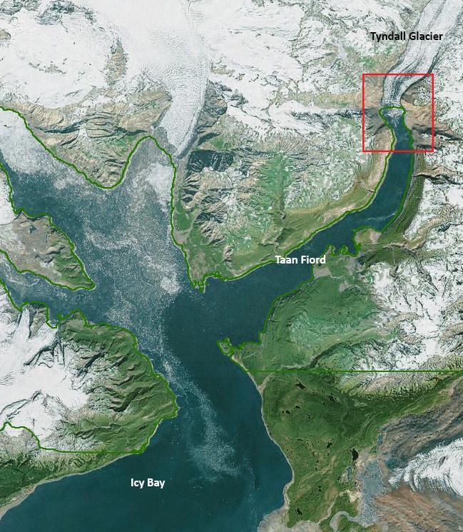
But this was no earthquake. It was a 60-second deluge of boulders, earth and trees. This high speed landslide occurred, undetected, in a remote slice of Alaska’s Wrangell-St. Elias National Park and Preserve on October 17, 2015.

Anyone buried under that mass would have likely never been found. Fortunately, no one was. Not a soul, as far as anyone knows, had so much as a hair blown out of place. And if the scientific community has anything to do with it, that will be the case for the inevitable next time.
Precipitous fjords, rugged mountain terrain, glaciated valleys…this is the scenery that attracts millions to coastal Alaska. However, these same features are prone to just this kind of event. Glacier Bay National Park, alone, has experienced eight large landslides since 2012, and in 1958 a 90-million ton rockfall in the park’s Lituya Bay triggered the largest known tsunami of modern times. As glaciers withdraw, destabilizing fiord walls, and thawing permafrost buckles the ground beneath them, more massive slopes are expected to give way.
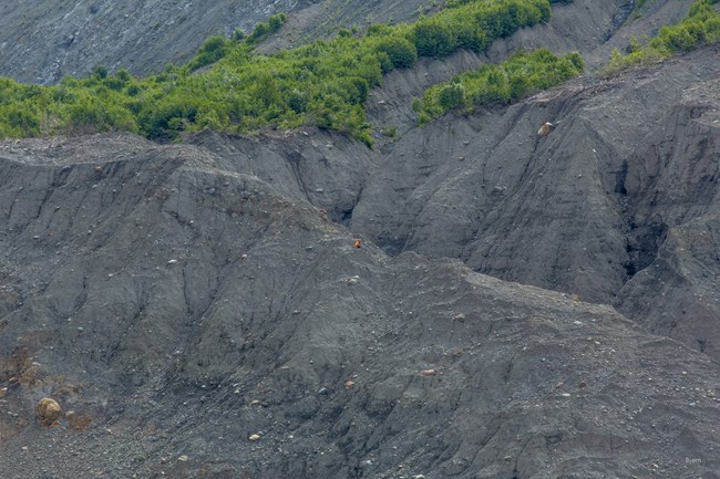
Which perhaps explains the sense of urgency in the team of earth scientists, funded by the National Science Foundation and the National Park Service, that clambered around the base of this crumbled mountain in the summer of 2016. The sheer mass of the devastation dwarfed their forms as they picked their way over the rubble. A detached onlooker might have noted an element of the quixotic in their mission. They were, however, intent on building an accurate picture of what occurred; before vegetation reclaimed the stripped beaches, and sediment confounded the evidence; before this dynamic landscape reshaped itself once again.
Before it happened somewhere more populated.
Tackling the Big Questions
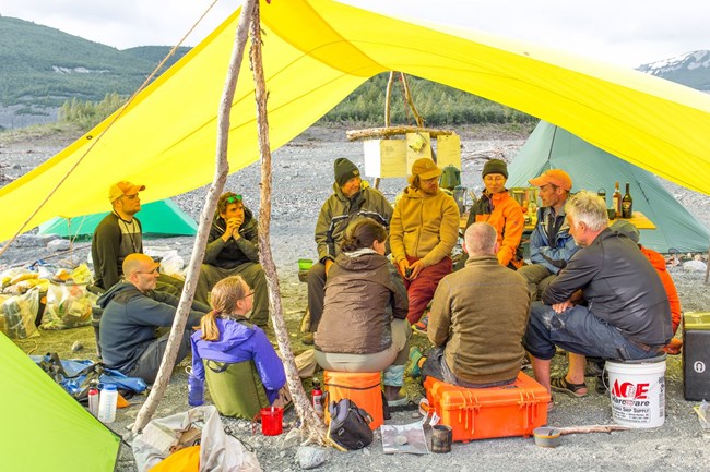
When grappling with what happened, like the incident itself, one question triggers another, which unleashes still more. How much debris was there and how far did it go? Which slope might be next to give way, and when? Could it trigger another tsunami? If so, how big will it be and how fast will it travel?The Icy Bay landslide provided the ideal opportunity to answer some of those questions. It occurred in terrain similar to that of more populated areas, and heavily visited sites. We have little understanding of tsunamis triggered by landslides, which behave differently than earthquake-generated surges. The sheer scale of the event magnified its impacts, making them easier to study. And, no one was harmed. It was, in a sense, the perfect experiment.
What Can We Learn From this Event?
Several studies have already come out of the 2016 expedition, with more pending. And, while none provide definitive answers, all contribute crucial insight for predicting and planning for large-scale geologic events.In one study, a team of geologists set out to map the landslide deposits – the boulders, hummocks and sediment - strewn about the landscape, in order to better understand how a landslide behaves when it makes contact. In this, the Icy Bay affair provided a golden opportunity; rarely do landslides spew their contents onto such contrasting environments. The team found debris on the land, on top of Tyndall Glacier, and in the fiord waters. They contrasted debris distribution in each scenario. They studied digital models and satellite imagery for clues to what triggered the slide. They examined rock surfaces and deposit sediment to reconstruct the mechanics of its movement. While further interpretation of the data is pending, useful information has already emerged.
The study confirmed, for example, that this collapse was a long time in the making. Like an aging spine gradually caving in on itself, the mountainside had been in a decades-long slump that began when Tyndall Glacier withdrew its buttressing walls. The study revealed that, just as the glacier (or its absence) was reshaping the valley, landslide debris was reshaping the glacier, impeding its calving, stretching it out and lowering its terminus. They identified previously undetected signatures unique to large landslides that will aid in identifying others long buried. Such findings will help pinpoint not only ancient slides, but future hazard zones as well.
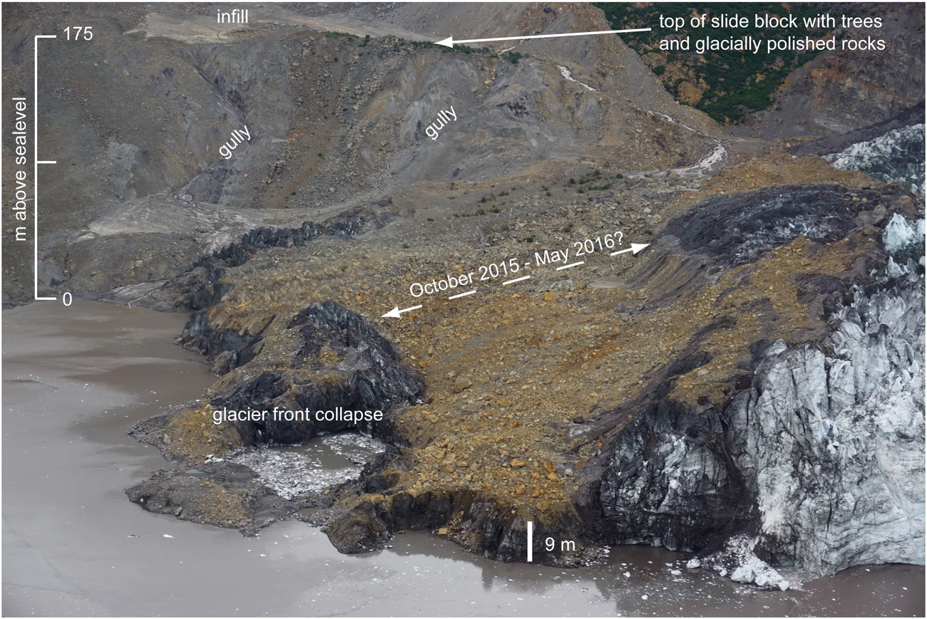
Reprinted from Sedementary Geology, Vol. 364, Feb 2018, A. Dufresne, et al., Sedimentology and geomorphology of a large tsunamigenic landslide, Taan Fiord, Alaska, pp 302-318, with permission from Elsevier.
What happens to all that momentum when high speed landslide meets big water? A third study attempts to answer that using software, known as D-claw, designed to simulate flows that involve mixtures of both water and sediment. Research Mathematician D.L. George and his team employed a mathematical computation which treats both landslide and tsunami as a single mass. This method enabled them to simulate landslide motion, wave generation, and shoreline inundation patterns which closely matched what actually occurred in Taan Fiord.
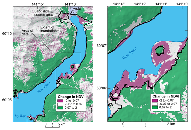
Ultimately, each study will uniquely enhance our understanding of large-scale geologic events. Their findings will be vital for informing critical decisions the next time a mountain collapses in Alaska’s rugged, spectacular and rapidly changing fjord lands.
Web article prepared by Deanna Ochs, OASLC Science Communicator.
