Part of a series of articles titled Copper River Basin Symposium - Wrangell-St Elias National Park and Preserve.
Article
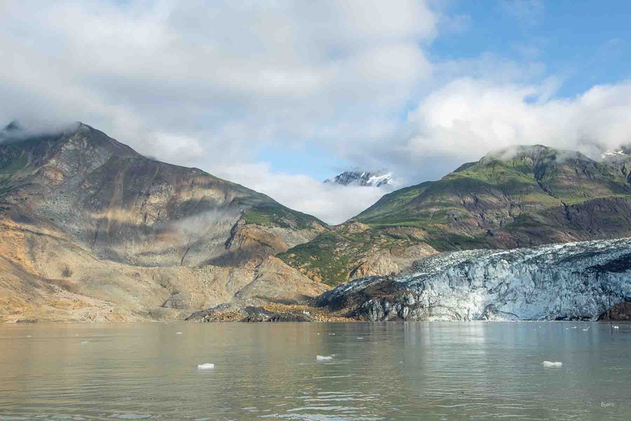
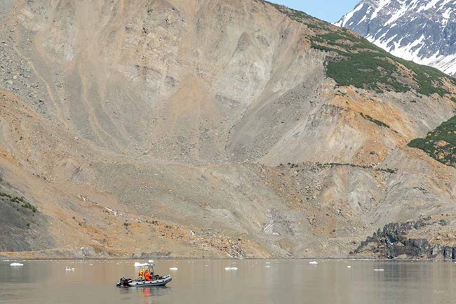
Taan Fjord Landslide and Tsunami

Ground Truth Trekking, licensed under CC BY 3.0
Recent papers take a detailed look at the events leading up to and during one of the most massive landslide and tsunamis ever recorded. The articles call attention to the increasing frequency and magnitude of natural hazards near glaciated mountains and attributes these incidents, indirectly, to climate change. Worldwide glacial retreat and thinning, it states, exposes unstable slopes and increases the likelihood of major landslides, triggering high-runup tsunamis.
Using a variety of Digital Elevation Modeling (DEM) and imagery sources, the research team was able to estimate the landslide volume, document movement leading up to the event, and map the deposit thickness. While at the site in 2016, they collected lidar and imagery for Structure from Motion (SfM) over Taan Fiord and parts of Icy Bay. Researchers employed a variety of instruments to conduct a ground-based tsunami runup survey, including a laser rangefinder, a total station, and two differential Real Time Kinematic (RTK) GPS systems.
Research results will provide critical insight into the processes of a landslide-triggered tsunamis and a benchmark for modeling landslide and tsunami hazards that may prove an indispensable tool in a warming climate.
See this video that describes the landslide and tsunami and the coordinated research that investigated it. Also see this article in Alaska Park Science.

Ground Truth Trekking, licensed under CC BY 3.0
The 2015 landslide and tsunami in Taan Fiord, Alaska
Abstract
Glacial retreat in recent decades has exposed unstable slopes and allowed deep water to extend beneath some of those slopes. Slope failure at the terminus of Tyndall Glacier on 17 October 2015 sent 180 million tons of rock into Taan Fiord, Alaska. The resulting tsunami reached elevations as high as 193 m, one of the highest tsunami runups ever documented worldwide. Precursory deformation began decades before failure, and the event left a distinct sedimentary record, showing that geologic evidence can help understand past occurrences of similar events, and might provide forewarning. The event was detected within hours through automated seismological techniques, which also estimated the mass and direction of the slide - all of which were later confirmed by remote sensing. Our field observations provide a benchmark for modeling landslide and tsunami hazards. Inverse and forward modeling can provide the framework of a detailed understanding of the geologic and hazards implications of similar events. Our results call attention to an indirect effect of climate change that is increasing the frequency and magnitude of natural hazards near glaciated mountains.
Higman, B., D. H. Shugar, […] M. Loso. 2018. The 2015 landslide and tsunami in Taan Fiord, Alaska. Scientific Reports 8: 12993.
Sedimentology and geomorphology of a large tsunamigenic landslide, Taan Fiord, Alaska
Abstract
On 17 October 2015, a landslide of roughly 60 × 106 m3 occurred at the terminus of Tyndall Glacier in Taan Fiord, southeastern Alaska. It caused a tsunami that inundated an area over 20 km2, whereas the landslide debris itself deposited within a much smaller area of approximately 2 km2. It is a unique event in that the landslide debris was deposited into three very different environments: on the glacier surface, on land, and in the marine waters of the fjord. Part of the debris traversed the width of the fjord and re-emerged onto land, depositing coherent hummocks with preserved source stratigraphy on an alluvial fan and adjacent moraines on the far side of the fjord. Imagery from before the landslide shows that the catastrophic slope failure was preceded by deformation and sliding for at least the two decades since the glacier retreated to its current terminus location, exposing steep and extensively faulted slopes. A small volume of the total slide mass remains within the source area and is topped by striated blocks (> 10 m across) and standing trees that were transported down the slope in intact positions during the landslide. Field work was carried out in the summer of 2016, and by the time this paper was written, almost all of the supraglacial debris was advected into the fjord and half the subaerial hummocks were buried by glacial advance; this rapid change illustrates how highly active sedimentary processes in high-altitude glacial settings can skew any landslide-frequency analyses, and emphasizes the need for timely field investigations of these natural hazards.
Dufresne, A., M. Geertsema, D. H. Shugar, M. Koppes, B. Higman, P. J.Haeussler, C. Stark, J. G. Venditti, D. Bonno, C. Larsen, S. P. S.Gulick, N. McCall, M. Walton, M. G. Loso, and M. J. Willis. 2018. Sedimentology and geomorphology of a large tsunamigenic landslide, Taan Fiord, Alaska. Sedimentary Geology 364:302-318. DOI: 10.1016/j.sedgeo.2017.10.004
Submarine Deposition of a Subaerial Landslide in Taan Fiord, Alaska
Abstract
A giant landslide fell into Taan Fiord, Alaska, on 17 October 2015 and caused a tsunami that ran up 193 m—the fourth highest ever recorded. All 10 of the highest tsunami runups ever recorded were caused by this mechanism of a landslide entering a water body. These events are rare; most occurred more than 60 years ago, and the physical environment before and after the landslide are generally not well documented. In Taan Fiord, Alaska, we collected excellent postlandslide data of the Earth's surface, both above and below sea level. We are able to calculate the volume of the landslide and the volume that entered the fjord. We are able to image the landslide and postlandslide deposits, on and beneath the fjord bottom, up to 6 km away from where it entered the water. These deposits are distinctive in their character, up to 70 m thick, and we anticipate that other such deposits should be recognizable in other fjords. The careful documentation of the physical environment of the fjord before and after the landslide, combined with tsunami runup and flow directions, should make this a place where tsunami modelers can test their models to see if they work correctly.
Haeussler, P. J., S. P. S. Gulick, N. McCall, M. Walton, R. Reece, C. Larsen, D. H. Shugar, M. Geertsema, J. G. Venditti, and K. Labay. 2018. Submarine deposition of a subaerial Landslide in Taan Fiord, Alaska. Journal of Geophysical Research, Earth Surface DOI: 10.1029/2018JF004608
Last updated: October 19, 2022
