Overview
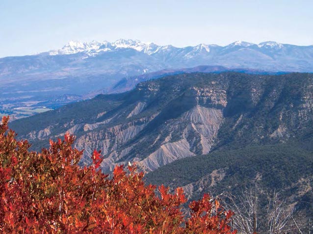
Vegetation reflects the environmental characteristics of an area, as well as current and historical land use. Vegetation is a primary resource of the landscape; it forms habitat for animal species and background for human activities. In the early days of development of the modern study of ecology in North America, Clements (1916) described plant communities as distinct units of interacting species. Gleason (1926), on the other hand, believed that plant communities were simply aggregations of species, where individual species’ distributions were determined by environmental and topographic factors such as temperature, soil type, and elevation.
Current views of plant communities or vegetation types allow for consideration of both views. While species distribution may be determined by environmental factors, there are aggregations of plant species that occur in more-or-less distinct patterns (sometimes with species influencing each other) (Riklefs 1982). These patterns can be described and analyzed, and the studies provide clues to ecosystem processes and management techniques (Grossman et al. 1998).

USGS Southwest Biological Science Center
Frameworks developed for vegetation description include those based on plant form (for example, structural characteristics - tree, shrub, herbaceous; or leaf characteristics - evergreen or deciduous, needle-shaped or broadleaved) (Kuechler 1949, Raunkiaer 1934). Daubenmire (1968) believed that vegetation types were most usefully described by their plant species composition. A descriptive, hierarchical system, based on plant form at the higher levels, and species composition at the lower levels, forms the basis of the National Vegetation Classification (NVC) used today by many federal agencies and conservation groups (Grossman et al. 1998).
The description and classification of vegetation types has been accompanied by attempts to understand and map their distribution (Grossman et al. 1998). Daubenmire (1974) suggested that since plant communities integrate all impinging environmental conditions, the classification and description of plant associations provides a framework for understanding the ecological composition and structure of a given landscape. Accordingly, plant associations can be used to define map units, or spatial representations of the distribution of vegetation. Plant associations provide the information linkage between a vegetation type’s spatial distribution and its ecology. By grouping land areas based on their ability to support similar associations, general management observations and recommendations can be made for each grouping. In addition, resource managers have found that the classification of vegetation into plant associations has provided insight into, and the ability to predict vegetation changes in response to various disturbance processes (Muldavin et al. 2010). Understanding the characteristics of the vegetation enhances the potential for successful monitoring, management, restoration, and protection of natural resources (Cogan and Salas 2006).
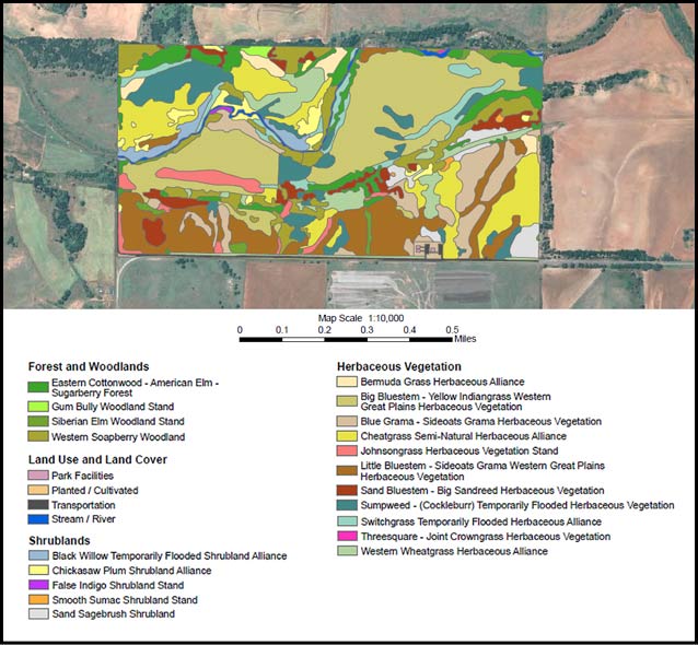
The U.S. Geological Survey (USGS) and the National Park Service (NPS) formed the USGS-NPS Vegetation Mapping Program in 1994 to cooperatively inventory and map vegetation in more than 280 national parks across the United States. The program’s goals are to provide baseline ecological data for park resource managers, obtain data that can be examined in a regional and national context, and provide opportunities for future inventory, monitoring, and research activities. The NPS goal is to have the majority of the parks mapped. Member parks are currently developing and implementing vegetation mapping projects to produce detailed maps of vegetation types across park sites (e.g., see map below). As of August 2014, 267 NPS units had completed vegetation mapping projects (because this may change rapidly, please consult https://science.nature.nps.gov/im/inventory/veg/products.cfm for current information).
More mapping projects are ongoing, and additional projects are in the planning stage. A number of parks in the NPS Inventory and Monitoring (I&M) Networks of the American Southwest have been mapped to date. For example, maps are complete for ten parks in the Southern Plains Network (SOPN). In the Southern Colorado Plateau Network (SCPN), vegetation maps are complete for 16 parks, with one in progress and due to be complete in 2016. In the Sonoran Desert Network (SODN), four maps are complete, with seven in progress; and in the Chihuahuan Desert Network (CHDN), two vegetation maps have been completed and five maps are in progress. The vegetation maps provide valuable data in an easily accessible format, and they are invaluable tools for park managers in a broad array of applications. Example applications are discussed in the last chapter of this series.

from Cogan and Salas 2006
Part of a series of articles titled Vegetation Mapping in the American Southwest.
Last updated: July 1, 2015
