Conclusion
The USGS-NPS Vegetation Mapping Program provides baseline ecological data for park resource managers, obtains data that can be examined in a regional and national context, and provides opportunities for future inventory, monitoring, and research activities. The use of the NVCS and the USGS-NPS vegetation mapping protocols facilitates effective resource stewardship by ensuring compatibility and widespread use of the information throughout the NPS, as well as by other federal and state agencies. A comprehensive set of vegetation maps for our national parks, including those in the American Southwest, is an invaluable tool for researchers, park managers, and anyone who hopes to deepen their understanding of the scope and diversity of our natural heritage.
References

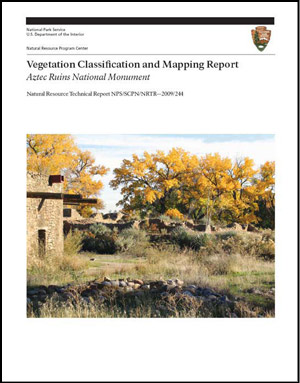
Photo by J. Beren
Cogan, D., and D. Salas. 2006. Washita Battlefield National Historic Site Classification and Mapping Project Natural Resource Report NPS/MWR/HTLN/NRR—2006/001. National Park Service, Johnson City, Texas.
Cogan, D. 2007. Lyndon B. Johnson National Historical Park Vegetation Classification and Mapping Project Natural Resource Report. Report for the Southern Plains Network. National Park Service, Johnson City, Texas.
Daubenmire, R. 1968. Plant communities: A textbook of plant synecology. Harper and Row, Publishers, New York, New York.
Federal Geographic Data Committee (FGDC). 2008. National Vegetation Classification Standard, Version 2. http://www.fgdc.gov/standards/projects/FGDC-standards-projects/NVCS_V2_FINAL_2008-02.pdf.
Gleason, H.A. 1926. The individualistic concept of the plant association. Torrey Bot. Club Bull. 58:7-26.
Grossman, D.H., D. Faber-Langendoen, A.S. Weakley, M. Anderson, P. Bourgeron, R. Crawford, K. Goodin, S. Landaal, K. Metzler, K.D. Patterson, M. Pyne, M. Reid, and L. Sneddon. 1998. International Classification of Ecological Communities: Terrestrial Vegetation of the United States. Volume 1. The National Vegetation Classification System: Development, Status, and Applications. The Nature Conservancy, Arlington, Virginia. Accessed at http://www.natureserve.org/ publications/library.jsp.
Hanna, D., L. Floyd-Hanna, and D.P. Hanna. 2008. Mapping successional communities in post-fire vegetation, Mesa Verde National Park. Report on file, National Park Service, Southern Colorado Plateau Network, Flagstaff, Arizona.
Kuchler, A.W. 1949. A physiognomic classification of vegetation. Ann. Assoc. Amer. Geogr. 39:201-210.
Muldavin, E., A. Kennedy, C. Jackson, T. Neville, P. Neville, K. Schultz, and M. Reid. 2010. Vegetation Classification and Distribution Mapping Report: Bandelier National Monument. Natural Resource Technical Report NPS/SODN/NRTR–2010/00X, National Park Service, Fort Collins, Colorado.
Raunkaier, C. 1934. The life forms of plants and statisitical plant geography. Clarendon Press, Oxford University Press, Oxford, United Kingdom
Riklefs, R.E. (1982). Ecology. Chiron Press, Inc., New York, New York.
Thomas, L.P., M.N. Hendrie (editor), C.L. Lauver, S.A. Monroe, N.J. Tancreto, S.L. Garman, and M.E. Miller. 2006. Vital Signs Monitoring Plan for the Southern Colorado Plateau Network. Natural Resource Report NPS/SCPN/NRR-2006/002. National Park Service, Fort Collins, Colorado.
Thomas, K.A., M.L. McTeague, L. Ogden, M.L. Floyd, K. Schulz, B. Friesen, T. Fancher, R. Waltermire, and A. Cully. 2009. Vegetation classification and distribution mapping report: Mesa Verde National Park. Natural Resource Report NPS/SCPN/NRR—2009/112. National Park Service, Fort Collins, Colorado.
Prepared by Ben Gillock, Patty Valentine-Darby, and Anne Cully, 2009.
Part of a series of articles titled Vegetation Mapping in the American Southwest.
Last updated: July 1, 2015
