What streamwater thermal regimes currently exist in Glacier Bay National Park and Preserve?
What landscape characteristics are responsible for the variation in stream temperature?
Project Dates
Fall 2014—Fall 2016
Did You Know?
Water temperatures in streams across southeast Alaska have
been slowly warming over the past few decades. This may have
implications for aquatic organisms in those streams. One example
is Auke Creek near Juneau, a low elevation watershed with a
large lake. Recent research has shown the timing of adult Pacific
salmon spawning migrations in the last 40 years have shifted to
avoid the warmest summer stream temperatures.
Introduction

With air temperatures in the coastal temperate rainforest of the southeast Alaska projected
to increase by 1.7-3.7°C by the end of the century, researchers from the University of Alaska
are seeking to better understand sources of variation in stream temperature regimes in the
regions salmon bearing streams. A warming climate will impact landcover and hydrology in
southeast Alaska, ultimately having the potential to alter the physical characteristics of
aquatic habitats in coastal streams within the region. The goal of this research is to understand
how watershed thermal regimes vary spatially across the landscape of southeast Alaska,
including Glacier Bay. In particular, we are studying how a stream’s thermal regime responds
to its environment and localized climate by analyzing how stream temperature is
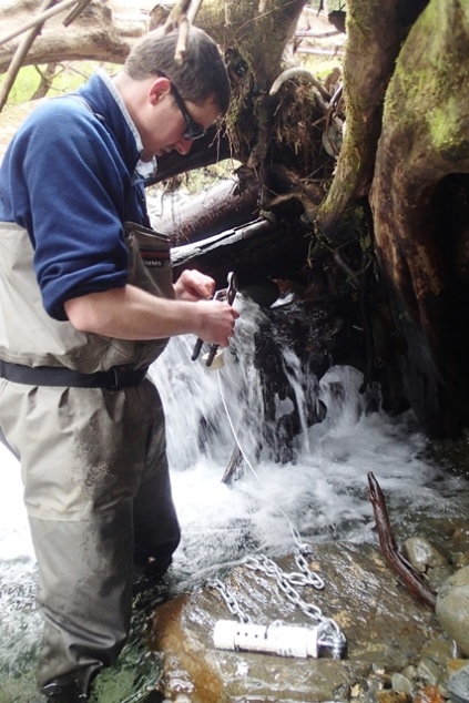
affected by the interaction of air temperature with landscape controls such as forest cover, lake cover, and watershed slope. Beginning in May 2014, researchers deployed stream temperature sensors in selected watersheds throughout the entire panhandle of southeast Alaska, from Ketchikan to Yakutat.
Climate in the Glacier Bay region is projected to change more rapidly than most other regions of southeast Alaska, with pronounced increases in air temperature and precipitation by the end of the century. Understanding relationships between stream temperature and the diverse landscape characteristics encompassed by Glacier Bay watersheds is critical for understanding overall stream temperature variation in Southeast Alaska.
Methods

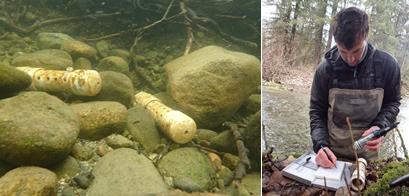
Continuous stream temperature data was collected from fall 2014 through spring 2016. Two temperature sensors were installed in nine streams in fall 2014, with each sensor pro-grammed to take a temperature reading every hour. The moni-toring sites were visited twice in 2015 to download data. The sensors will be removed in July 2016.
Findings

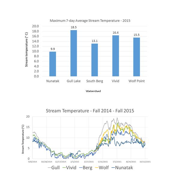
Stream temperature for the full duration of the monitoring period was successfully collect-ed in five watersheds. Temperature data from 4 watersheds is not presented due to sensor burial. Stream tem-perature tended to be warmest in water-sheds with lakes as a prominent part of the landscape. The two streams with the warmest 7-day aver-age temperature in 2015 have 1% or greater percentage of lake area within the drainage.
Learn More
Analysis is currently ongoing for the regional study. Once completed, the thesis will be available from the University of Alaska Fairbanks.
Climate Change workshop– April 13-14, 2016, Juneau Alaska. A presentation given by Michael Winfree can be viewed at the following link: http://www.seakfhp.org/wp-content/uploads/2016/03/4-Winfree_SHORT_presentation_20160414.pdf
Last updated: September 15, 2016
