How do soil scientists describe soils? What kinds of soils occur in the park?
Project Dates
June 2012 - June 2014
Did You Know?
The ambitious task of inventorying the soils on 54 million acres of National Park Service lands in Alaska combines high technology methods, such as satellite imagery, with old-fashioned grunt fieldwork.
Introduction

The NPS Alaska Inventory and Monitoring Program is working with the U.S. Department of Agriculture Natural Resources Conservation Service to conduct soils inventories in the three NPS units in Southeast Alaska. The objective of the inventories is to gain a better understanding of how soils contribute to the richness and character of the parks by identifying soil types and describing their distribution. The project will provide reference information about soil types, wetland hydrology, and geophysical processes.
Why should park managers care about soils? On various scales, soil influences ecological processes that modify and drive vegetation patterns, regional hydrology, nutrient dynamics, habitat development, and landscape evolution. Through its structure, texture, and permeability, soil influences vegetation and succession processes and provides a way for nutrients to be recycled. Such processes create the complex and diverse landscapes that are protected in the parks.
This project will provide information to help assess the vulnerability of areas to various sources of disturbance and allow the discovery of adverse effects to the natural quality of soils. It will provide a baseline data set that can be used to inform a variety of future research and monitoring studies, including habitat evaluations, hydrological models, geohazard evaluations, vegetation studies, and climate change models.
Methods

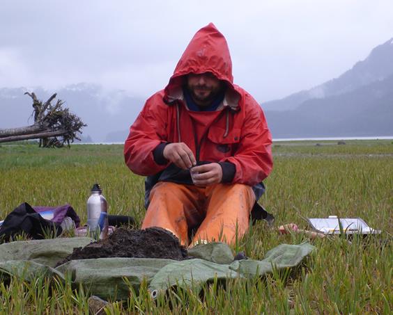
Field crews consist of two people—one soil scientist and one vegetation ecologist—and 2 to 3 crews will be working in and around the park. A chartered live-aboard vessel equipped with a skiff is used to access the park along the coast.
Field work is accomplished primarily by walking along predetermined transects and digging soil profile pits or extracting soil cores with an auger. Assuming the ability to map 80,000 - 2 million acres at various scales per field season, it is anticipated the project will require two seasons to complete the systematic examination, description, classification, and mapping work.
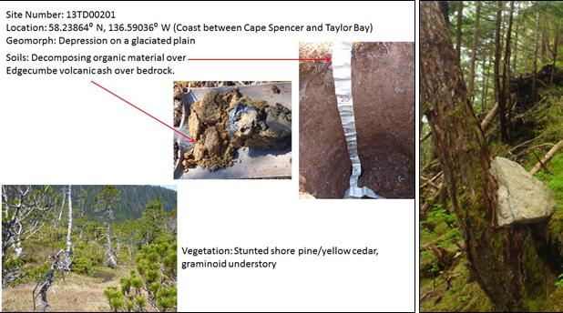
To identify and classify soils, the soil scientists study five soil-forming factors: climate, topographic relief, biological activity, time, and parent material. Using soil samples taken from the field, scientists describe the current physical and chemical properties of soil horizons, such as soil color, texture, structure, and soil pH. Data are also collected for vegetation, landforms, and surface hydrology. Ecological site descriptions, which describe soil properties associated with major plant communities, are also compiled.
The crew will analyze information from field plots to identify areas with similar soil-forming factors. This information, along with high resolution satellite imagery, digital aerial photography and digital elevation models will be used to create a GIS-based soils map of the park. They will also describe their findings in a formal report.
Learn More
Natural Resources Conservation Service website: www.ak.nrcs.usda.gov/soils/index.html
National Park Service Alaska Region Soils Inventory website:
www.science.nature.nps.gov/im/units/akro/inventory/soils.cfm
Last updated: September 15, 2016
