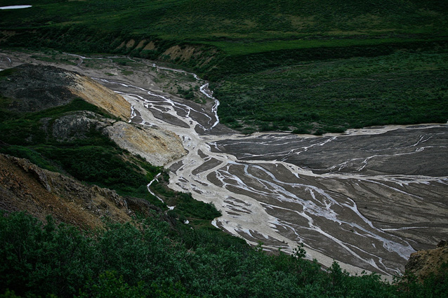
Photo by Diane Kirkendall
Watch a bull caribou splash up the Savage River. Relax to the gurgle of the creek entering Wonder Lake. Feel the pressure of icy water on your legs as you safely cross a braided river while backpacking. Because Denali’s landscapes are rich in rivers and streams, the chances are good you’ll encounter wild flowing waters while visiting Denali National Park and Preserve.
Large (rivers) or small (streams and creeks), these waters flowing across the Denali landscape are strongly influenced by their source, the local geology, and processes within the watershed. The water source may be melting glaciers, melting snow, or groundwater springs. The local geology determines the chemical make-up of the water. Processes such as erosion can influence the stability of the stream bed by determining the gradient of the stream, current flow, and substrate particle size.
Types of Rivers and Streams
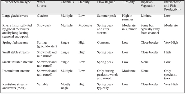
Researchers have studied the physical habitat and the assemblages of macroinvertebrates (e.g., insects such as midges, mayflies, stoneflies, and caddisflies) for many rivers and streams within the park. The rivers and streams fall into seven types (see next two pages) based primarily on the stability of the stream bed and their water source. These factors also influence the biological communities of the streams. The community composition of fish and macroinvertebrates in a stream (which species and their abundance) can indicate changes in stream environments or watershed processes.
Life in Rivers and Streams
The energy source for macroinvertebrates in the rivers and streams is ultimately sunlight, either via algae and plants growing in the water or from leaf litter that enters the stream from the nearby riparian zone in the fall. Some invertebrates graze on algae or shred leaf litter, while others are predators on other invertebrates.
Many insects have aquatic stages in their life cycle, including mayflies and stoneflies, two groups well known to those who go fly fishing. Arctic grayling are found in many Denali’s streams, and much of their diet is aquatic macroinvertebrates. Juvenile arctic grayling are often eaten by birds such as dippers, mergansers, goldeneyes, and kingfishers.
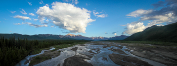
Photo by Alex Vanderstuyf
Large Glacial Rivers
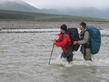
These rivers are glacially-fed. In the summer (peak in July), they roil with suspended sediment loads (high turbidity, low clarity) as long days of sunshine melt glacial ice. Hikers and backpackers should be aware that these rivers, which may be easily crossed in the morning (low glacial melt), often become higher and unsafe to cross by afternoon (peak glacial melt). The braided (multiple) channels are continually shifting across wide gravel floodplains with little vegetation. The changing flow and unstable river beds make it difficult for macroinvertebrate and fish communities to persist in these rivers. Consequently, these rivers support a low diversity of invertebrates (usually restricted to a few specialized species) and few, if any, fish. Examples along the Park Road: Teklanika River (Mile 31.3); East Fork Toklat and Toklat River (Mile 53.2) —two forks meet to form Toklat under the bridge; McKinley River (turnoff for McKinley Bar Trail at Mile 84.6)
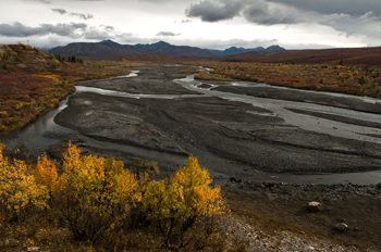
NPS Photo / Tim Rains
Rivers historically fed by glacial meltwater and by long-lasting seasonal snowpack
These rivers are often slightly turbid during the summer due to the input of some glacial water. Unlike the large, glacier-fed rivers, these river channels are more stable (although at times there are multiple channels across the floodplain) and are relatively productive streams.
Examples along the Park Road: Savage River (Mile 14.8); Sanctuary River (Mile 22.8)
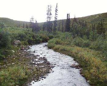
Photo by Sandy Miller
Spring-Fed Streams
These streams are small shallow systems fed principally by springs. Because groundwater is the source of water for these streams, the water is cooler in summer and warmer in winter compared to streams fed by surface run-off. Because they are fed by springs, their flow is also relatively constant creating a stable channel that permits a close border of riparian plants (commonly willow and alder) to develop. The overhanging trees and shrubs shade the stream and provide inputs of leaves, which serve as food for some stream invertebrates. These streams are typically very productive, supporting a high abundance and diversity of macroinvertebrates and fish populations. Examples along the Park Road: Hogan Creek (Mile 21.2); Stony Creek West (Mile 60.6)
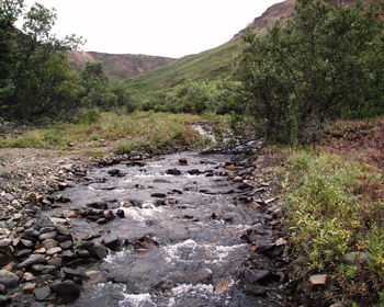
Photo by Sandy Miller
Small Stable Streams
These streams are similar to spring-fed systems in having a very stable streambed with a close border of vegetation, but are fed principally by snowmelt and rain runoff. These are productive streams supporting fish populations and a wide diversity of invertebrates. Examples along the Park Road: Tattler Creek (Mile 37.5); Igloo Creek (Mile 34.1, 37.05)
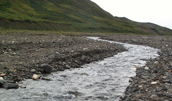
Photo by Sandy Miller
Small Unstable Streams
These clearwater streams are fed by snowmelt and surface run-off, but typically possess a high gradient and an actively migrating channel. These streams typically have a broad floodplain with no vegetation. These streams have little algal growth, a low diversity of invertebrates, and rarely support fish populations. Examples along the Park Road: Highway Pass Creek (Mile 59.3); Unnamed streams that tumble down the steep north side of Cathedral Mountain and cross the road in Igloo Canyon (between Miles 35 and 36.5)
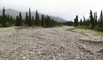
Photo by Sandy Miller
Intermittent Streams
These streams flow in the spring during peak snowmelt, but do not have an adequate inflow to sustain them through the summer and fall unless there are periods of high rainfall. During dry times, these streams will simply be dried-up river beds. Amazingly, some aquatic insects may be able to survive in these streams by synchronizing their life cycles to when water is present in the stream. They can lay eggs that can survive dry periods until water returns. Examples along the Park Road: Numerous examples toward eastern end of park (e.g., between Miles 6 and 12)
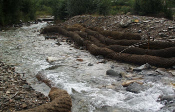
Photo by Sandy Miller
Kantishna Rivers and Streams
Many of the rivers and streams located in the Kantishna Hills are some of the most productive streams in the park, supporting a high abundance and diversity of macroinvertebrates. However, some rivers in this area have been influenced by placer mining (e.g., channelization; presence of toxic chemicals and heavy metals). Current efforts to restore stream habitat include using coconut fiber logs to help direct stream flow. Examples along the Park Road: Moose Creek (e.g., Mile 89.2); Eureka Creek (e.g., Mile 91.2); Friday Creek (e.g., Mile 92.3)
NPS Photo Katlin Thoresen
Research Findings
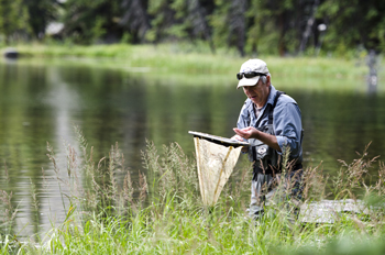
Dr. Sandy Milner, of the Institute of Arctic Biology at the University of Alaska Fairbanks, and his students have logged many hours collecting stream macroinvertebrates from 14 long-term study sites in Denali. Since 1994, Milner has studied the benthic macroinvertebrates with particular respect to the chironomids (midges) and the “EPT” groups, i.e., Ephemeroptera (mayflies), Plecoptera (stoneflies), and Trichoptera (caddisflies).
NPS Photo
There is significant natural variation from year to year, especially in unstable stream types. Some taxa, particularly stoneflies, are absent in some years. Persistence of macroinvertebrate assemblages is correlated with low total snow cover over the previous winter, inferring that high snow years produce spring flood peaks that reduce or eliminate some of the stream biota. The amount of chlorophyll a in the streams is also positively correlated with densities of macroinvertebrates.
Last updated: April 21, 2016
