Last updated: April 9, 2023
Article
Protecting Coastal Treasures from Future Floods

NPS Photo/Harpers Ferry Center
By Minh Phan
It was five years ago -- in October, 2012 -- when Hurricane Sandy struck the Northeast, flooding some areas along the coast with more than eight feet of water. The storm impacted nearly 70 national park sites in the region, with parks like Fire Island National Seashore and Gateway National Recreation Area among the hardest hit.
Coastal Treasures Threatened by Storms and Sea Level Rise
As the National Park Service (NPS) worked to recover from Sandy, structures were rebuilt or rehabilitated in ways that could reduce the potential for impact from future storms and sea level rise. National parks are home to treasured resources like historic forts, statues, and lighthouses that visitors from around the world come to enjoy. Understanding where these structures are located along the coast and how high they sit above sea level is an essential first step in protecting them.
With Hurricane Sandy relief aid, several coastal parks in the region set out to measure the height of the first floors of buildings and structures. This information helps managers determine how vulnerable cultural resources and visitor use facilities are to rising seas and future storms. In order to proceed with these studies, however, researchers needed high-accuracy elevation information to evaluate how the water levels relative to the land and foundations underneath these structures have changed over time.
Even before Hurricane Sandy, the NPS was working to provide the foundation of accurate and consistent elevation information at parks across the Northeast. Elevation information is essential as it provides a measurement on which other data can be based for virtually all types of research.
Backbone Monuments a Starting Point for Measuring Change
“In order to measure change, you have to know where you started measuring from,” explains Neil Winn, a Geographer and Geographic Information Systems Specialist at Assateague Island National Seashore. With high-resolution elevation data, researchers can establish reliable trends and understand how the land has shifted and changed with the passing of time. In the wake of the storm, the expansion of important elevation mapping became a major priority.
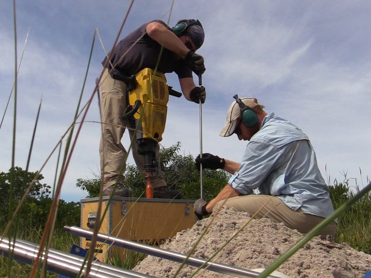
One way to use elevation data to assess future storm risks is to install permanent markers, called backbone monuments, at specific locations that pinpoint precisely measured elevation values. In partnership with the Environmental Data Center (EDC) at the University of Rhode Island (URI), the NPS installed a network of backbone monuments in ten northeast coastal parks. Locations were chosen by each park, oftentimes relating to park infrastructure or points of significance.
These monuments, which are steel rods driven deep into the ground and marked by brass discs, provide a reliable point of reference for researchers to compare the heights of other objects and structures nearby. Researchers can then use survey equipment to measure the height of the structure within 2-4 cm of the actual elevation value.
Following Hurricane Sandy, the U.S. Department of the Interior awarded nearly $21 million to the NPS Northeast Region to study coastal systems and resources and help coastal parks enhance their ability to respond to and protect against future storms. This funding was instrumental in mapping the first floor building heights of key structures in NPS parks. The monument installations prior to Sandy allowed researchers to precisely measure the elevations of many important structures across the Northeast, like the Statue of Liberty.
The elevation information collected after Hurricane Sandy can be used to predict how buildings in different parks may be affected by the next powerful coastal storm or even sea level rise. This in turn provides parks with information to help prioritize actions to protect or move structures and upgrade buildings to make them more resistant to extreme weather events.
Low-lying Areas and First Floors Prone to Flooding
At Gateway National Recreation Area, for example, park managers used first-floor elevation information to take a closer look at the many buildings in and around Fort Hancock at Sandy Hook, New Jersey. During Hurricane Sandy, storm waters flooded basements and other low-lying areas at the park. Equipped with accurate building height information, the park worked to move utilities and heating systems from the bottom floors up to higher areas, which will limit the amount of damage expected from future storms.
Thanks to the installation of elevation markers and the many research activities that rely on these monuments, park staff have the ability to anticipate future changes and make science-based decisions on how best to protect the many resources and visitor facilities that preserve a piece of our country’s history. With this knowledge, the NPS will work to prepare its national parks and historic sites for what are likely to be more frequent and intense storms in hopes they can be here for generations to come.
