Can we detect shifts in Earth’s crustal plates on the park’s outer coast?
Project Dates
Continuous and ongoing since 2007.
Did You Know?
The Pacific Plate is moving northwesterly about 5 cm annually (and diving beneath) relative to the North American Plate. The Fairweather Fault, where the two plates collide, is visible at the surface as the prominent trench known as Desolation Valley that parallels much of the park’s outer coast.
Introduction

The University Navstar Consortium (UNAVCO) is a partnership of research institutions that supports and promotes a better understanding of Earth by using high-precision techniques to measure crustal deformation. The Plate Boundary Observatory (PBO) is a UNAVCO project that precisely measures Earth deformation resulting from the constant motion of the Pacific and North American tectonic plates in the western U.S. These Earth movements can be very small and incremental or very large and sudden such as those displayed in earthquakes and volcanic eruptions.
PBO’s network of 1100 permanent, continuously operating Global Positioning System (GPS) stations, along with strainmeters, seismometers, and other geodetic instruments, measures earth deformation associated with the boundary between the Pacific Plate (mostly beneath the ocean) and the North American Plate (mostly supporting the continent). UNAVCO is responsible for instrument installation, maintenance, communications, data archiving, and data availability.
In collecting data, PBO is addressing the following scientific questions:
- What are the forces that drive plate-boundary deformation?
- What determines the spatial distribution of plate-boundary deformation?
- How has plate-boundary deformation evolved?
- What controls the space-time pattern of earthquake occurrence?
- What are the dynamics of magma rise, intrusion, and eruption?
- How can we reduce the hazards of earthquake and volcanic eruptions?
Methods and Findings

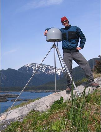
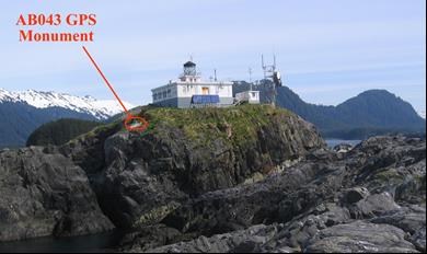
A short, drill-braced GPS monument (SDBM) was installed near the Cape Spencer Lighthouse in Glacier Bay National Park in May 2007. The location was chosen partly because of proximity to the lighthouse, which provides power, and to a cell tower, which provides the internet connection by which data are transmitted to the processing facility in Boulder, Colorado. Anchored in bedrock, the continuously-operating GPS very precisely and with sub-millimeter accuracy measures its position relative to the center of the earth, both horizontally and vertically.

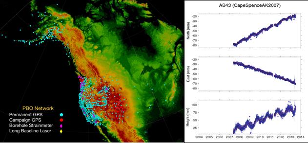
Left: PBO's network of 1100 permanent, continuously-operating GPS stations spans the Pacific/North American plate boundary in the western U.S. and Alaska, with additional stations on the stable continental interior.
Right: These GPS time series plots show that the station is moving northward about 10 mm/yr, westward about 7 mm/yr and vertically upward about 11 mm/yr. Cape Spencer is on the edge of the North American plate (mostly supporting the continent), which is moving northwestward at a much slower pace than the Pacific Plate (mostly beneath the ocean)
Learn More
UNAVCO website at http://www.unavco.org/unavco.html
Last updated: September 13, 2016
