Although pinyon-juniper woodlands cover millions of acres, they are among the least-studied North American forest types.
Introduction
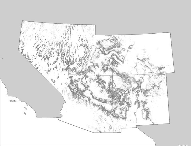
Defined by the presence of one or more species of pinyon pine (Pinus spp.) and juniper (Juniperus spp.), this forest type is associated with a range of different vegetation. The majority of pinyon-juniper woodlands are found in regions subject to temperature extremes and limited moisture availability. Covering as much as 15% of the land area in 5 states—Arizona, Colorado, Nevada, New Mexico, and Utah—pinyon-juniper woodlands provide a wealth of resources and ecosystem services, from wildlife habitat and vegetative cover for watershed protection, to pinyon nuts and fuelwood (Gottfried et al. 1995). Although they cover millions of acres, pinyon-juniper woodlands are among the least-studied North American forest types.
Distribution

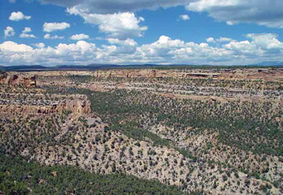
NPS Photo.
Studies of packrat middens, dry caves, pollen cores, lake sediments, and archaeological sites provide important information about the distribution of pinyon-juniper woodlands since the last major advance of continental glaciers in North America. During the “Wisconsinan” glaciation, which ended roughly 10,000 to 15,000 years ago, pinyon-juniper woodlands occurred in areas that today are the Chihuahuan, Mojave, and Sonoran desert lowlands (Betancourt et al. 1993). Warming temperatures and decreasing precipitation caused the range of pinyon-juniper woodlands to shift northward and to areas of higher elevation, roughly 13,000 years ago (Betancourt et al. 1993; Gori and Bate 2007). Predictably, pinyon-juniper woodlands extended to lower elevation, more xeric communities during periods of higher moisture availability, and receded to higher elevations again as climatic conditions became warmer and drier.
Elevation and climate
Today, pinyon-juniper woodlands generally occur between 1,370 and 2,290 meters (4,500 to 7,500 feet) in elevation, transitioning from grasslands or shrublands at lower elevations, and to ponderosa pine (Pinus ponderosa) or other montane forest associations at higher elevations (Daubenmire 1943; Gori and Bate 2007). With a few exceptions, juniper is more abundant than pinyon at lower elevations, while pinyon predominates at higher elevations (Gottfried et al. 1995). Mean annual temperatures in pinyon-juniper woodlands range from 40° to 61° F (4.4° to 16.1°C), and mean annual precipitation ranges from 7 to 25 inches (18 to 63 cm) (Ronco 1990; Gori and Bate 2007).
Range, species composition, structure, and many stand characteristics of pinyon-juniper woodlands are greatly influenced by moisture availability and season of precipitation (Gottfried et al. 1995). Some types occur in regions where the majority of precipitation falls as winter snow. Other types are found in regions where summer monsoon rains predominate, and still others occur in regions of bi-modal annual precipitation (occurring in summer and winter).
Soils
The soils of pinyon-juniper woodlands vary in texture from gravelly, sandy loam to compacted clay. Substrates vary in depth, parent material, and moisture availability. Although pinyon-juniper woodland soils are often alkaline, well-drained, shallow, and rocky with low fertility, some sites with deeper, more mesic (moderately moist) soils support higher productivity, and higher density of trees and understory shrubs and grasses (Ronco 1990; Gori and Bate 2007). Pinyon and juniper trees make use of what are generally moisture- and nutrient-limited environments by concentrating soil, soil moisture, organic material, and nutrients beneath their canopies over time, creating “islands” of higher fertility (Barth 1980).

Part of a series of articles titled Pinyon-Juniper Woodlands.
Last updated: February 3, 2015
