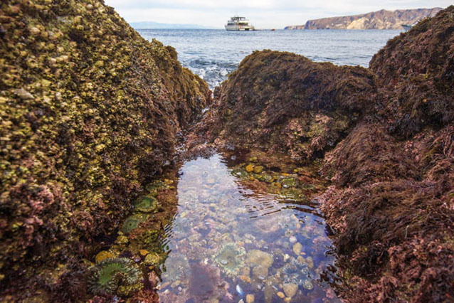
The rocky intertidal zone, or the band of rocky coastline that is flooded by high tides and exposed during low tides, is home to a wealth of colorful seaweeds and uniquely adapted invertebrates. In Southern California, Cabrillo National Monument and Channel Islands National Park both protect rocky intertidal habitat to the delight of curious visitors young and old.
July 21, 2016 - Cabrillo NM’s intertidal zone is one of the region’s best-protected and most easily accessible rocky intertidal areas, and a popular San Diego tourist destination. Channel Islands NP intertidal areas are more remote, but harbor an unparalleled variety of marine life.
Jessica Weinberg McClosky / NPS
Alex Warneke / NPS
Although rocky intertidal life is adapted to harsh conditions such as crashing waves and scorching sun, it is nonetheless vulnerable to human impacts like trampling, harvest, invasive species, and pollution. Rocky intertidal species are also vulnerable to climate change, and not only via rising sea levels, air temperatures, and ocean temperatures. The ocean also absorbs a significant portion of the excess carbon dioxide in the atmosphere, triggering changes in seawater chemistry that lead to a more acidic ocean (with more positive hydrogen ions and a lower pH value). This process, known as ocean acidification, makes it more difficult for intertidal organisms to build shells and perform other functions essential for life.
Cabrillo NM and Channel Islands NP are concerned about the impact that ocean acidification will have on their intertidal communities and the ability of their visitors to enjoy a seascape rich in marine life. They already monitor populations of several key rocky intertidal species to better understand and protect the ecosystem long term as part of the National Park Service’s Inventory and Monitoring Program. However, to understand the dynamics of ocean acidification in the rocky intertidal and how the monitored species are responding, a new type of monitoring has become necessary.
CINP / NPS
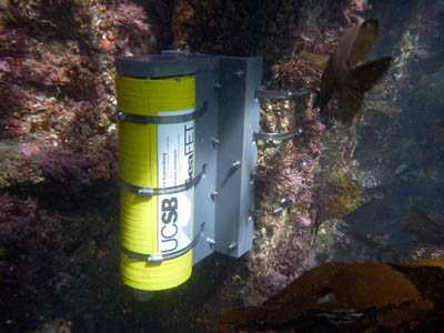
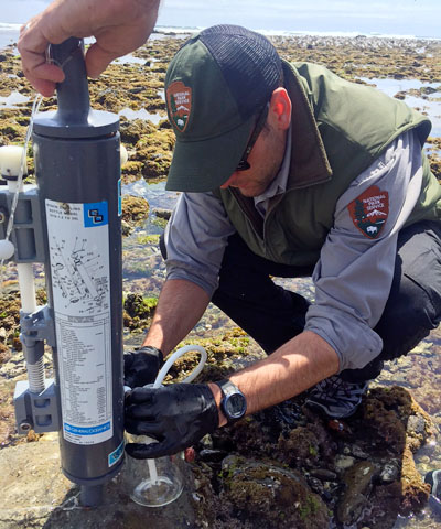
Cabrillo NM recently initiated an ocean acidification monitoring program to detect long-term trends in ocean pH within the park’s intertidal zone. Following protocols developed by Olympic National Park, Cabrillo NM installed specialized SeaFET pH sensors that continuously measure the pH of the ocean.
Channel Islands NP will soon begin monitoring pH as well, in Santa Cruz Island's rocky intertidal zone. Marine biologists from the North Coast and Cascades and Mediterranean Coast Inventory and Monitoring Networks will convene on the Island this summer to deploy a pH sensor according to the same Olympic NP protocol followed at Cabrillo NM. While the University of California Santa Barbara in collaboration with Channel Islands NP have already been monitoring pH in subtidal waters, this new sensor will be directly focused on the rocky intertidal zone, located together with the same fixed plots used to monitor intertidal species.
Alex Warneke / NPS
In tracking ocean pH in the intertidal zone, park scientists will for the first time be able to evaluate the natural range of intertidal pH and monitor any episodic or sustained fluctuations in pH into the future. They will be able to further evaluate trends in organism abundance, diversity, and community composition with respect to ocean acidification dynamics, both within and across parks and monitoring networks. What is learned will aid park management in understanding how climate change is affecting the park resources now and in the future so that targeted protection and restoration action can be accurately and thoughtfully applied.
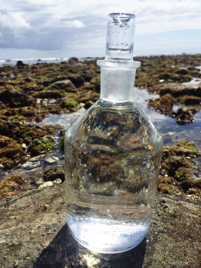
In addition to the new long-term pH monitoring in the park, Cabrillo NM recently collaborated with NOAA and US Navy researchers during a NOAA West Coast Ocean Acidification research cruise. Thanks in part to the help of Navy partners, Cabrillo NM was able to coordinate water sampling at two nearshore stations and one intertidal station with the NOAA Ship Ronald H. Brown and the Smith Lab at Scripps Institute of Oceanography. These nearshore and intertidal samples will help connect the dots between data collected in the intertidal zone and at the NOAA cruise station offshore, giving scientists an idea of how pH changes across the ocean’s surface as it makes its way closer to shore.
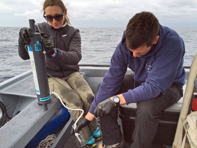
Suzanne Graham
Deciphering such regional patterns in water chemistry would have been a difficult endeavor for park researchers working alone. While ocean acidification is a global issue, collaborative working groups such as these make it possible for resource managers to make the best possible decisions for ensuring the future of protected marine areas. With pioneering research such as this, the National Park Service is committed to addressing and managing challenges posed by our rapidly changing climate for this and future generations.
Prepared by the Mediterranean Coast Inventory and Monitoring Network.
Last updated: March 15, 2017
