One of the most useful and important management tools recently developed for the computer is the Geographic Information System (GIS), which can be used to store, sort, and recover geographic data. GIS can contain maps, images, and other information related to archaeological sites. Such a system can be a vital tool in historic lands preservation.
Geographical Information Systems

The British march to Burn Washington began in Bladensburg and ended in defeat in the City of Washington in the Brookland Historical District in Ward 5 at what is known today as Fort Circle Park. GIS has been used to reconstruct historical maps covering this attack, which has helped capture the attitudes of those who made them, and also assisting preservationists, archeologists and scholars studying the War of 1812.
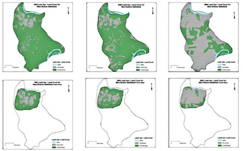
Geographic Information Systems are not only used to bring new life to historical maps, though, but also to aid in decision making for preservation strategies. These systems operate by consolidating layers of data, such as elevation, land use, soil types, and archeological sites, to carry out advanced calculations. Among many other practical applications, GIS is used in Battlefield management to make assessments on the impacts of proposed development, to measure historic site fragmentation and to monitor resource change over time. This is useful as the typical lifecycle of a battlefield moves from a pristine battlefield landscape to a battlefield that has lost its defining features. In its pristine stage, a battlefield would be expected to have only few patches (areas that remain undeveloped) that are large, and of course, a high percentage of battlefield intact area. Overtime the areas of undeveloped battlefield become smaller and more disjointed. GIS helps to monitor this kind of change and helps make decisions to best protect the resource so that is will remain for future generations to visit and interpret.
The National Park Service Cultural Resources Geographic Information Systems (CRGIS) facility was created in 1989 to institutionalize the use of GIS, Global Positioning Systems (GPS), and Remote Sensing technologies in historic preservation within the National Park system and other federal agencies. Since it was created CRGIS has conducted GPS surveys of hundreds of historic places including War of 1812 sites. They have undertaken a wide range of GIS analyses including, developing fragmentation analyses, identifying factors affecting the long-term preservation of earthworks and developing standards for the collection, management, and distribution of cultural resource spatial data. The Facility also has shown how GIS can be used in disaster situations, such as flooding, drought and hurricane damage.
Learn More
Part of a series of articles titled Preserving the War of 1812 for Future Generations.
Last updated: February 26, 2015
