Last updated: November 15, 2021
Article
Water Quality Trends in Zion National Park, 2006–2016

About once a month, network staff collects water-quality samples on the North Fork Virgin River, North Creek, and La Verkin Creek. After the samples are analyzed, the network reports the results to park managers. This consistent, long-term monitoring helps alert managers to existing and potential problems.
Looking at the results over time can help managers know how they’re doing at addressing those problems—or at maintaining good water quality. A recent report by the Northern Colorado Plateau Network (NCPN) examined trends in Zion’s water quality from 2006 to 2016. Key findings showed:
- Water quality at the locations monitored in Zion National Park has remained relatively stable and high-quality over time, as indicated by a general lack of trends in water-quality parameters. A few exceptions are outlined below.
- E. coli continues to be a problem on the North Fork Virgin River. Chronic exceedances of state standards for fecal indicator bacteria indicate a need for continued management upstream of the park to protect public health and safety—and the need for consistent monitoring as management actions are implemented.
- Water quality in North Creek appears to be stabilizing after a wildfire burned much of the watershed in 2006.
- Changes in water quality at La Verkin Creek are likely to be natural in origin and are not of a magnitude that warrants management concern at this time.

North Fork Virgin River
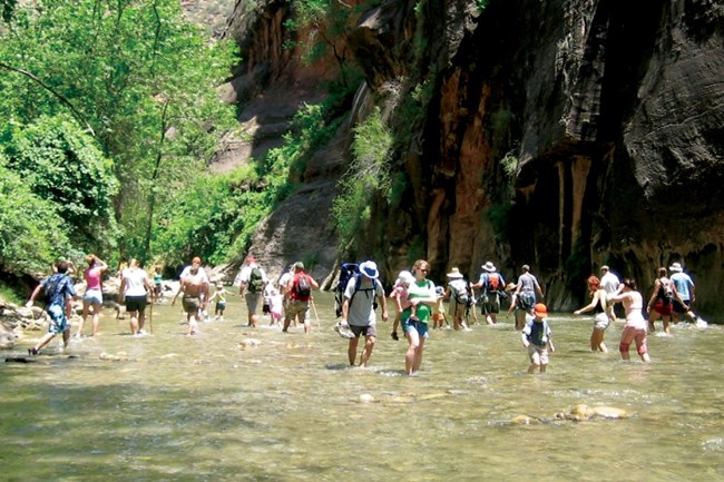
The sampling location on the North Fork Virgin River is located upstream from the park, making it possible to monitor water conditions flowing into the park. This area is the trailhead for one of the most popular wading backpacking trips in the park, the Zion Narrows. On a typical summer day, about 80 permitted hikers walk the Narrows from top to bottom. Hikers can also enter the Narrows from the bottom and hike upstream without a permit; more than 2,000 people a day have been documented doing this. Hiking the Narrows involves nearly continuous contact with the water, either through wading or swimming.
Recent years have seen chronic fecal bacteria (E. coli) contamination in the Zion Narrows. The State of Utah has included the North Fork Virgin River on a list of impaired waters, known as a 303(d) list, for this parameter, along with water temperature. It the highest-priority non-point pollution impairment in the state.
Intensive monitoring by the park, NCPN, and Utah Division of Water Quality has shown the source of the problem: excessive runoff from flood-irrigated pastures adjacent to the river. Runoff from these grazed pastures carries cattle feces into the stream. Combined data from the network and park found that when the pastures were irrigated and cattle were present, the E. coli standard was exceeded in 82% of 44 samples. Other possible sources include human waste.
For several years, the park, state, and other parties have been working together on suitable management actions to improve water quality. A vault toilet has been installed at the Narrows trailhead, and a private outhouse previously located over an irrigation ditch has been removed. However, the upstream flood irrigation continues to impair the river. In December 2017, the Utah Division of Water Quality completed a Total Maximum Daily Load analysis for the North Fork that includes a plan to bring surface-water quality into compliance. Chronic exceedances of E. coli support the need for continued management action and monitoring to improve public health and safety.

North Creek
North Creek drains the western slopes of Horse Pasture Plateau, carving several deep, narrow canyons into the Navajo Sandstone, which is about 550 meters (1,800 ft) thick at the sampling location. A portion of the North Creek watershed burned in 2006, followed by a catastrophic flood in 2007.
Wildfire not only burns vegetation but also can change the properties of soils. Reduced vegetation leads to increased erosion. Soils and other burned sediment are carried into streams, altering stream chemistry and increasing nutrient loading and turbidity. These introduced nutrients and toxins can cause eutrophication, killing aquatic life.
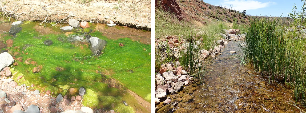
Low and high concentrations of some parameters have changed since the wildfire. High concentrations of alkalinity, nitrogen, and specific conductance have decreased, and low values of pH have increased. pH values above 9.0, exceeding the state water-quality standard for aquatic life, have occurred in more than 10% of samples throughout the post-fire period. However, there were no pH exceedances from July 2014 to September 2016, indicating a possible improvement in conditions. Although not statistically significant, there have also been fewer exceedances of the pH water-quality standard in North Creek in recent years. Nitrogen species may have fallen below a critical threshold for eutrophication, as shown by a reduction in observed algal blooms at the site since 2006. These trends in the low and high concentrations of water-quality parameters suggest that post-fire variability is stabilizing in North Creek.

La Verkin Creek
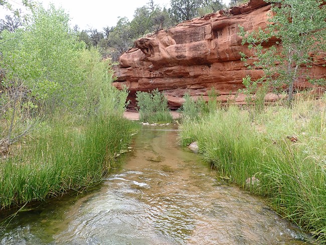
La Verkin Creek cuts deep canyons through the north-central portion of the park in a northeast-to-southwest direction. Specific conductance, sulfate, and turbidity showed statistically significant decreases in seasonal median values at La Verkin Creek. The cause of these decreases is unknown, but as land use and management has not changed in the watershed over time, the process is likely natural.
Download a pdf of this brief
