Article
Predicting Vegetation and Topographic Change in Response to Altered River Flows on the Northern Colorado Plateau
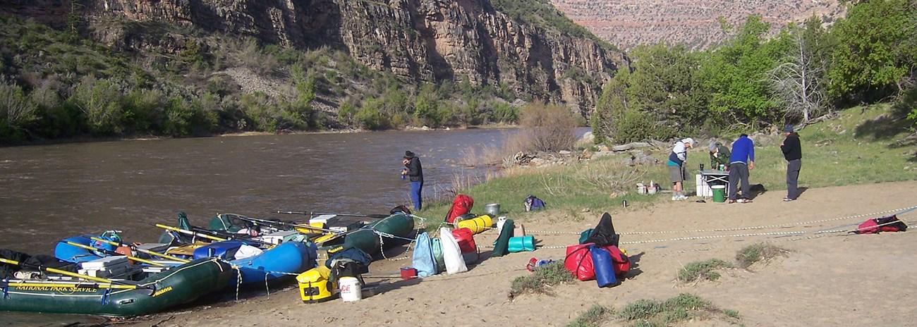
A new model can help park managers understand how changes in river flow may affect downstream vegetation and riparian topography—and vice versa.
Vegetation Shapes Rivers
Lots of things can impact the quality of your raft trip. Weather. Water levels. Packing the right (or wrong) gear. But would you expect plants to play a role?
Riparian plants influence the shape and character of rivers—and river flow helps determine what grows where. On dammed rivers, natural flow patterns are stabilized to generate electricity, store water, and reduce flooding. In general, this kind of slow, steady flow (and prolonged inundation) promotes growth of hydric (water-loving) plants.
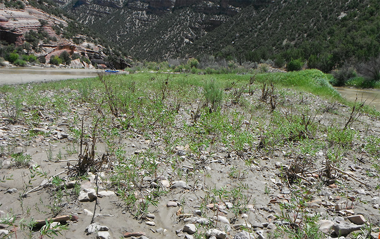
During summer base flow, native willows and non-native tamarisk establish low in the channel. Dense patches of these short, shrubby plants slow the river and trap sediment. As sediment accumulates, a stable base flow (such as found on dammed rivers) can encourage plant growth, and an active river channel can turn into a more stable floodplain. Over time, the floodplain grows higher, narrowing the river channel.
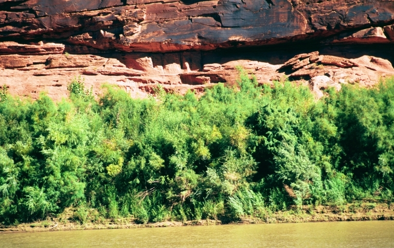
Eventually, the floodplain may grow too high for native willows to survive. But because of their dryland adaptations, tamarisk can thrive on elevated surfaces. Their deep roots help stabilize soil that might otherwise wash away. These root systems also divert water, deepening the main channel. Eventually, what was once a gradual transition from channel to floodplain can become a steep bank, armored by tamarisk. This makes it difficult for boaters to access campsites and degrades conditions for fish.
River health—and recreation—require that managers introduce enough variation in flow to maintain quality riparian areas and spawning conditions for fish. Undammed rivers, and those with dams managed to mimic variable natural flows, maintain diversity by keeping plants “on their toes.” They must be able to either quickly grow when floods recede, have root systems deep enough to withstand the power of water, or be flexible enough to absorb the power of water. One plant, water knotweed, grows as an aquatic plant during spring runoff, then transitions to a terrestrial plant as the water recedes—much as a pollywog changes into a frog. Flows that vary from year to year prevent any one plant type from dominating the others. After snowy winters, floods wash some plants away and create new habitats for others.

Photos ©Biopix: JC Schou. Used with permission.
How Does Flow Affect Vegetation?
But how do we know what the downstream effects of different flows will be? Knowing the answer could help river managers predict how riparian vegetation might change in response to shifts in flow from changing climate patterns and/or dam regulation, and respond accordingly.
Modeling the Answer
Scientists from the Northern Colorado Plateau Network, U.S. Forest Service, and University of Montana developed a model that predicts how different plant guilds will respond to flow patterns. They tested the model in Dinosaur National Monument, at a site on the Green River and one on the Yampa River. On the Green River, flows are partially regulated by Flaming Gorge Dam. The Yampa is unregulated.
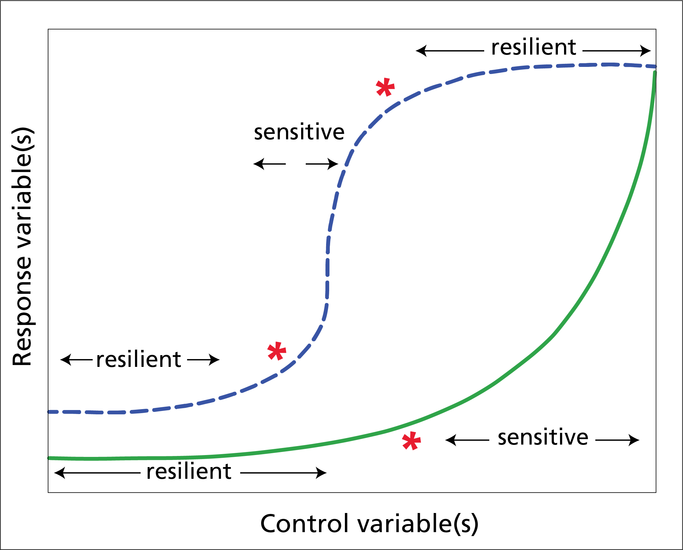
The model uses “response curves” to describe the relationships among flow, vegetation, and geomorphology. Response curves link the response of an ecosystem property to environmental variables. In this case, they show how one variable (e.g., plant guilds) changes in response to changes in another (e.g., flow). Depending on the shape of the curve, thresholds may exist, indicating where a response variable is sensitive or resilient to change.
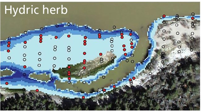
Using vegetation data collected by the Northern Colorado Plateau Network, the model predicted where six different plant guilds (see table) were most likely to be present in response to flow velocity and length of inundation. It also predicted how densely vegetated a plot would be. The model took into account how vegetation types can affect flow patterns, and attempted to look at how topography might change in response to a flood.
| Guild | Example species |
|---|---|
| Hydric herb | common three-square bulrush |
| Hydric pioneer tree/shrub seedling | Fremont cottonwood |
| Mesic short herb | wild licorice |
| Mesic tall herb | giant goldenrod |
| Mesic shrub/tree | sandbar willow |
| Xeric late-seral shrub | five-stamen tamarisk |
What We Learned
Riparian vegetation
The model accurately predicted the general distributions of plant guilds along the river. Hydric guilds were most likely to occupy plots inundated for most of the growing season. Xeric guilds were found in dry areas. Between plots regularly and rarely inundated during the growing season, conditions were optimal for mesic guilds, which prefer a moderate amount of moisture.
Areas with faster velocities and longer periods of inundation were less likely to be vegetated. Hydric and xeric guilds could be expected for a wide range of velocities, from very low up to 4 meters/second. Mesic guilds were most likely to be found in areas with low-to-moderate velocities. Most plant guilds, especially hydric and xeric ones, were more sensitive to shifts in small discharges that typically occur late in the growing season. Mesic guilds were more responsive than hydric or xeric guilds to shifts in maximum velocity.
At plots with mature woody guilds, plant cover was 20–70% more likely to be dense than on other plots. Dense cover was also more likely at plots with mesic short herb guilds.
Topography
Topographic response curves predicted erosion or deposition at a vegetation plot after a single flood event. The model had some success, but was better at predicting occurrence of the plant guilds.
The best models accounted for velocity, sediment load, and vegetation. Vegetation cover was a strong determinant of topographic response on the Green River site. On the Yampa, the abiotic factors were stronger predictors. Other studies have similarly suggested that when sediment loads are out of balance with transport capacity (i.e., velocity)—as they are on the regulated Green River—vegetation more strongly controls the magnitude of topographic changes during floods.
Observed and predicted response


Left image
Observed topographic response from the 2016 flood event at the Seacliff site. Areas where colors match indicate accurate prediction by the model.
Right image
Predicted topographic response from the 2016 flood event at the Seacliff site. Areas where colors match indicate accurate prediction by the model.
Why it Matters
In the future, flows on regulated rivers, like the Green, could be altered to generate more power, reduce flooding, or help endangered fish. Flows on unregulated rivers could be altered by climate change, or by diversions. Flow stabilization could promote different communities than those that normally occur on unregulated western rivers. Changes in flow could promote or deter stands of non-native tamarisk.
This model can help river managers predict the downstream effects of shifts in flow, and respond accordingly. For example, after several years of stable flows and minimal peak flows, vegetation might be encroaching on habitat and favorite camps. Managers could recommend that a higher spring flow be released to scour the vegetation and open up these areas. Managers who have just removed a tamarisk stand could recommend a larger peak flow to mobilize sediments trapped by the tamarisk.
Future long-term monitoring will help validate or refute the findings of the model. Being able to incorporate data showing the changes that occur after a change in flow back into the model will make it more able to predict what will happen before change occurs.
Information in this brief was summarized from R. M. Diehl, A. C. Wilcox, D. M. Merritt, D. W. Perkins, and J. A. Scott. 2018. Development of an eco-geomorphic modeling framework to evaluate riparian ecosystem response to flow-regime changes. Ecological Engineering 123:112–126.
Print this brief (legal-size)
