Last updated: January 14, 2020
Article
Discovering the Secrets of Resilience: Through long-term monitoring, National Park Service scientists learn how coastal places rebound from storms and adapt to sea level rise
Baranowski/NPS
Now and then, Jim Lynch encounters snakes in the field. He’s confronted alligators before, and he’s dodged lightning in an open boat. That’s all part of a typical day’s work for a National Park Service (NPS) coastal biologist like Jim.
Since 2011, Jim has worked in several National Parks along the Atlantic coast. He travels with a team of park scientists into wetlands, taking a car or boat as far as possible, and then hauling gear on foot, long distances across muddy and uneven terrain through all kinds of weather. But enduring these challenging treks is just part of the average day in the field. Jim is grateful to be doing it, and he loves working in the parks.
“It’s amazing I’ve been doing this this long,” he says, “and I still like doing it . . . It’s nice to be out and away from the office, and these parks are drop-dead gorgeous. Especially early in the morning or late in the day, when the sun is going down and there are long shadows: it’s beautiful.”

Lynch/NPS
Resilient salt marshes protect coastal communities
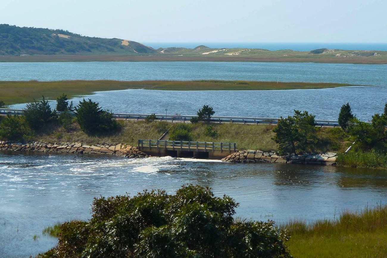
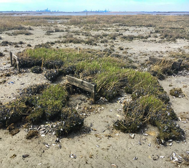
Nothing is permanent. Stressors to the natural environment have the potential to transform entire ecosystems, no matter how beautiful or treasured. Ecosystem monitoring answers a growing need to learn more about how to protect the natural resources along our coastlines. As part of an effort to conduct ecosystem monitoring in National Park sites along the northeast coast, Jim Lynch focuses on salt marshes, sensitive but important wetlands that have been vanishing in the last four decades due to pressures from development and sea level rise.
Salt marshes do vital work for coastal communities. They prevent erosion, offer protection from floods and storm surges, and act as natural water filters, capturing pollutants and other damaging elements. But only healthy salt marshes can play a critical, protective role in the resilience of coastal communities.
Lynch/NPS
Because salt marshes are closely interconnected with the rest of the coastal environment, they have become a priority of the Inventory and Monitoring program of NPS’s Northeast Coastal and Barrier Network (NCBN), a regionally defined network of eight National Park sites that conducts long-term monitoring of key indicators. NCBN, which is one among 32 such networks nationwide, refers to these key indicators as vital signs, a useful analogy to explain the purpose of monitoring, which is to track and assess the condition of park ecosystems.
Salt marsh monitoring, in particular, can reveal a lot about the overall health of coastal parks and can help park managers inform the public about what people can do to save salt marshes—and the plants and animals they contain—from disappearing.
Baranowski/NPS
Elevation: a salt marsh vital sign
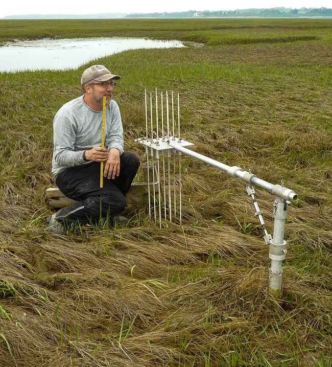
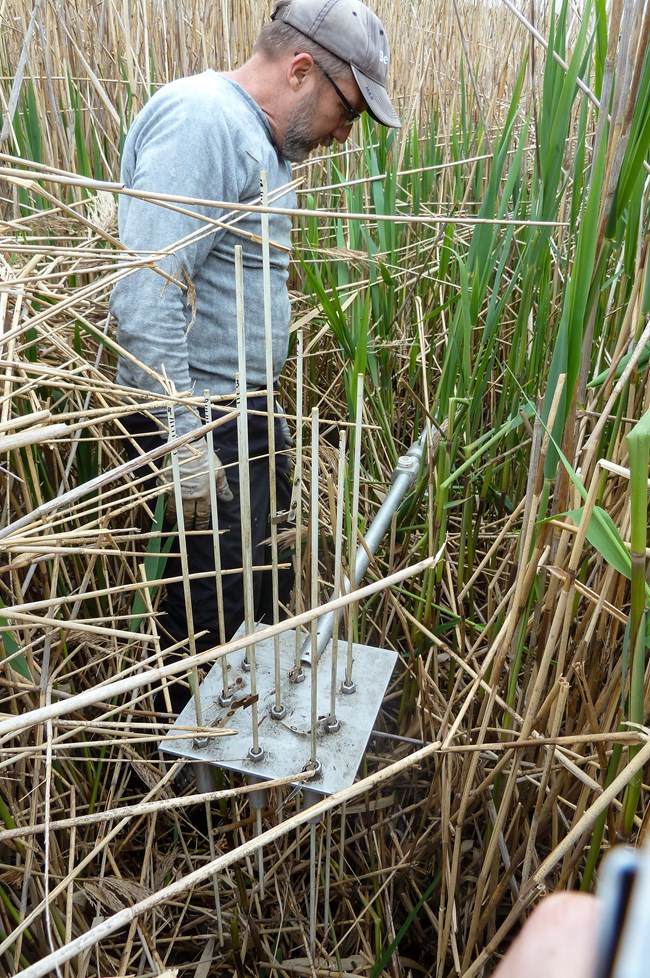
Traveling through several National Parks from Maine to Virginia, Jim measures gradual changes occurring in salt marshes. The vital sign that he tracks for NCBN is salt marsh sediment elevation. Using a device called a Surface Elevation Table (SET), he learns whether existing salt marshes are building up sediment fast enough to keep pace with sea level rise and to avoid drowning.
Salt marshes are wetlands, Jim explains, but “The norm for wetland plants is to be partly wet and partly dry, not permanently wet.” Salt marsh plants thrive when the marsh surface is submerged during high tide but exposed during low tide. When they drown, salt marshes fail to provide storm protection, cease to promote good water quality, and they deteriorate as homes for the invertebrates, commercial and recreational fish species, and birds that depend on salt marshes for migration, protection from predators, feeding, breeding, and nesting.
Change may be slow on a salt marsh, but small changes have serious consequences. The slightest shifts in elevation—in relative height above sea level—can indicate trouble ahead. So, in order to study salt marshes, scientists must be precise, patient, and determined, like Jim.
Baranowski/NPS
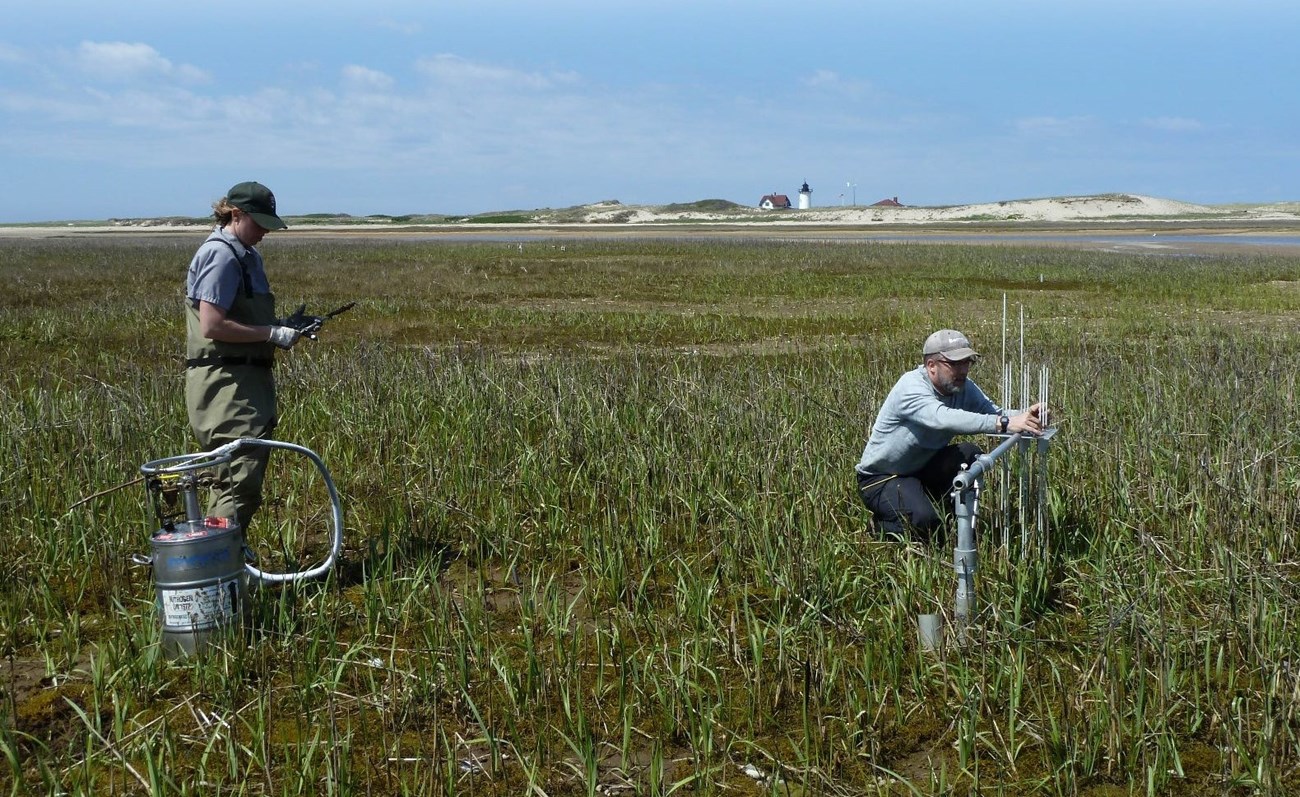
Twice a year, Jim collects elevation measurements on marsh surfaces at each of NCBN’s monitoring sites: Cape Cod National Seashore in Massachusetts, Fire Island National Seashore in New York, Gateway National Recreation Area in New York and New Jersey, Assateague Island National Seashore in Maryland, and Colonial National Historic Park in Virginia. Throughout the NCBN sites, there are more than 120 SET’s to survey, and at each, Jim notes changes of mere millimeters per year.
NCBN has long relied on SETs to take these precise elevation measurements for monitoring salt marshes. In addition to SET measurements, park scientists gather other kinds of elevation data, including absolute ground elevation, which is done with GPS survey instruments. Though not an NCBN vital sign, ground elevation information can also provide park managers with critical information to help guide decision-making about natural resources, cultural resources, and physical resources, including infrastructure.
Lynch/NPS
The devastating impacts of Hurricane Sandy, which struck the U.S. Atlantic coast in October 2012, prompted the federal government to award funding to NPS for projects that go beyond the scope of vital signs monitoring to enhance the resilience of coastal parks. A portion of one federal award made to NCBN was used to purchase a new cache of advanced geodetic survey instruments for capturing very precise ground elevations.
The federal funding also made it possible to train park scientists to use the new survey equipment. With a large group of people prepared to operate the survey instruments, NPS has begun to collect precise elevation data about important sites in coastal parks in order to prepare better for future storms and sea level rise. While the new survey equipment will support post-Sandy research efforts to enhance coastal resilience, it will also compliment the findings of natural resource monitoring.

Lynch/NPS
People can help to revive suffering salt marshes
NCBN scientists like Jim track the health of the natural resources along our coasts, including salt marshes, because healthy natural resources contribute to resilient coastal communities. Salt marshes, for instance, protect the coastal places that people depend on to live, work, play, wonder, learn, or just get away. Elevation data can reveal tiny changes that could have disastrous consequences. When vital signs monitoring of marshes or other ecosystems shows, for instance, that stressors are causing drastic changes to critical natural resources, park managers have an opportunity to educate the public about what people can do to reduce ecosystem stressors and help invaluable natural resources thrive.
Written by Jamie Remillard & Caroline Gottschalk Druschke
To learn more about monitoring wetland elevation, visit the Northeast Coastal and Barrier Network's website.
