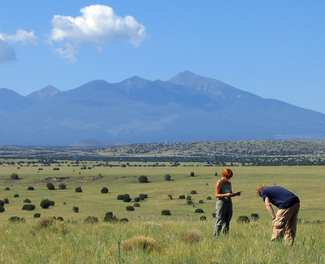
Vegetation and soils are the foundation upon which all terrestrial ecosystems are built. Soils provide the medium for the storage and delivery of water and nutrients to plants, which in turn provide animal populations with both habitat and food.

NPS photo
Vegetation affects the spatial distribution of soil resources through processes such as nutrient uptake, litter deposition, and control of overland water flow. These interactions result in a tight linkage between the spatial patterning of vegetation and soils—especially in dryland ecosystems, where both water and nutrients are limiting. In addition, degradation of one of these resources can cause deterioration in the other; a drought might cause die-back of vegetation, resulting in increased soil erosion and further degradation of plant communities. In the semi-arid uplands of the Colorado Plateau, the Southern Colorado Plateau Network (SCPN) is monitoring soil stability and vegetation composition and structure in order to track changes in ecosystem condition.
Long-term Monitoring
Since 2007, SCPN has been annually monitoring vegetation and soils in national parks on the southern Colorado Plateau, focusing on the predominant ecosystems of greatest concern to park managers. Permanent half-hectare plots are established in each of these ecosystems to measure species frequency and abundance, forest structure, amount of exposed soil, and soil stability.
When first established, these plots are monitored annually for three-to- five years in order to estimate spatial and temporal variability in the vegetation and soils attributes that we are tracking. After that time, we determine how many plots are required to detect trends and set up a revisit schedule where we visit each plot twice every five years. We plan to establish monitoring plots in 12 SCPN parks where upland vegetation and soils occur.
| Park units monitored for upland vegetation and soils | |
Park | Monitored ecosystems |
Aztec Ruins NM | Grasslands/shrublands |
Bandelier NM | Mixed conifer forest, pinyon-juniper woodlands |
Chaco Culture NHP | Grasslands/shrublands |
Glen Canyon NRA | Desert shrublands |
Grand Canyon NP | Mixed conifer forest, pinyon-juniper woodlands |
Mesa Verde NP | Pinyon-juniper woodlands |
Petrified Forest NP | Grasslands/shrublands |
Petroglyph NM | Grasslands/shrublands |
Wupatki NM | Grasslands/shrublands |
Management Applications
The legacy of past livestock grazing, altered fire regimes, adjacent land-use activities, and climate change are major issues impacting the condition of upland ecosystems within SCPN parks. For example, climate change may alter the relative dominance of species, shift the elevational distribution of some communities, decrease vegetative cover and increase erosion, cause mortality of key species, and allow for the spread of nonnative species. Other human stressors include visitor use, exotic plant invasions, and air pollution.
The first several years of monitoring data will be used to describe current conditions for upland vegetation and soil resources. Over time, the data will be used to detect changes in the condition of upland ecosystems that could result from one or more of the stressors listed above. Understanding these trends will help park managers as they manage upland ecosystems and respond to emerging park issues.
Contact
Megan Swan, Megane-mail us
Prepared by the Southern Colorado Plateau Network Inventory and Monitoring Program
Tags
- aztec ruins national monument
- bandelier national monument
- chaco culture national historical park
- glen canyon national recreation area
- grand canyon national park
- mesa verde national park
- petrified forest national park
- petroglyph national monument
- wupatki national monument
- swscience
- american southwest
- southern colorado plateau
- scpn
- uplands
- project
- monitoring
- science
- pinyon-juniper woodlands
- forests and woodlands
- soils
- grassland communities
- shrubland communities
- montane forests
- jmrlc
- natural resources
Last updated: January 12, 2023
