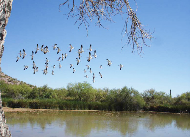
Seeps, springs, and tinajas are critical surface water sources in the arid and semi-arid Sonoran and Chihuahuan deserts.
Springs, seeps, and tinajas are critical surface water sources in the arid and semi-arid Sonoran and Chihuahuan deserts. These waters are primary interfaces between groundwater and surface water. They are also biodiversity hotspots. They support obligate (and generally rare) aquatic species and provide drinking water for terrestrial animals—including humans.

A. Barnard / NPS
Seeps are small, seasonally dry springs that support plants and animals adapted to drier conditions.
Springs dry less often and may be perennially wet. They support more aquatic and riparian habitat than seeps, including species that depend on moist soils or open water.
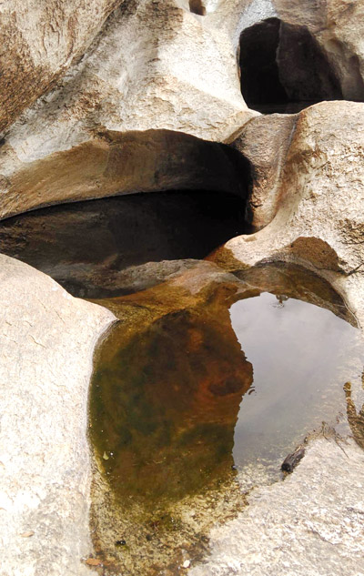
Tinajas, or “small jars” in Spanish, are surface waters found in naturally occurring bedrock catchments. They are fed by springs and/or precipitation. Tinajas comprise the majority of available surface water in many large southwestern parks, such as Organ Pipe Cactus National Monument and Saguaro National Park.
The Chihuahuan Desert Network and Sonoran Desert Network have selected seeps, springs, and tinajas as a high priority for ecological monitoring. Several parks in these networks contain water bodies linked with key natural or cultural resources. Rattlesnake Springs, at Carlsbad Caverns National Park, was used by the Mescalero Apache since the 1400s and by U.S. Cavalry patrols in the 1880s. Quitobaquito Spring feeds Quitobaquito Pond at Organ Pipe Cactus National Monument.
Monitoring Objectives
Springs monitoring is based on a two-tier hierarchy. Level I springs are monitored qualitatively and less frequently than Level II springs. Level II springs are monitored annually using primarily quantitative methods.
Proposed specific, measurable objectives for springs, seeps, and tinajas (hereafter, “springs”) are to determine status and long-term trends in:
Channel morphology
- Spring orifice (opening) and basin pattern and geometry and sediment-size distribution
- Spring-brook cross-sectional area, sinuosity (a measure of how meandering the spring-brook is), channel slope, and sediment-size distribution
Riparian and wetland vegetation
- Spring and spring-brook cover of common (>10%) perennial plant species
- Spring and spring-brook frequency of uncommon perennial plant species and selected non-native invasive annual and perennial plant species
Water quality
- Daily, seasonal, and/or annual core water quality parameters (temperature, specific conductivity, pH, dissolved oxygen, turbidity)
- Seasonal and/or annual total nitrogen, total phosphorus, selected metals, and E. coli (when possible)
Water quantity
- Spring discharge
- Seasonal and annual base flow conditions on spring-brooks
- Wetted distance (area that is wet) of spring-brooks
Aquatic macroinvertebrates
- Abundance of selected taxa and community structure
- Selected multimetric indicators of biotic integrity - measures of stream condition that are based on the status of the living organisms within it.
Fish
- Presence or absence of key species
- Fish communities on local and regional scale
Methods

NPS
Channel morphology
Level I: Visual surveys are used to assess spring and spring-brook disturbance levels and particle-size distribution as appropriate. Length, width, and depth measurements are recorded for springs and spring-brooks.
Level II: Survey-grade equipment is used to measure length, width, and depth of springs. A longitudinal profile and three evenly distributed, permanent channel cross sections are located on each selected spring-brook. Particle-size surveys are conducted in springs and across each spring-brook.
Riparian and wetland vegetation
Level I: Visual surveys are used to estimate spring and spring-brook cover and species composition.
Level II: Small quadrats are employed to identify community composition and quantify abundance of plant species. At spring-brooks, vegetation sampling is conducted on 20-m transects along each of the three permanent channel cross sections. Vegetation data are recorded within three structural categories using the point-intercept method, with points spaced every meter. Soil cover is recorded to substrate class (e.g., sand, gravel). In the two meters surrounding the transect, frequency data are collected on plant species not encountered during point-intercept sampling. Data on tree and shrub recruitment are collected in a 20-m-wide band surrounding the thalweg (line along the spring-brook marking the deepest section). Extremely large trees are mapped and vigor metrics are collected (e.g., basal area, height). In extensive wetlands, a combination of cross sections and plots are used to assess vegetation composition.
Water quality
Level I: A handheld, multiparameter water quality instrument is employed to collect data on core water quality parameters. Level II: At selected springs, a multiparameter datalogger (sonde) collects continuous (15–30 min) core water quality measurements for two-week deployments seasonally, or as appropriate. Nutrients, inorganics, metals, contaminants, and E. coli samples are collected quarterly or as appropriate.
Water quantity
Level I: Spring discharge measurements are collected or estimated using simple volumetric methods.
Level II: At selected springs, logging discharge meters and/ or pressure transducers are employed to collect continuous discharge or stage data. Discrete discharge measurements are used in combination with staff gages, crest gages, and logging pressure transducers to collect data at springs and spring-brooks, as appropriate.
Aquatic macroinvertebrates
Level I: Visual surveys are used to assess and estimate spring and spring-brook macroinvertebrate communities and abundance.
Level II: Quantitative macroinvertebrate samples are collected with equipment that allows for sampling fixed areas. Semi-quantitative samples are collected according to timed sampling with appropriate-sized nets. In spring-brooks, where appropriate, samples are collected in riffles for determining trend and for comparison with state indices of biotic integrity (IBIs). Methods are designed to be directly comparable to state and federal (Environmental Protection Agency [EPA], National Water-Quality Assessment Program [NAWQA]) methodologies.
Fish
The networks are working with adjacent land management agencies and state departments of fish and game to monitor fish communities in and around the parks, enabling the data to be analyzed in a regional context. Methods will include passive trapping, electrofishing, and seining.
Products, Scope, and Schedule
An annual summary report documenting effort and initial findings is produced in February of each year. Information on springs is also communicated through live presentations, resource briefs and other written summaries, and other media produced and distributed through the network websites and Science of the American Southwest.
An initial inventory of springs for Sonoran Desert Network and selected Chihuahuan Desert Network parks has been completed, and monitoring has begun. The monitoring protocol and standard operating procedures were published in 2018.
Originally prepared by Andy Hubbard and Evan Gwilliam, Sonoran Desert Network Inventory and Monitoring Program, 2010. Updated 2016.
Last updated: February 14, 2019
