How much water flows in the Alsek River compared to other rivers? How much does the flow vary seasonally?
Project Dates
Ongoing since 1991
Did You Know?
The U.S. Geological Survey operates over 7,000 stream gages across the U.S. The gage (hydrologists use this alternate spelling of “gauge”) on the Alsek River is one of the most remote and difficult to access.
Introduction

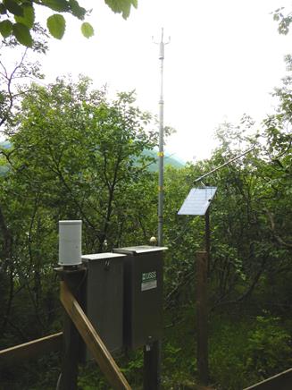
The gaging station measures stream flow on the Alsek year-round. A length of tubing runs along the ground from the pressure sensor shown here to the river. Atop the tall pole is an anemometer that measures wind speed and direction.
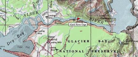
The Alsek, a large-volume glacial river originating in Canada, is one of very few rivers that breach the Coast Range on their way to the Pacific. Most of the U.S. portion of the Alsek River is included within the boundaries of Glacier Bay National Park and Preserve.
Spurred partly by concerns over threats to water quality from possible large-scale copper mining activity in Canada, a gaging station was set up in July 1991 by the NPS, in cooperation with the U.S. Geological Survey (USGS) and the Water Survey of Canada. In 1992 the gage was officially designated an International Gaging Station. Originally the station collected water quality data, but currently it collects only stream flow (water volume per unit time) data.
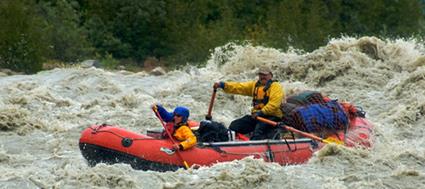
The Alsek is probably one of the most difficult rivers to gage in the state of Alaska and perhaps the entire nation. There are few suitable locations to gage the river due to the strong glacial influence and braided channel configuration. The size and slope of the Alsek combined with large seasonal fluctuations in discharge present additional problems.
Methods

Stream gaging involves measuring stage (the height of the water surface compared to a known reference at a location on the river), and discharge (the quantity of water passing the location per unit time), then establishing and maintaining a relation between stage and discharge. Subsequently, discharge can be calculated by measuring the stage.
The Alsek gaging station uses a “bubbler system” to measure the stage of the river. Bubbler systems work by detecting the pressure required to force air or (in this case) nitrogen gas through a submerged tube, the outlet of which is securely anchored in place. The flow of gas is just enough to prevent water from backing up into the tube. The pressure required to push the gas out changes with the depth of the water above the tube outlet. These changes are recorded and converted to a record of the river stage by the sensor, or transducer, located on land some distance from the river. The data are transmitted to satellites hourly and automatically uploaded to the USGS website.
Discharge is measured by physically and incrementally measuring the cross-sectional area of the river and the velocity of the water. In a dynamic river like the Alsek, physical changes in the shape or elevation of the riverbed necessitate frequent measurements of discharge to maintain the relationship between discharge and stage. Hydrologists visit the station 5-7 times per year to measure discharge.
Climate data (wind direction and speed, precipitation, and temperature) are also collected at the station.
Findings

Glacial meltwater drives the Alsek River flow. Peak flow, which occurs in July and early August, is about 190,000 cubic feet per second (cfs). Winter flow might be less than 5,000 cfs. The Alsek flows clear in winter, but is very turbid in summer when swollen with glacial meltwater. The lower part of the river typically freezes over in winter up to about four miles from the mouth at Dry Bay.
The Alsek is bigger than the Stikine River and about half the size of the Copper River.
Learn More
The USGS Alsek River stream flow website is at: https://waterdata.usgs.gov/ak/nwis/uv/?site_no=15129000&PARAmeter_cd=00065,00060
A detailed description of the monitoring methods and practices can be found at https://pubs.usgs.gov/circ/circ1123/collection.html.
Last updated: September 13, 2016
