Last updated: March 18, 2021
Article
Measuring light pollution across a landscape
It takes a special camera to take a special picture—forty-five images in the case of a customized camera used by the National Park Service to document night sky quality. NPS scientists with the Natural Sounds and Night Skies Division (NSNSD) discussed the camera—how it works, what the images reveal, why it is important, and how it advances the NPS mission.
Sky Quality
The ability to see the Milky Way and stars depends on what the NPS refers to as “sky quality.” Different factors affect sky quality, like fire smoke and clouds. Light pollution also masks views of the night sky. Unshielded, outdoor light causes light pollution. Instead of aimed down where intended, light shines out, forming glare. Sky glow accumulates from the escaped light and artificially brightens the night sky. Light domes appear above cities and towns and can be visible 200 miles away or more in some places.The color temperature of outdoor light bulbs also affects sky quality. The NPS generally prefers warm-colored light (soft white and amber) to blue-white bulbs, which emit a much brighter light with far more glare.
The NPS specialized CCD (charge-coupled device) camera captures light in the night sky, which scientists can measure. The information helps parks and neighboring communities assess the extent of light pollution, identify light sources, reduce light, and mitigate impacts.

NPS / Li-Wei Hung
Out With the Old …
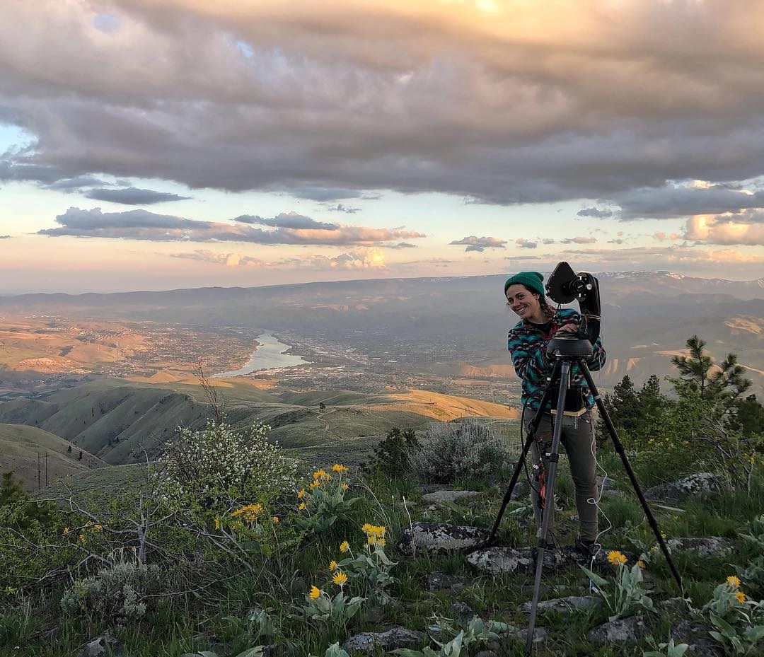
Wenatchee, Washington, May 2018: At dusk atop Burch Mountain off a lookout above the City of Wenatchee, NPS scientists Li-Wei Hung and Ashley Pipkin worked quickly to install the night sky monitoring camera. The weather had been unexpectedly cloudy all day, and the pair nervously scanned the sky for signs of a lift. It wouldn’t be the first time weather sabotaged field work. Skies must be clear for the camera to take usable images, and night sky scientists constantly confirm the weather prior to travel. A band of darkening clouds hovered above the horizon, yet the weather forecast predicted clear skies by 11 p.m. They set up and waited. As good timing would have it, the clouds parted as if on cue. The night was cold, but the sky was clear, and the scientists collected their data.
Wenatchee is a gateway community along the Columbia River south of North Cascades National Park. Stellar celestial views characterize much of the wilderness in this northeast Washington area. As one of the biggest cities in Chelan County, Wenatchee emits the majority of light that the county produces—but not for much longer. The city is among a roster of communities across Chelan County slated to improve its lighting. Beginning in June 2018 and expected to last a few years, the project will replace old light fixtures and bulbs with new. Goodbye high pressure sodium lamps. Hello soft white LEDs.
County planners reached out to NPS because they wanted to document baseline light conditions before the improvements take place so they could assess the benefits from the newly installed lights. The scientists will return once changes are complete to document and compare results. Both the park and Chelan County will likely see benefits. The conversion will not only reduce light above county communities and public lands, but will also reduce costs and energy use.
“Generally, the CCD camera data can be very useful in helping park planners and resource managers document conditions and impacts from various activities, and assess improvements to night sky resources in sensitive areas such as visitor campsites and wildlife nesting areas,” Pipkin said.
Pipkin is a biologist and resource specialist based in Lake Mead National Recreation Area, Nevada. She balances a busy schedule of night sky monitoring with educational outreach in parks across the Pacific West Region.

NPS / Dan Duriscoe
Camera Basics
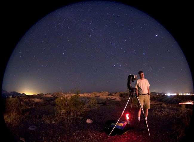
Hung and Pipkin are among a handful of NPS scientists trained to run the specialized camera. Bob Meadows, a physical scientist and NPS employee since 1986, has been using this camera system for the last seven years. There are currently six cameras in the fleet. To date, the program has completed night sky quality assessments in more than 125 park units. He outlined the camera basics.
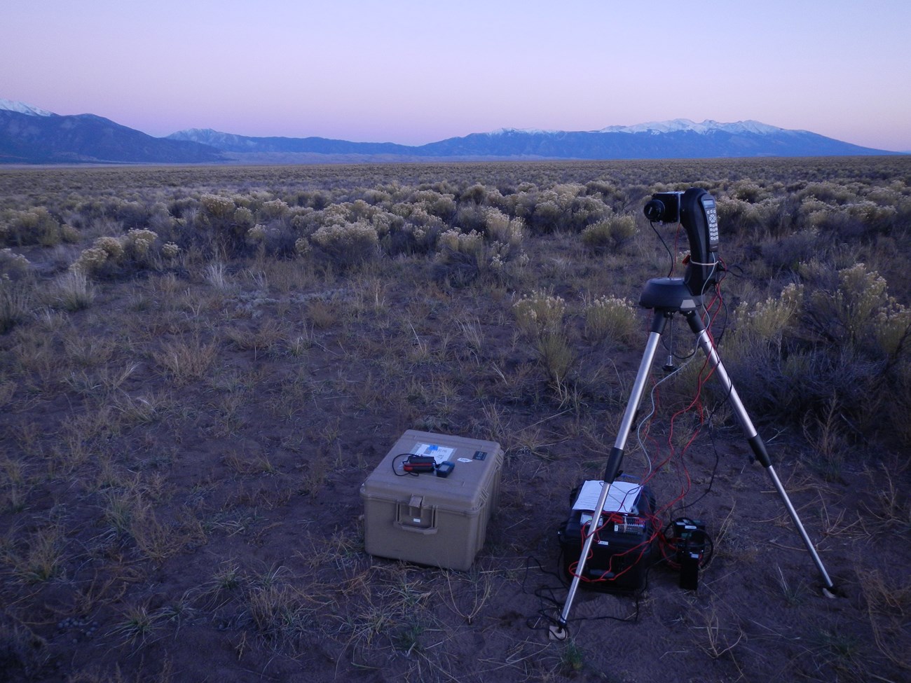
Equipped with a modified telescope mount, tripod, customized scripts, filter wheels, and accessories, the camera is pre-programmed to run automatically once it is set. It takes a total of 45 night sky images.
“The telescope mount is directed through computer scripts on a small laptop to precisely rotate the camera clockwise, counterclockwise, and upward by specific degrees to image the entire sky from horizon to the zenith directly overhead,” Meadows said.
He referred to this total capture as “all-sky brightness”—measurements of all sources of light, both naturally occurring and anthropogenic. The natural sources include the Milky Way, integrated starlight, planets, zodiacal light, and airglow.
“The images give comprehensive, highly accurate data about night sky quality. The camera is able to document conditions over a large area and is very sensitive. In some locations, it can detect light domes from large cities more than two hundred miles distant.”

Geek Facts:
- The camera is leveled before use and aligned to Polaris, around which all celestial bodies appear to rotate. With true north at horizon, it orients in sync with its scripts and star chart software.
- A 50 mm lens is used with an aperture of f2, which lets in as much as five times the light as other lenses—important for taking images at low light levels. Exposure time varies based on location. Bright, urban settings may only need an exposure of one second or less, whereas naturally dark parks may need as much as 14 seconds.
- The camera and its devices are synced to GPS time for absolute alignment. Images are internally stamped with the time, date, park code and location, latitude, longitude, and site elevation, and current weather measures.
- The camera takes a reference picture of the zenith at the beginning and end of each sequence to record any change in sky conditions during this time. Its total range captures 360 degrees of light from zenith to 7 degrees below the horizon. Capturing light along the horizon is important because this is where sky glow concentrates and is most visible.
- NPS camera measurements are used to calibrate a continental-scaled skyglow model using NASA’s satellite imagery of the earth at night: http://advances.sciencemag.org/content/2/6/e1600377.full
With so many details at stake, Meadows said it’s important to have a checklist and patience.

NPS
What the Images Reveal
With a PhD in astronomy, Hung brings expertise in the physical sciences combined with comprehensive programming and data collection skills. After a site visit, she processes the data at the NPS office in Fort Collins, Colorado. She uses a script to extract the metrics, and combines the 45 images to create a seamless, 360 degree panorama of the sky. The resulting mosaic contains 36 million light measurement points from the combined, outdoor light. A second mosaic shows only anthropogenic light, which she makes by subtracting celestial light from sources such as the Milky Way.
She and team scientists prepare a snapshot report of their findings for parks and communities. The summary includes image mosaics, data metrics, and weather details such as temperature, humidity, and wind. She said her goal is to distill complex, technical data in easy-to-understand language for park managers and resource chiefs who are unfamiliar with the subject, while also providing depth for researchers.
“The reports explain the ratio of natural to artificial light. The light domes really stand out in the visuals,” she said. “They are a quick way for anyone to learn about night sky conditions at different parks.”
Ultimately, the reports help resource managers and planners make informed decisions that help restore the ecological integrity of environments at night while giving people enjoyable night sky experiences.
Related Content:
- National Park Service Night Skies Website:
https://www.nps.gov/subjects/nightskies/index.htm - NASA DEVELOP National Program
https://develop.larc.nasa.gov/2018/summer/USUrban.html
Article by Julie West, communications specialist, NPS Natural Sounds and Night Skies Division
Tags
- lake mead national recreation area
- north cascades national park
- natural sounds and night skies division
- nsnsd
- light pollution
- night skies
- inventory and monitoring
- monitoring
- park science
- women in science
- women in stem
- find your park
- picture yourself in a park
- camera
- science and technology
- technology
- park after dark
- measurements
- north cascades national park
- pacific west region
- lake mead national recreation area
- science
- connected conservation month
