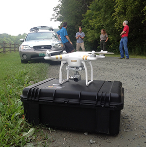
On August 25, 2015, a small Uncrewed Aircraft System (UAS) “drone” quadcopter took flight from a field adjacent to Marsh-Billings-Rockefeller National Historical Park in Vermont. The commercial operator flew the UAS without a hitch and with little fanfare, but it was a first and had significant importance.
High Priority Project

NPS
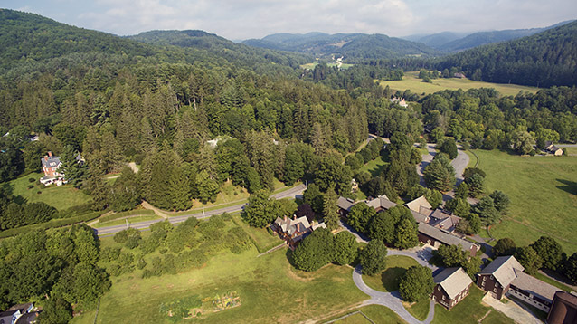
Marsh-Billings-Rockefeller had a small but high priority in-house project that could benefit from a perspective that only an aviation resource could provide: aerial photographs. There were no approved crewed aircraft service providers nearby, and the more remote approved providers were cost prohibitive due to the expense of ferrying aircraft to the area. The park illustrator, Liza McElroy, contacted the acting Regional Aviation Manager, Meg Gallagher, to inquire about the use of UAS for the project, stating “the angle the images will be taken will not necessitate that the drone fly over park property. I wanted to check with you about any regulations and rules we need to be aware of; is there anything we need to do in order to stay within compliance of NPS drone regulations?”
Though unfeasible just a year ago, the number of FAA-approved commercial UAS operations has greatly expanded over the past year, with over 2500 companies approved, and an average of 50 more being added each week. Authorized under Section 333 of the FAA 2012 Reauthorization Act, commercial UAS operators are providing services for the motion picture industry, news organizations, agriculture, forestry, real estate and now the National Park Service.
Completing the Project through Collaboration

NPS
Working with Ms. McElroy, the WASO Regulations program specialist, and procurement experts, the NPS Branch of Aviation revised the crewed aircraft “End Product Contract” model to apply it to FAA-approved UAS service providers. An “End Product / Best Value Determination Tool” (internal link) was produced to walk potential users through a process to acquire similar products in a cost effective and safe manner while complying with purchasing, procurement, operational control, as well as the NPS Director's Memo 14-05. Deputy Superintendent Christina Marts wrote a concise scope of work for the contract, outlining the expectations and obligations of both the contractor and NPS.
The Final Product

NPS
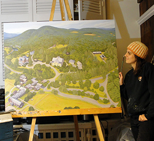
The aerial photographs were delivered as requested and three months later Liza McElroy met her end goal to create a large illustrated map of the park for display on a kiosk for visitors as they enter the grounds. After the operation was complete, the NPS Branch of Aviation held an after action review (AAR) with both the park and the UAS vendor, AirShark, based in Montpelier, VT and operated by Jon Budreski, a former NPS employee. The AAR helped further refine this end product UAS process so other NPS units can benefit in the future from the project at Marsh-Billings-Rockefeller National Historical Park.
The photos provided the artist with the needed perspective. The park achieved its goal.
Last updated: October 8, 2024
