Article

Intertidal Mapping Using Unmanned Aircraft
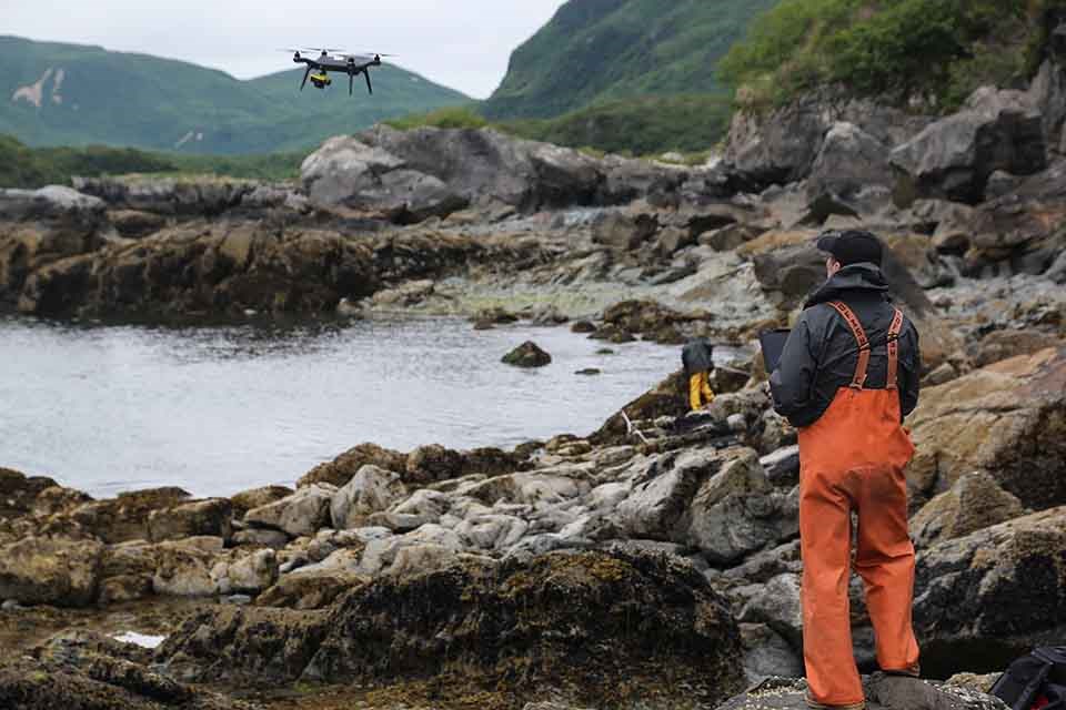
A researcher employs a UAS on the intertidal coastal zone.
A researcher operates a small Unmanned Aircraft System (sUAS) to map the intertidal zones of Katmai National Park and Preserve.

NPS/Jim Pfeiffenberger

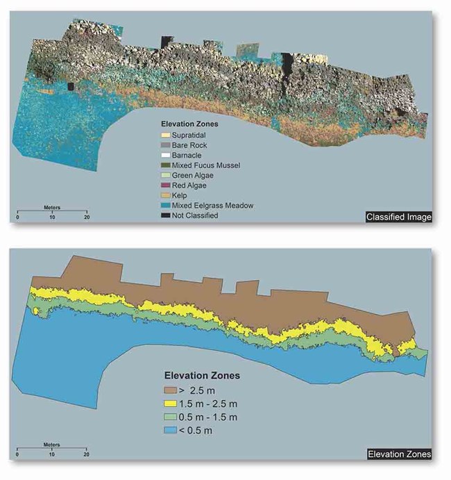
In 2017, the National Park Service, U.S. Geological Survey, and Gulf Watch Alaska collaborated to collect aerial photography at two long-term intertidal monitoring sites along the coast of Katmai National Park and Preserve. We used a vertical take-off and landing (VTOL) small Unmanned Aircraft System (sUAS). This pilot project was the first time that a sUAS was used to map intertidal sites in a national park in Alaska. The purpose was to demonstrate capabilities of sUAS for creating precise digital Elevation Models (DEMs) from high-resolution aerial imagery, and to evaluate these products for assessing species presence and abundance within intertidal elevational zones.
A pair of maps, the top map shows an orthomosaic image taken by a UAS, and the lower image shows the coded elevation zones based on the imagery.
Spectral classification of Takli intertidal site from RGB Ortho Mosaic image (upper), and corresponding elevation zones (lower).
Employing a sUAS, high-resolution orthophoto-mosaics and DEMs were produced for each study site. We established photogrammetric ground control using static GPS surveys of markers that were placed within the study sites prior to each flight. Each low-altitude (<50’) flight was performed over small, intensively sampled monitoring sites (~50m by ~20m).

The products will allow us to correlate elevation with species presence and abundance, and if produced annually, such data may facilitate detection of shifts in topography and beach elevations at the site level, which result from physical disturbances (e.g., ice scour, earthquakes, storms). These data will also be valuable when interpreting annual variation in community structure within sites. Further, sUAS measurements over time can be used to perform future assessments of intertidal ecosystem changes due to sea-level rise or changing climatic conditions.
Logos for partners who supported the UAS project
Thank you to our partners who supported this work: the U.S. Geological Survey, Gulf Watch Alaska, and the Exxon Valdez Oil Spill Trustee Council.

Katmai National Park & Preserve

Last updated: March 20, 2018