Last updated: April 8, 2021
Article
Springs Monitoring at Guadalupe Mountains National Park
NPS
Springs
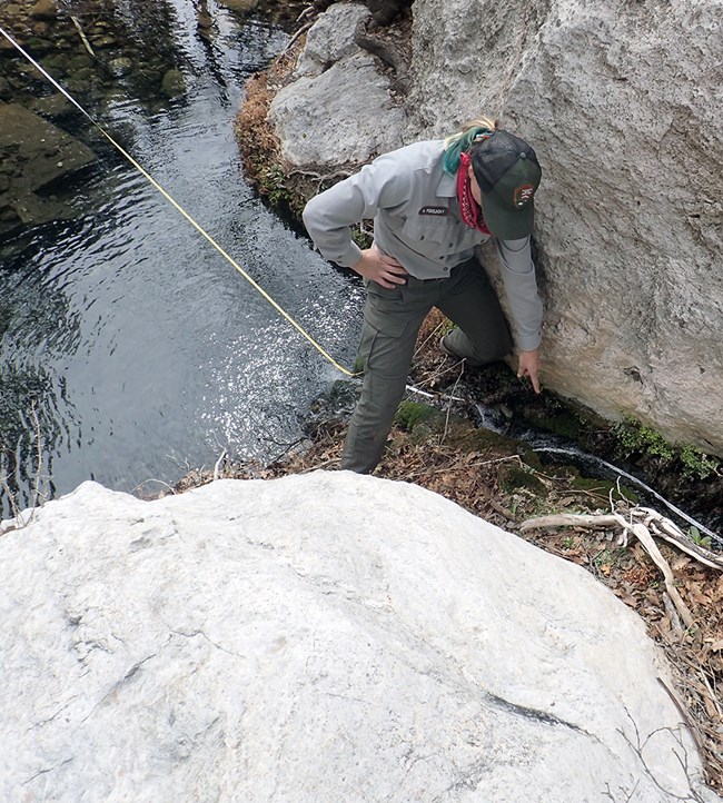
Springs are places where water flows from the ground—naturally or sometimes augmented by humans. They are relatively rare but ecologically important natural resources in the American Southwest. Despite their small size, springs tend to be hot spots of biodiversity in arid lands, supporting a large number of aquatic, riparian (springside/streamside), and terrestrial species. They are sparsely distributed across the landscape and aquatic organisms, riparian vegetation, and associated wildlife vary greatly from spring to spring. Arid-land springs often have endemic species (species unique to that spring or area) due to their isolation and persistence.
Common stressors to plants and animals in and around springs include reduced water availability due to drying and water temperature extremes (such as freezing), reduced light penetration (due to turbid water), and biochemical conditions outside of normal for a site. Climate change is an emerging stressor on springs in the American Southwest. Changes in amounts and quality of water can disrupt ecosystem functions and processes and lead to lower species diversity. The Chihuahuan Desert Network monitors springs at Guadalupe Mountains National Park to detect broad-scale changes in aquatic and riparian ecological condition that could pose a threat to these important resources.
NPS
What Do We Monitor?
We monitored six sentinel springs at Guadalupe Mountains National Park: Bone, Dog Canyon, Guadalupe, Sharp Rock, Smith, and Upper Pine springs. Sentinel springs are chosen as representative systems that act as indicators of ecological change.
Site Characterization
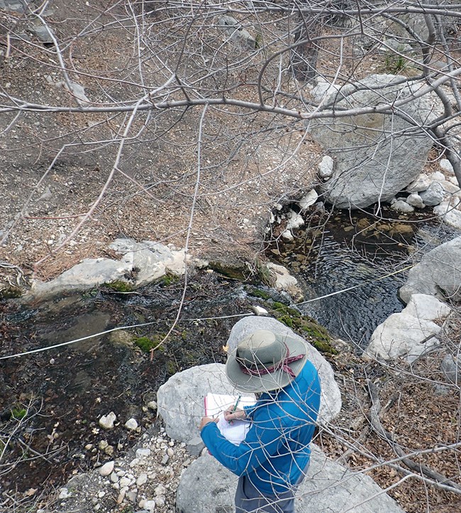
Once every five years at each spring, the spring type, location, site diagram, site description, and vegetation community characteristics are reassessed to determine any major changes to the spring type.
Site Condition
Each year, we evaluate site condition, which includes taking photo points, characterizing natural and anthropogenic (man-caused) disturbances (on a scale of 1–4 where 1 = undisturbed), and surveying for invasive, non-native plants and animals. We also survey for obligate wetland plants (plants that almost always occur only in wetlands) and facultative wetland plants (plants that usually occur in wetlands, but also occur in other habitats).

NPS
Water Quantity
Each year we characterize water quantity by measuring the persistence of springs (determined by examining the variance in spring water temperatures) and wetted extent (the length, width, and depth of surface water). We also estimate spring discharge (flow).
Water Quality
Water chemistry and core water quality parameters are monitored every year, including water temperature, pH (how acidic or alkaline the water is), specific conductivity (a measure of dissolved compounds and contaminants), dissolved oxygen (how much oxygen is present in the water), and total dissolved solids (another indicator of potentially undesirable compounds).
Each spring has a unique water source and geology, and both can affect water chemistry. We are currently collecting baseline data and report raw data for each spring below. With more data in future years, we will develop assessment points for each spring to better understand spring water quality conditions and trends.
Park Springs in Water Year 2018
(October 2017–September 2018)
Data provided here are provisional and will be subject to additional analyses and interpretation in the future. We will update this page as new information becomes available.
NPS
Bone Spring
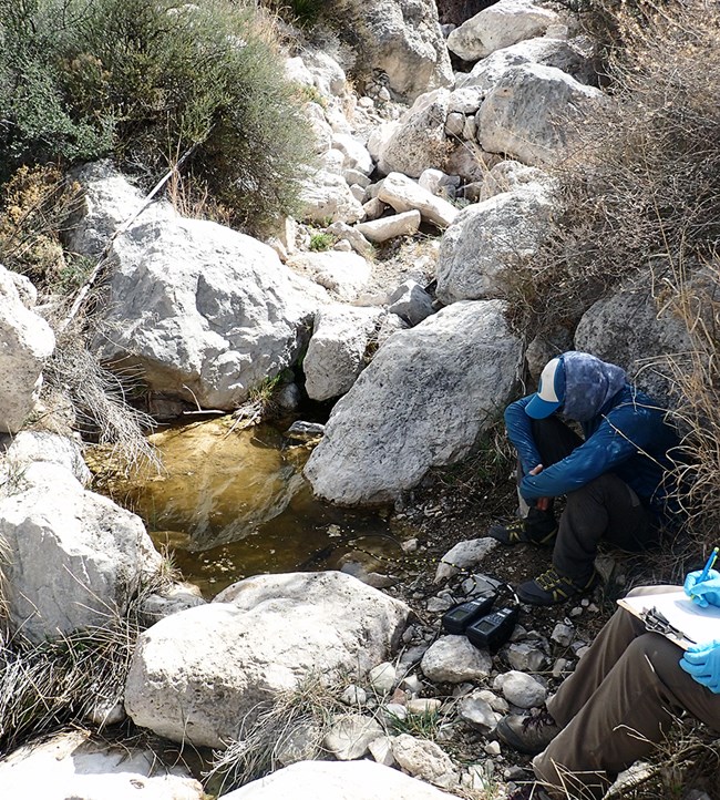
Bone Spring is located at a point where the drainage changes from steep and close bedrock canyon walls to less steep with open canyon walls, indicating a change in the surrounding geology. Bone spring was classified as a rheocrene spring (a spring that emerges as a flowing stream) in a larger drainage when we visited in March 2018. The spring emerged between two medium-sized boulders as a small trickle between maidenhair ferns (Adiantum sp.).
The water flow was cool and clear and spilled into a plunge pool, the first of many pools interspersed along the springbrook. The surface area of most of the pools was between 2 and 4 m2 and pool depths ranged from 0.5 to 1.0 m.
The substrate was dominated by boulders with gravel deposits present in flatter sections. Some areas of the springbrook were incised (cut more deeply) and there is evidence that runoff events in the drainage affect the overall system.
Site Disturbance
The spring had minimal disturbance, but there was moderate evidence of contemporary human or wildlife use based on social trails along the springbrook (mean disturbance value of 1 = undisturbed). There is also sign of moderate historical human use of the spring (some rockwork and pipes), but it is unlikely that this manipulation has significantly changed the flow or quality of the spring. There was slight disturbance from flooding.
Obligate and Facultative Wetland Plants
6 species: horsetail (Equisetum sp.), cattail (Typhaceae family), cottonwood (Populus sp.), tamarisk (Tamarix sp.), mule-fat (Baccharis salicifolia), and maidenhair fern (Adiantum sp.).
Invasive, Nonnative Species
2 species: horehound (Marrubium vulgare) and saltcedar (Tamarix ramosissima). Only one to five individual plants were found for these species.
Water Quantity
The spring was mostly dry during the sampling period from March through September 2018 (the sensor was deployed in March). Discharge from the orifice (orifice A) was estimated at 6.0 ± 0.1 L/min. The channel was estimated to be between 200 and 500 m long. The first 100 m of the channel had a mean wetted width of 1.47 m and mean depth of 5.3 cm. The wetland obligate vegetation found at the spring indicate that this area likely has some surface water all year.
Water Quality and Chemistry
The water chemistry of the spring was typical for this area and geography. The water was mineral rich with a slightly elevated pH. Baseline results are shown in the tables below. We do not report any dissolved oxygen values here because the instrument did not pass its post-calibration check.
| Sampling Location (Orifice) |
Sample Time (24 hr) |
Temperature (°C) |
Dissolved Oxygen (mg/L) |
pH | Specific Conductivity (µS/cm) |
Total Dissolved Solids (mg/L) |
Exposure |
|---|---|---|---|---|---|---|---|
| 1(A) | 11:40 | 14.6 | not available | 8.15 | 1063.0 | 689.0 | Partial sun |
| Sampling Location (Orifice) |
Alkalinity | Calcium | Chloride | Magnesium | Potassium | Sulfate |
|---|---|---|---|---|---|---|
| 1 (A) | 205 | 70 | 19 | 95 | 0.8 | 260 |
NPS
Dog Canyon Spring
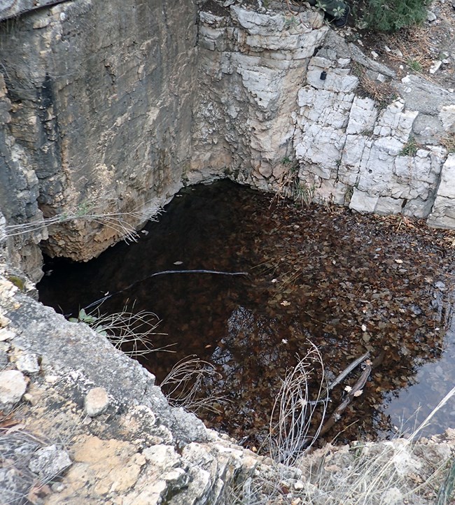
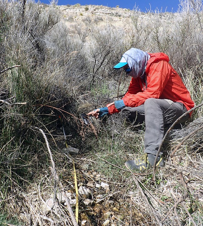
This spring is located on the side of a drainage in the remote northern end of the Park. When we visited the spring in March 2018, we classified it as a limnocrene spring, a spring that emerges as a pool. The spring emerged as a cool, clear, confined pool on the southern edge of an active drainage channel. The pool is roughly 3.5 x 2.8 m in size and fluctuates around 1.0 m deep. The pool was filled with 50 to 90 cm of leaf litter with approximately 20 cm of clear water on top where all the water quality measurements were taken. The northwest corner has a small outlet, but appears to be wetted due to trampling rather than outflow from the pool.
The spring was heavily modified as a stock tank in the historical past. A 3 x 3-m alcove that was 1 m deep was hand cut out of the bedrock at the spring creating a semi-springbox with some adjoining rockwork for stairs and channels. The rockwork alcove/springbox has created a pool where the water that seeps from the back wall collects. It is also likely that some water enters the pool from below the pool surface.
Site Disturbance
The spring had moderate evidence of contemporary human use and was heavily disturbed in the past by humans making flow modifications as described above. It had a mean value of 1 (undisturbed) when all disturbances were combined but the mean value was 2 (slightly disturbed) for human disturbance. Game trails were the only natural disturbance observed and deer were observed at the site during our visit.
Obligate and Facultative Wetland Plants
None
Invasive, Non-native Species
None
Water Quantity
The spring was wet from March (when sensors were installed) until early July 2018 and then was generally dry for the remainder of Water Year 2018. However, the sensor was found above the water when we visited in 2019, so the dry readings in the last quarter of Water Year 2018 may not represent actual conditions. Sensors were not deployed in Water Year 2017, so will need further data to understand whether the spring is dry for parts of the year. Discharge was not measurable in this limnocrene system. Due to the inaccessibility of the pool, a single length and width was measured to roughly estimate that the size was 2.88 m long and 3.50 m wide.
Water Quality and Chemistry
The water chemistry of the spring was typical for this area. Baseline results are shown in the tables below.
| Sampling Location (Orifice) |
Sample Time (24 hr) |
Temperature (°C) |
Dissolved Oxygen (mg/L) |
pH | Specific Conductivity (µS/cm) |
Total Dissolved Solids (mg/L) |
Exposure |
|---|---|---|---|---|---|---|---|
| 1(A) | 08:58 | 6.7 | 5.30 | 7.64 | 598.7 | 389.4 | Shade |
| Sampling Location (Orifice) |
Alkalinity | Calcium | Chloride | Magnesium | Potassium | Sulfate |
|---|---|---|---|---|---|---|
| 1(A) | 205 | 70 | 19 | 95 | 0.8 | 260 |
NPS
Guadalupe Spring
This spring is located in the foothills below "El Capitan." It is in a low-sloping reach of a drainage in an open grassy area. When we visited the spring in March 2018, we classified this spring as a rheocrene spring, a spring that emerges into a flowing stream. The spring started in a cobble-boulder area covered in a dense patch of Apache plume (Fallugia paradoxa) and continued downslope in a small channel that was intermittently widened by trampling in the wetted area. The downstream channel becomes increasingly incised (cut deeper) and interspersed with small pools, with the largest measuring 1.0 x 2.0 m. The spring brook drops several meters down multiple maidenhair fern (Adiantum sp.) covered slopes. The final section of the springbrook is wider with surface water more dispersed among wetland obligate plants. The spring terminates more than 100 m downstream from the orifice.
Site Disturbance
There was minimal evidence of historical human use and flow modification (pipes and possible stone berms). Wildlife trampling and beds along the spring length were the only natural disturbances observed. Median and mean disturbance scores were 1 (undisturbed) for anthropogenic and natural disturbances.
Obligate and Facultative Wetland Plants
4 species: horsetail (Equisetum sp.), sedge (Carex sp.), mule-fat (Baccharis salicifolia), and maidenhair fern (Adiantum sp.)
Invasive, Non-native Species
1 plant species: bermudagrass (Cynodon dactylon), scattered patches
Water Quantity
The spring was wet for the majority of the sample period from October 2017 to May 2018, with drying events in the spring. No data are available after May because the temperature sensors failed. Discharge from the orifice was estimated at 19.9 ± 0.4 L/min. Channel length was not measured but was estimated to be between 200 and 500 m. The first 100 m of the channel had a mean wetted width of 76.6 cm and mean depth of 1.8 cm.
Water Quality and Chemistry
Slightly higher pH at the downstream end of the channel indicates complex hydrogeology at this site and might mean that the spring brook is gaining reach. Baseline results are shown in the tables below.
| Sampling Location (Orifice) |
Sample Time (24 hr) |
Temperature (°C) |
Dissolved Oxygen (mg/L) |
pH | Specific Conductivity (µS/cm) |
Total Dissolved Solids (mg/L) |
Exposure |
|---|---|---|---|---|---|---|---|
| 1(A) | 14:30 | 19.6 | 7.19 | 7.66 | 759.0 | 494.0 | Shade |
| 2(A) | 14:40 | 16.8 | 7.65 | 8.14 | 711.0 | 461.5 | Partial |
| Sampling Location (Orifice) |
Alkalinity | Calcium | Chloride | Magnesium | Potassium | Sulfate |
|---|---|---|---|---|---|---|
| 1(A) | 235 | 110 | 12 | 50 | 1.3 | 128 |
| 2(A) | 245 | 76 | 15 | 50 | 1.5 | 145 |
NPS
Sharp Rock Spring
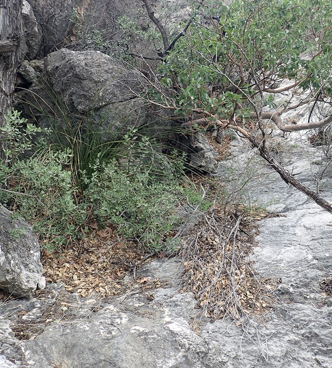
This spring was completely dry when we visited on March 25, 2018. A few small depressions in the bedrock contained water and leaf litter, but it is unclear if this was from rain the previous night or from past seepage from the spring. Some evidence of past seepage is present on the bedrock slab at the orifice and on the bedrock channel downslope.
Site Disturbance
The mean value for anthropogenic disturbance was 1 (undisturbed) and for natural disturbance was 1.5 (slightly disturbed). Median values for anthropogenic and natural disturbances were 1 (undisturbed). There was no surface water and many dead trees had fallen over the channel. Due to the bedrock substrate, potential disturbances were difficult to discern.
Obligate and Facultative Wetland Plants
None
Invasive, Non-native Species
None
Water Quantity
Temperature sensors were not deployed due to concern about sensor loss, so there are no data on wet/dry periods. There was no surface water available for discharge or wetted extent measurements.
Water Quality and Chemistry
No core water quality or water chemistry was measured in 2018 due to a lack of surface water.

NPS
Smith Spring
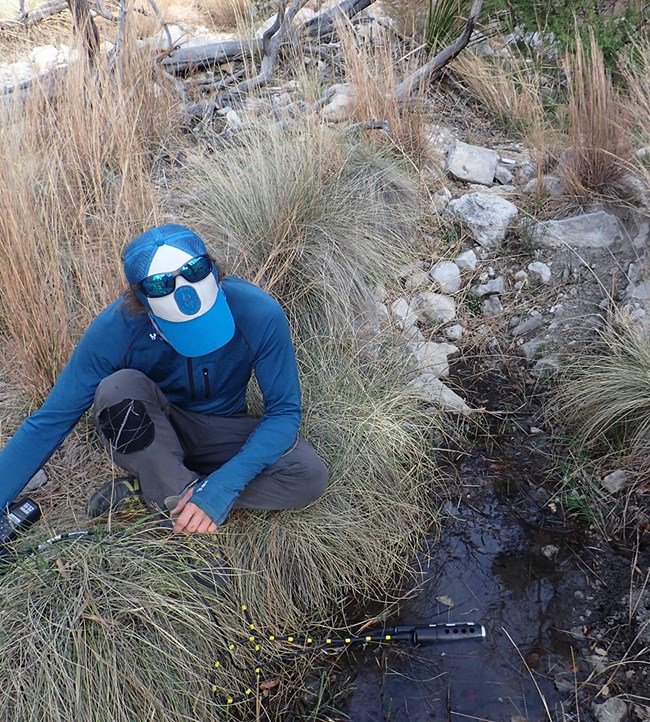
This spring was classified as a rheocrene spring (a spring that emerges as a flowing stream) when we visited on March 25, 2018. It is a developed site with a visitor trail leading to the spring. Metal railings and rock work surround the spring and springbrook. The spring emerges from boulders and cobble in an oak and madrone-lined drainage where the slope in the channel decreases. There are two spring openings: orifice A creates a cool and clear pool, and orifice B emerges from a scoured channel as a shallow flow. These orifices combine to create a mostly straight, running stream with pools.
The channel and pools are lined with large boulders and occasional eroded banks stabilized by tree roots. Downstream, the channel narrows to a 20 to 30-cm wide chute and spills into the largest pool of the system (6.0 x 5.5 x 1.5 m). At the downstream end of the pool, the channel splits in two. The left channel is larger and we measured it as the main channel. It continues under a fence and reaches a width of more than 1.0 m where the Smith Spring Trail crosses it. The last portion of the stream returns to a series of wide plunge pools. The entire springbrook extends 100 to 200 m downstream from the spring origin.
Site Disturbance
High visitation, including a designated trail and social (and/or wildlife) trails around the site, led to a rating of 4 (highly disturbed) for contemporary human use and hiking trails. Mean value for anthropogenic disturbance was 2 (slightly disturbed). The mean values for natural disturbance and median values for both types of disturbances were 1 (undisturbed).
Obligate and Facultative Wetland Plants
2 species: sedge (Carex sp.) and maidenhair fern (Adiantum sp.)
Invasive, Nonnative Species
None
Water Quantity
The spring was wet for all of the sample period (October 2017 to April 2018). The sensor failed April 28, 2018. This is a large output spring. Discharge 2.5 m downstream from orifice A was 101.2 ± 1.8 L/min and 2.5 m downstream from orifice B was 65.4 ± 1.8 L/min. Discharge was 138.8 ± 2.1 L/min 35 m downstream of orifice A. This location is downstream of where flow from the two orifices join. The first 100 m of the springbrook had a mean wetted width of 1.4 m and mean depth of 3.6 cm.
Water Quality and Chemistry
Water quality and chemistry are typical for the geology and elevation of the spring. Baseline results are shown in the tables below.
| Sampling Location (Orifice) |
Sample Time (24 hr) |
Temperature (°C) |
Dissolved Oxygen (mg/L) |
pH | Specific Conductivity (µS/cm) |
Total Dissolved Solids (mg/L) |
Exposure |
|---|---|---|---|---|---|---|---|
| 1(A) | 08:34 | 15.1 | 6.98 | 7.28 | 534.6 | 347.1 | Shade |
| 2(B) | 08:38 | 14.7 | 6.90 | 7.29 | 533.1 | 346.5 | Shade |
| Sampling Location (Orifice) |
Alkalinity | Calcium | Chloride | Magnesium | Potassium | Sulfate |
|---|---|---|---|---|---|---|
| 1(A) | 275 | 64 | 9 | 80 | 0.3 | 2 |
| 2(B) | 290 | 48 | 4 | 27 | 0.6 | 7 |
NPS
Upper Pine Spring
We classified this spring as a rheocrene spring (a spring that emerges as a flowing stream) when we visited on March 23, 2018. Upper Pine Spring emerges from two orifices in a drainage among boulders and cobbles. Orifice A forms a cool, clear, 0.5 x 2.7-m pool with a silty substrate before flowing through a small channel (4.0 m long) to a 4.0 x 2.0 x 0.5-m pool with 60% algae cover and a silty substrate. The channel constricts again before forming a 1.5 x 3.0-m pool with a substrate ranging from silt to cobble and boulders. Leaf litter from surrounding trees accumulate where rocks have decelerated the flow in the channel. Downstream, the springbrook pours into a 6.0 x 1.0 x 0.25-m pool with a silty substrate and then flows over rocks and vegetation debris before pouring over a travertine slide into a shallow terminal pool.
Orifice B emerges about 4 m from orifice A as a cool and clear trickle from below a small boulder and flows into a 1.0 x 1.5-m pool with a thick algae mat. There did not appear to be any discharge from this pool and it does not connect to the main channel. It forms a series of pools with flow in between, reaching over 70 m downstream from the spring orifice, terminating with the water flowing over a steep travertine surface into a pool.
Site Disturbance
There was moderate disturbance due to historical human use and flow modifications. Slight evidence of drying, fire, and non-livestock (wildlife) use was present as well. The mean and median disturbance values for anthropogenic and natural disturbances were 1 (undisturbed).
Obligate and Facultative Wetland Plants
4 species: spikerush (Eleocharis sp.), bluestem (Andropogon sp.), maidenhair fern (Adiantum sp.), and sedge (Cyperaceae family)
Invasive, Non-native Species
None
Water Quantity
The spring was wet throughout Water Year 2018. Discharge from orifice A was estimated at 1.2 ± 0.02 L/min. Discharge from orifice B was not estimated. The 73-m springbrook had a mean wetted width of 65.2 cm and mean depth of 8.2 cm.
Water Quality and Chemistry
Water quality and chemistry are typical for the geology and elevation of the spring. Baseline results are shown in the tables below.
| Sampling Location (Orifice) |
Sample Time (24 hr) |
Temperature (°C) |
Dissolved Oxygen (mg/L) |
pH | Specific Conductivity (µS/cm) |
Total Dissolved Solids (mg/L) |
Exposure |
|---|---|---|---|---|---|---|---|
| 1(A) | 08:46 | 14.8 | 6.32 | 7.31 | 512.9 | 333.5 | Shade |
| 2(B) | 08:50 | 14.8 | 6.57 | 7.33 | 518.0 | 336.7 | Shade |
| Sampling Location (Orifice) |
Alkalinity | Calcium | Chloride | Magnesium | Potassium | Sulfate |
|---|---|---|---|---|---|---|
| 1(A) | 275 | 56 | 64 | 195 | 1.2 | 3 |
| 2(B) | 265 | 58 | 12 | 90 | 0.4 | 5 |
