Last updated: April 8, 2021
Article
Groundwater Monitoring at Guadalupe Mountains National Park

NPS
Groundwater
Groundwater is one of the most critical natural resources in the American Southwest, including at Guadalupe Mountains National Park. It provides drinking water, irrigates crops, and sustains rivers, streams, and springs throughout the region. Groundwater is closely linked to long-term rainfall and surface waters: precipitation and ephemeral flow recharge groundwater, reappearing months, years, decades, or even centuries later as perennial and intermittent streams and springs. Groundwater also sustains vegetation throughout the region, and it is the primary source of water for almost all people in the southwestern U.S. Groundwater interacts either directly or indirectly with all key ecosystem features of the arid Chihuahuan Desert Ecoregion.

NPS
Geology and Aquifers at the Park
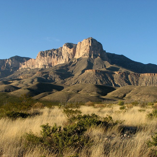
The Capitan Reef at Guadalupe Mountains National Park is one of the most well preserved fossil reefs in the world, and reef formations are exposed in the park. The Capitan Reef Complex aquifer, which lies under most of the park, is made mostly of dolomite and limestone stratigraphic units with a thickness as much as 719 m in a 16 to 23-km wide strip. Immediately west of and at the base of the Guadalupe Mountains, Quaternary alluvium forms a layer on top of the reef complex. The Capitan Reef Complex aquifer is primarily recharged through precipitation. Water extracted from this aquifer east of the park has been used for oil reservoir flooding.
On the far west of the park is the down-faulted Salt Basin, a graben (valley formed by downward movement of land) filled with Tertiary and Quaternary alluvium and lake deposits. The Bone Spring-Victorio Peak aquifer lies under the Salt Basin and residential and agricultural areas west of the park, including Dell Valley. This aquifer is primarily recharged by downward seepage from the Sacramento River and from irrigation return flows and infiltration on the Diablo Plateau. In this region, groundwater loss is generally due to evaporation, flow to adjacent aquifers, and water pumping. Groundwater pumping from the Bone Spring-Victorio Peak aquifer supports agricultural irrigation and the public water supply in the town of Dell City. This aquifer is hydraulically connected throughout the Salt Basin, and water level changes in the aquifer have the potential to impact the unique ecology of the Salt Basin dunes.
Groundwater Threats
Oil and gas production and development for municipal uses are the primary activities that threaten groundwater in and next to Guadalupe Mountains National Park. The Far West Texas Water Plan includes a strategy to support the increasing El Paso population by pumping water from the Bone Spring-Victorio Peak aquifer west of the park and transporting it to El Paso beginning in 2060. This water will need to be desalinated, and the effluent water from the desalination process will be mixed with untreated water and released to disposal wells. We don't know how these changes to groundwater will affect groundwater and springs within the park.
What Do We Monitor?
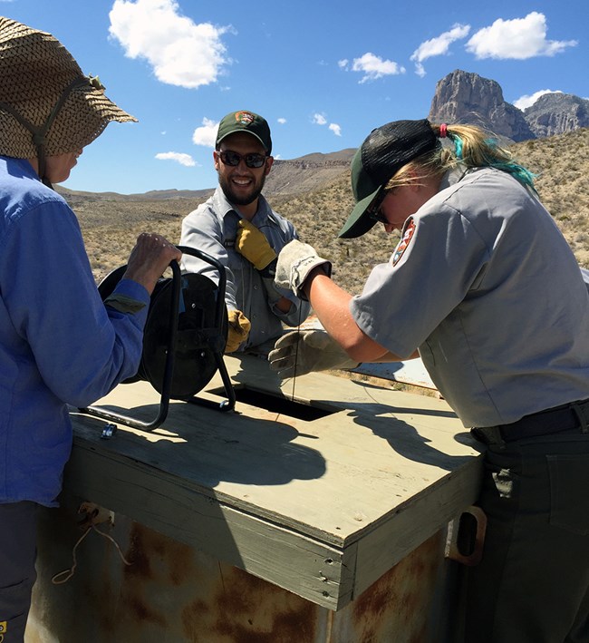
The Chihuahuan Desert Network and NPS regional and park staff monitor three wells at Guadalupe Mountains National Park. We collect data manually each quarter of the year and every six hours by pressure transducers. Our monitoring started in 2010 at the request of park staff and following the recommendations of the Water Resource Division of NPS.
| Well Name | State Well # | Inside or Outside Park | Well depth (ft) | Notes |
|---|---|---|---|---|
| Signal Peak Well | 4710201 | Outside; on NPS property | 1,240 | Completed in the Capitan Reef Complex aquifer |
| Lemonade Well | 4808904 | Inside | 51 | Completed in shallow alluvium of Salt Flat |
| PX Well | 4701201 | Inside | 300 | Completed in Quaternary alluvial fan sediments at the base of the Guadalupe Mountains |
Highlights from Water Year 2018
(Oct 2017–Sept 2018)
Water level data are not available for the first half of Water Year 2018 due to equipment failure. New pressure transducers were installed in all three wells on April 9, 2018.
Water levels in the three wells were within 80 ft in elevation of each other for the entire monitoring period. The aquifers that the three wells are completed in are hydraulically connected, but they also show localized responses to withdrawals and recharge, as observed in Lemonade and Signal Peak wells.

NPS
Signal Peak Well
Depth to water in April 2018 was 1,140.30 ft below ground surface (bgs) and declined throughout the rest of Water Year 2018. The lowest water level was on September 26, 2018 at 1,141.22 ft below ground surface. This is a decline of 8.92 ft since we began monitoring in Water Year 2010 and 11.32 ft since the well was installed in 1978.
Water level at this well has generally shown a downward trend over the monitoring record with two exceptions. The first was a manual measurement on November 6, 2013 and the second was late in September 2014, which may have been in response to a multi-day rain event and subsequent flooding. Over an 18-day period, 15.41 inches of precipitation fell, exceeding the 20-day, 50-year return interval of 14.6 inches.

NPS
Lemonade Well
Depth to water in April 2018 was 28.38 ft below ground surface. In May, the water level dropped approximately 1.4 ft and then increased 0.5 ft. This step down and step up is unusual in the record and the cause is unknown. From June through September 2018, the water level remained relatively the same, ending at 29.22 ft below ground surface, which was 0.54 ft lower than the manual measurement in Water Year 2017.
The water level in Lemonade Well has been variable over the monitoring record due to nearby groundwater pumping and leaking pipes. However, excluding those periods, water levels have remained similar over time, varying within a range of about 1.5 ft. The largest increase occurred in September and October 2013 following a 4.76-inch rain event.

NPS
PX Well
Depth to water in April 2018 was 278.40 ft below ground surface. Water level declined through the rest of Water Year 2018, with the lowest water level occurring on September 26, 2018 at 278.98 ft below ground surface. This indicates a net decline of 4.91 ft since monitoring began in Water Year 2010.
Water levels in PX Well demonstrate seasonal variability. Levels are stable or slightly increasing in fall and winter, followed by declining water levels in spring and summer. From 2009 to 2018, the well water level has declined five feet.

NPS
