Last updated: November 21, 2017
Article
Arroyo Incision and Expansion in Navajo National Monument
by Future Park Leaders of Emerging Change intern Olivia Beaulieu, University of Minnesota

During my Future Park Leaders of Emerging Change (FPL) internship, I worked to document how climate change is affecting Navajo National Monument located on the Navajo Nation in Northern Arizona. Navajo National Monument is comprised of three Ancestral Puebloan cliff dwellings, which were built into natural sandstone alcoves within canyons. Keet Seel Canyon—in which one of the cliff dwellings is located—experienced a flash flood event in 2011 that moved a massive amount of sediment. Projections suggest similar floods may become more frequent in areas of the southwest, threatening both the protection of—and access to—archaeological sites.
Over the course of the summer, I documented the ongoing erosion and deposition occurring within Keet Seel canyon and reconstructed the 2011 Keet Seel Canyon flood. To document the resulting change, I used repeat photography and compared photos from the 2017 summer to photos taken in 1934, 2007, and 2010. Every repeated photograph shows large amounts of sediment being moved in the canyon system. There are areas where entire river banks have been washed away and other areas where sediment has built up and partially filled the river channel.
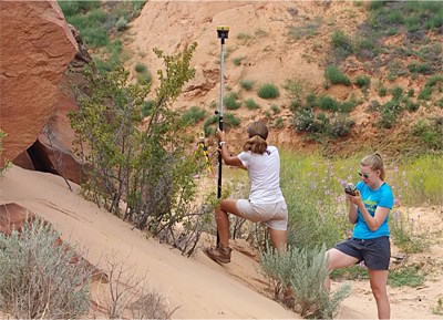
To reconstruct the 2011 flood, I collected cross sectional data from Keet Seel Canyon. I modeled the flood flow using the Hydrologic Engineering Center River Analysis System and determined the discharge of the flood to be approximately 2,500 cubic feet per second and the recurrence interval to be between 100 and 500 years. This was an extremely large flood event, the likes of which may become more frequent under climate change projections.
Keet Seal Canyon: 1934 to 2011


Left image
1934 photo of Keet Seal canyon
Right image
2011 photo of Keet Seal canyon
