Last updated: March 29, 2019
Article
The Fort Vancouver Village

NPS Photo
NPS Photo
Introduction to the Village
Established with the fort in 1829, the village was one of the largest settlements in the West during its time.
Housing the workers and their families, and the fur brigades when they returned from their expeditions, the population of the village exceeded 600 people during peak times. Company employees, their wives, and children supported the Fort's extensive operations including several hundred square miles of agricultural land, a shipyard, distillery, tannery, sawmill, gristmill, and dairies.
During the late 1840s and early 1850s, slowing returns from trapping and growing numbers of settlers led to a shift in focus from the fur brigades to land-based mercantile opportunities. With this change came a shift in the village activity and population. The numbers of Hawaiian employees increased, such that by the 1850s the village became known as "Kanaka Town," or "Kanaka Village," referring to the Hawaiian word for "person."
Not only was the village a living quarters for the Company employees, it was also crucial in establishing the U.S. Army as a permanent presence in the Pacific Northwest.
Arriving in 1849, the U.S. Army and the Hudson's Bay Company coexisted amicably -- at first. The Army rented many of the village buildings, hired Native American laborers, and made use of the trade available through the Fort's market.
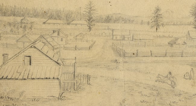
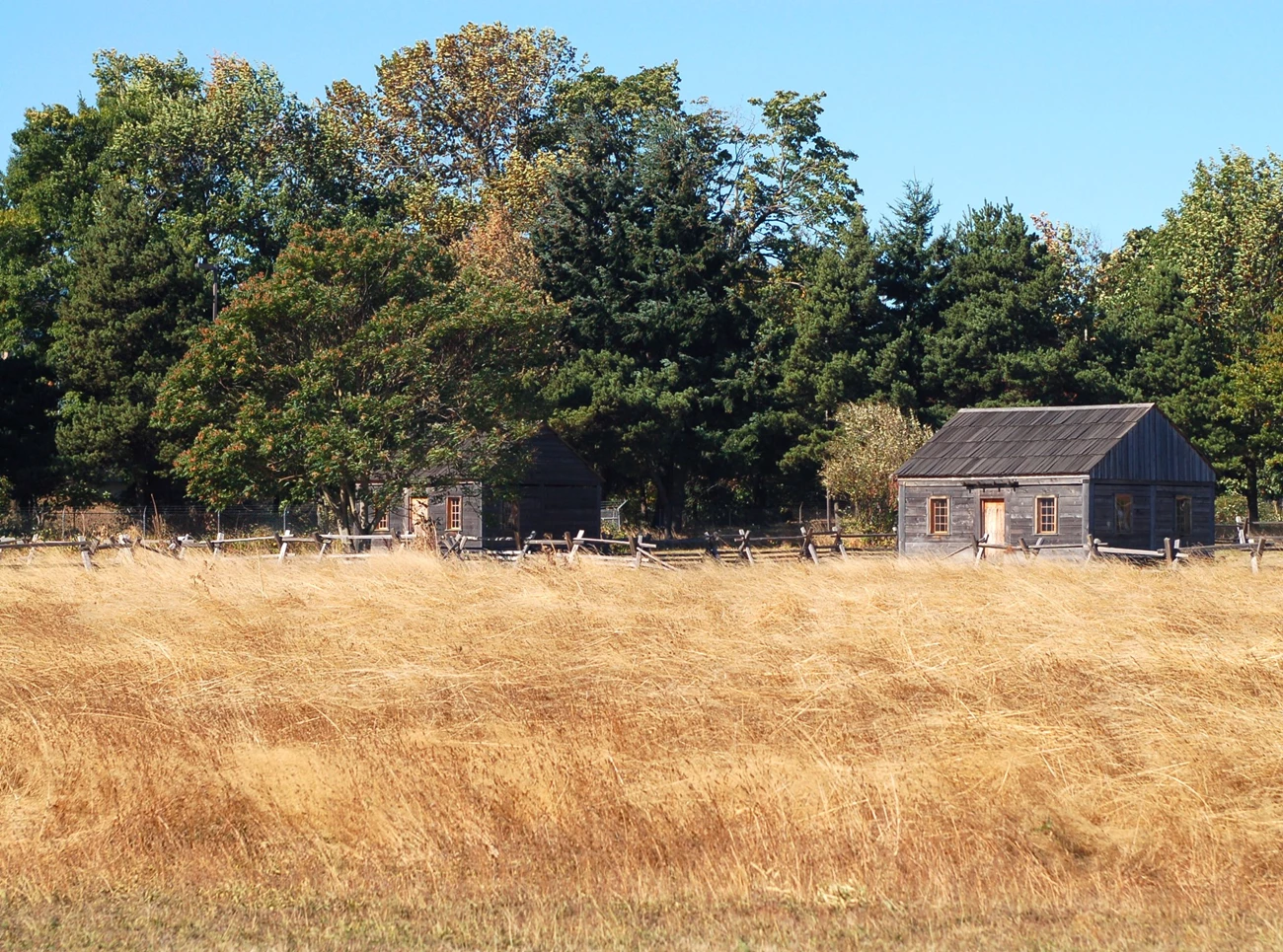
In the early 1850s, the Army built several new buildings in the village area, including the Quartermaster Depot, shown in the photo, and Captain Rufus Ingalls' house, where Ulysses S. Grant lived from 1852 until 1853.
Increasing pressure on land in the West by American settlers and declining returns from trapping soured the relations between the Army and Fort Vancouver in the latter half of the 1850s. The Hudson's Bay Company withdrew its operations to Victoria B.C. in June of 1860, leaving the Fort and village in the hands of the Army.
The Army occupied some of the buildings, but fire destroyed all visible traces of the establishment by 1866. After 1866, the Army used the Kanaka Village area in a variety of ways, from a drill ground to a motor pool.
With the creation of the Civilian Conservation Corps or CCC (1933-1942), the village area became the regional training facility and headquarters of the CCC. The CCC was responsible for many regional public works projects, such as Timberline Lodge.
From one of the largest, multiethnic communities in the West, through the coexistence of the U.S. Army and the Hudson's Bay Company, to the headquarters of the CCC in the middle of the 20th century, Kanaka Village holds great potential to provide visitors a unique experience of history.
NPS Photo
Population of the Village
Estimates regarding the number of people living in the Village are difficult to make-there are abundant records of employees, but these don't indicate where they lived, or with whom. Nevertheless, it is clear that the population of the Village was fluid and seasonal, with many employees sent out on brigade for the majority of the year.
During peak season when the fur brigades returned to rest and re-supply, the settlement contained upwards of 600 inhabitants. For many years, the village was the largest settlement between Yerba Buena, (present day San Francisco, California) and New Archangel (Sitka, Alaska).
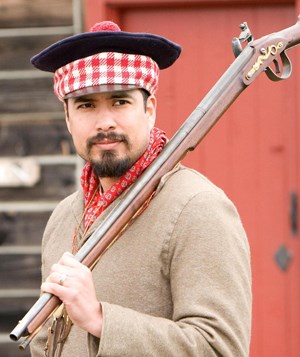
Not only was the village one of the largest settlements in the West during the fur trade era, it was also unmatched in its diversity. The Hudson's Bay Company purposefully hired peoples from different backgrounds, thus providing opportunities in the fur trade business to a variety of people from both the Old World and the New.
Much of what we know about the diversity of the village population comes from Company and Catholic Church records, which indicate that English, French-Canadian, Scottish, Irish, Hawaiian, Iroquois, and people from over 30 different regional Native American groups lived and worked here harmoniously.
The Métis- a culture of mixed European and Native heritage - added to the diversity of the village. The Métis grew as the number of marriages à la facon du pays (marriages contracted without clergy) increased.
Few of the village spoke English, though French, Gaelic, Hawaiian, and a variety of Native American languages were often heard. In order to communicate with one another, most villagers learned Chinook Jargon, a mix of Chinook, English, and French.
Women and children were clearly an important part of population of the village, but they are rarely mentioned in the Company records. Unfortunately, the only information we have on the women and children of the village comes from the birth, death and baptismal records of the Catholic and Anglican Churches. These are not dependable counts since they record only specific people at the moments they were in contact with the clergy for a specific rite (e.g. birth, marriage, or death). Regardless, it is clear that the women and children accompanied their husbands on the brigades, and performed many duties in the dairies, in the fields, and other activities helping to sustain Fort Vancouver.
With the decline of the fur trade, and the expansion of American immigration and settlement of the region, the population of the village gradually shifted. The focus on waterways and the French-Canadian voyageurs gave way to mercantile activities.
The number of Hawaiians working as contract laborers for the Company grew steadily during this period. The large number of Hawaiian workers in the village led to the name "Kanaka Town" in the early 1850s - "Kanaka" is the word for "person" in the Native Hawaiian language.
NPS Photo
The Look of the Village
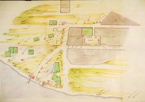
Our understanding of what the village looked like during the fur trade era is the result of analyses of various maps, drawings and descriptions made by visitors to the village, as well as archaeological investigations.
The village was located west of the fort stockade, extending south from present-day 5th street (then called Upper Mill Road) to the Columbia River.
In the east, the village extended from the fort palisade approximately one-third to one-half of a mile to the west, approximately where I-5 lies today.
From inventories and maps we can estimate that there were approximately fifty dwellings in the village, though this number changed throughout the history of the village as numbers of employees waxed and waned.
These homes were mostly single-story houses, built in a variety of styles--including the "log-cabin," "post-on-sill," and "frame-and-weatherboard" styles.
The village dwellings are described as having earthen floors. Most had unfinished wood walls, though some had plastered walls of clay or wallpaper.
The furnishings were sparse, consisting of a mix of European and Native American objects. Village structures probably housed permanent workers, while seasonal workers and brigades who were not lucky enough to bunk with a relative or friend probably slept in tents or out in the open.
Most of the historical maps and accounts place the structures along roads or lanes. At least two roads--one running north-south and another running east-west--have been identified cartographically and archaeologically.
The north-south road connected the wharf and the pond area to Upper Mill Road. The east-west road (or Lower Mill Road) began in the village, passed by the southern wall of the stockade and continued on for several miles to the Company mill. In the village, where the Lower Mill Road intersects with the north-south lane, an entrance gate was indicated.
Today, most visitors enter the palisade from the north gate, through the gardens. In the nineteenth century, almost all traffic would have been through the southeastern gates in the palisade. Thus, most of the workers, traders, and visitors would have passed under the entrance gate on Lower Mill Road on their way to the Fort to work or conduct business.
Not only were there dwellings in the village, but a variety of other important structures as well. The unfortunate illnesses spread by European trade and settlement created the need for a hospital outside of the Fort palisade, which was built next to the pond.
Other structures nearby functioned as stables, a cooper's shop, a salt store, boat sheds, a distillery, a tannery, and servant's quarters.
A Salmon Store was established on the end of the wharf where salmon was salted and packed for shipment to places like the Hawaiian Islands.
Archaeology in the Village
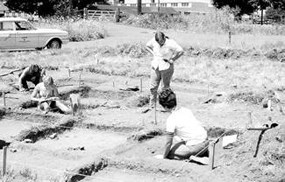
Archaeological excavations and the analysis of its material culture are primary sources for understanding the village and much of the history of Fort Vancouver and Vancouver Barracks.
The first recorded archaeological investigations in the village area were in the northeastern area of the village in 1968, by Susan Kardas and Edward M. Larabee, and a University of Washington field school.
These excavations uncovered four house structures and several other features, such as animal burials and a well.
The next decade brought University of Washington researchers David and Jennifer Chance to the Village as a part of a salvage project for the Washington Department of Transportation (WSDOT).
They investigated the northern tip of the pond, a refuse pile from a house on the south side of SR-14, and the 1850s U.S. Army structure known as the Ingall's House - where Ulysses S. Grant lived briefly.
Among the tens of thousands of artifacts recovered in the pond excavations were well-preserved organic remains such as clothing, shoes, and food! However, far more common were items such as transferprinted ceramics.
Part of the 1970s excavations uncovered evidence of the hospital structure, and revealed evidence that it had been surrounded by a picket structure. However, it is still a mystery as to whether the hospital stockade was built for quarantine purposes or to protect medical supplies from theft.
Regardless, this discovery was chilling evidence of the impact of the malaria and smallpox epidemics that swept through the Columbia River basin in the 1830s.This structure was investigated further by Caroline Carley of the University of Washington in 1977.
Some of the most extensive excavations in the village were carried out under a WSDOT contract for the SR-14 / I-5 interchange in 1980-1981. Bryn Thomas and Chuck Hibbs of Archaeological and Historical Services of Eastern Washington University excavated along the SR 14 corridor, and in the area north of what is now Old Apple Tree Park.
Further excavations by Bryn Thomas were conducted in the early 1990s as a preliminary examination of the area for the construction of a land bridge between the village, the Columbia River waterfront, and Old Apple Tree Park.
NPS Photo
