Media Included
- 70 years of montane forest change in Grand Canyon National Park - The chance rediscovery in Grand Canyon National Park (GRCA) of an early 1900s dataset used to create the park’s first vegetation map led to a rare opportunity to examine forest change in the park since 1935. In 2004, ecologist John Vankat led an effort to resample the historical plots, and shares his conclusions about forest development and the wide range of ecological conditions characterizing GRCA ponderosa pine, mixed conifer, and spruce-fir forests.
The surprise discovery in Grand Canyon National Park of some early 1900s photographs awaiting disposal led to a rare opportunity to examine forest change in the park since 1935.

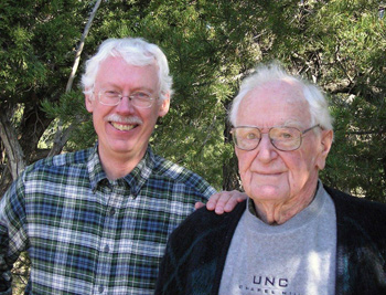
NPS Photo
John Vankat recognized a golden opportunity when he learned about a set of historical data sheets that Grand Canyon National Park (GRCA) staff had rescued from being discarded in the late 1990s. He set about using the rediscovered data as the basis for the first landscape-scale, quantitative study documenting multi-decadal changes in never-harvested Southwestern USA forests.
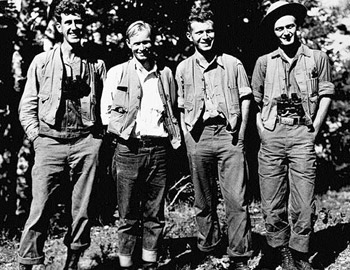
The data sheets document fieldwork from 1935 to produce the first vegetation map of GRCA. Claude "Bru" Wagner led this fieldwork with his 4-person crew, sampling 456 vegetation study plots to quantitatively document the park's forests, woodlands, shrublands, and grasslands. NPS staff, including Vankat—an ecologist with GRCA at the time—knew the value that resampling these historical plots would have in informing park management and advancing scientific knowledge about forest changes since 1935. Beginning in 2004, Dr. Vankat led the effort to relocate and resample the 1935 plots, with funding provided by the National Park Service (Washington Office, GRCA, Southern Colorado Plateau Network Inventory and Monitoring Program), the Colorado Plateau Cooperative Ecosystems Studies Unit, and the family of Claude Wagner.
Methods

Photo by Kent Wagner
Study area and relocation of historical plots
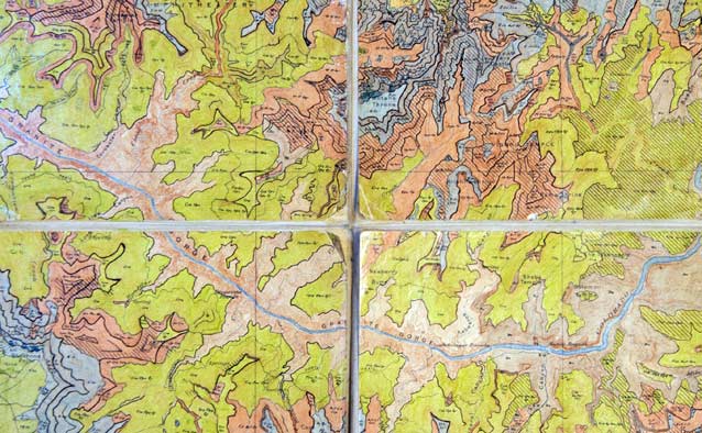
Dr. Vankat focused the resampling effort on above-rim plots in ponderosa pine, mixed conifer, and spruce-fir forests at GRCA. He knew that relocating the 1935 plots would be a challenge because they lacked permanent markers. He estimated their locations by comparing the topographic map on which plot locations were mapped in 1935 to current digital topographic maps. He then field-checked the estimated locations against patterns of environment and vegetation recorded in 1935 and only established a new plot where he found a good match with historical plot characteristics. Ultimately he and his field crew were able to resample 153 of the original 191 forested plots.
The 1935 study omitted a key area on the North Rim of GRCA where no topographic mapping had been done at that time. Fortuitously, as a professor of botany at Miami University, Oxford, Ohio, Vankat had directed a study in 1984 by graduate student Mark A. White to sample forests in this area of GRCA. Vankat and White relocated 34 of the 40 plots sampled in 1984, and added them to the study to enable a more thorough examination of mixed conifer and spruce-fir forests.
Data collection
Another challenge in comparing current with historical conditions was that data collection methods had changed since 1935. Accordingly, Dr. Vankat, in collaboration with SCPN staff, designed methods to allow comparison with the 1935 data while also generating data useful for current analysis methods. At each historical site, Vankat and his field crew laid out a 20 × 50 m study plot within which they collected data for live and dead trees, saplings, tree seedlings, shrubs, herbs, and environmental factors such as evidence of past fire.
Data analysis
To understand how forests had changed since 1935, Vankat analyzed shifts in tree density, basal area, and species composition over time. Analyses were grouped not just by forest type, but also by forest subtype along a moisture gradient (e.g., moist, mesic, and dry ponderosa pine forest). He added burn history as a potential factor in shaping forest changes, and also put findings into a generalized framework of forest development.
Results and Discussion
Ponderosa pine forest remained unchanged since 1935 in some characteristics, such as in tree density, but showed changes in other forest characteristics. Findings were different for each subtype (moist, mesic, and dry), highlighting the ecological variation within ponderosa pine forest. Vankat concluded that ponderosa pine forest in GRCA had moved through an accretion phase of forest development and currently was at or slightly past the point of inflection toward a recession phase. This is a new finding for Southwestern ponderosa pine forest.
The most surprising findings of this study were that both mixed conifer and spruce-fir forests had generally undergone large decreases in tree density and basal area since 1935 and 1984. No previous studies had reported this, except following major disturbances such as stand-replacing fire or insect outbreaks. In fact, previous models all assumed that tree density and basal area generally had increased in these forests throughout the 20th and into the 21st century.
Dr. Vankat hypothesized that the more moist conditions and faster growth rates of trees at high elevations had resulted in rapid increases in forest density and basal area soon after the beginning of fire exclusion in the late 19th century. This accretion phase of forest development led to unsustainably high densities and basal areas that were followed by a recession phase in which densities and basal areas decreased, as revealed by his study. This new insight suggests a shift in perspective is needed for management of these forests.
Overall, Vankat's findings suggest that GRCA forests display a wider range of ecological conditions and dynamics than previously thought, including decreases in mixed conifer and spruce-fir forest density and/or basal area from the 20th century to the present. Considering this and other kinds of variability that he found within and among vegetation types at GRCA, he advises managers to focus on ecologically relevant scales. Montane forests, particularly on GRCA's North Rim, occur in highly dissected landscapes with fine-scaled heterogeneity in topography, vegetation, and past fire severity. Some 21st century fires, by contrast, have burned at large spatial scales and have included large patches of high-severity, standreplacing fire. Understanding this difference in the scale of historical versus recent disturbance patterns is important for managing montane forests in GRCA and similar landscapes of the American Southwest into the future.
Further Information

NPS Photo
For greater detail, see the following journal publications. A parallel study of pinyon-juniper vegetation is scheduled for completion by Vankat in 2013.
Vankat, J. L. 2011. Post-1935 changes in forest vegetation of Grand Canyon National Park, Arizona, USA: Part 1- ponderosa pine forest. Forest Ecology and Management 261(3):309-325.
Vankat, J. L. 2011. Post-1935 changes in forest vegetation of Grand Canyon National Park, Arizona, USA: Part 2-Mixed conifer, spruce-fir, and quaking aspen forests. Forest Ecology and Management 261(3):326-341.
For an overview of southwestern forest ecology, see the following book.
Vankat, J. L. 2013. Vegetation dynamics on the mountains and plateaus of the American Southwest. Springer, Dordrecht, The Netherlands.
Project contact
Dr. John Vankat
Professor Emeritus
Department of Botany, Miami University, Oxford, OH,
vankatjl@miamioh.edu
Senior Research Ecologist
Merriam-Powell Center for Environmental Research, and Adjunct Professor, School of Forestry, Northern Arizona University, Flagstaff, AZ,
j.vankat@nau.edu
Prepared by Sonya Daw & John Vankat, Southern Colorado Plateau Network I&M Program, 2013.
Last updated: February 3, 2015
