Part of a series of articles titled NPS Alaska Region Fire Ecology Annual Report for 2017.
Article
NPS Alaska Region Fire Ecology Annual Report Summary 2017
By Jennifer L. Barnes and Jennifer L. Hrobak

NPS photo
The National Park Service (NPS) Alaska region fire ecology program provides science-based information to guide fire and land management planning, decisions and practices in order to maintain and understand fire-adapted ecosystems in Alaska.
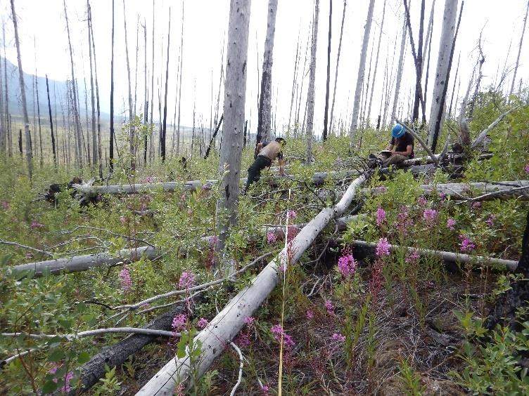
During the 2017 field season, the Alaska NPS fire ecology program conducted assessments at repeat burn sites (burned in 2009 and 2016) in Wrangell-St. Elias (Figure 1), re-monitored legacy 40 year post-fire tundra fire effects plots in Noatak, continued to collect seasonal fuel moisture samples, and assisted with fire research projects. The regional fire ecologists were involved with preparing monitoring protocols, agreements and research proposals, instructing classes, and participating on several agency and interagency committees. This annual report provides a brief summary about the NPS Alaska 2017 fire season, fire ecology monitoring results, fire research projects, and fire ecology program activities and outreach.

NPS photo
The 2017 fire season proved to be a relatively “normal” season, with hot and dry spells balanced with periodic rainfall that moderated fire activity in Alaska. The season began slowly with few fire starts in May due to lingering snowpack but steadily increased into June (AICC 2017 Fire Season Weather Summary, https://fire.ak.blm.gov/). The majority of the acres burned occurred in July with significantly warm temperatures in the 90 degree range and strong winds in the eastern Interior. The end of season rains began in early August, slowing fire season to a halt. Though Alaska recorded one of highest number of lightning strikes this summer, precipitation and high fuel moistures proved to limit ignitions and fire growth. By the end of the season, a total of 362 fires were reported with 653,147 acres burned, falling below the ten year average of approximately 1.2 million acres but just above the median annual area burned (AICC Situation Report Dec 22, 2017, https://fire.ak.blm.gov/).
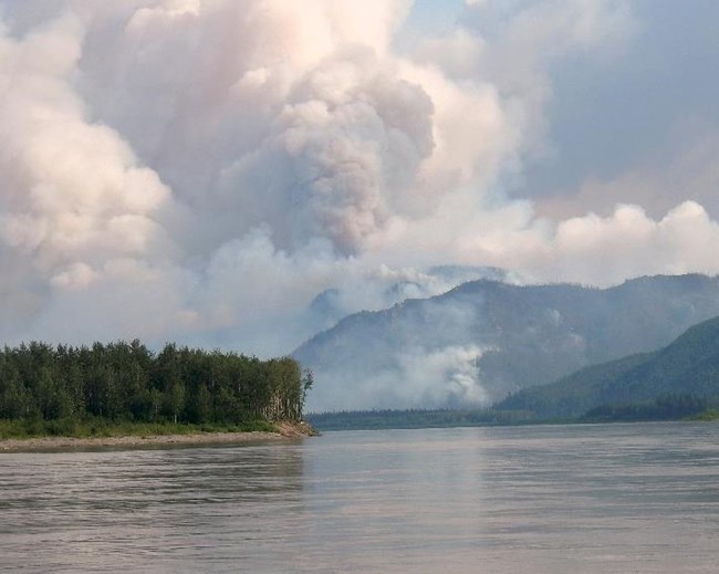
National Park Service in Alaska had a very light fire season, with the majority of fire starts (6) occurring in Yukon-Charley Rivers National Preserve. Overall, nine wildfires spanned across four park units for a total of 4,057 acres that burned within and adjacent to park boundaries (Table 1). Of the area burned, 4,008 acres were on NPS owned lands. The largest fire, Trout Creek in Yukon-Charley National Preserve, started within a recent 2015 fire scar and burned 2,980 acres (Figure 2). The Western Area fire management staff carried out prescribed fire pile burns in Denali and Lake Clark during 2017 (Table 1) for a total of 23 acres and accomplished fuels reduction projects at several sites in the parks.
| Park Unit | Number of Wildfires1 | Total Acres Burned1 | Number of Wildfires started on NPS Lands2 | Acres Burned NPS Lands2 | Number of Prescribed Fire Units | Acres of Prescribed Fires |
|---|---|---|---|---|---|---|
| Denali National Park and Preserve | 1 | 79 | 1 | 79 | 1 (Admin Rd.) | 22 |
| Gates of the Arctic National Park and Preserve | 1 | 492 | 1 | 488 | - | - |
| Wrangell-St. Elias National Park and Preserve | 1 | 1 | 1 | 1 | - | - |
| Yukon-Charley Rivers National Preserve | 6 | 3,485 | 5 | 3,440 | - | - |
| Lake Clark National Park and Preserve | 0 | 0 | 0 | 0 | 1 (Chinitna Bay) | 1 |
| Total for Region | 9 | 4,057 | 8 | 4,008 | 2 | 23 |
1 Includes total number of fires and acres of all wildfires that burned within or partially within the boundaries of the park unit. NPS boundaries include inholdings of lands not owned or managed by NPS. 2 Number of wildfires started and acres burned on NPS owned lands (WFMI stats).
Last updated: October 26, 2021
